
Yesterday, it was hard to believe it was the first day of December with temperatures into the upper 50s and lower 60s for most of New England.
However, not everyone got to participate in the unseasonable warmth.
In northern Maine, Caribou was in a winter wonderland for the first day of meteorological winter, with the National Weather Service office in Caribou reporting that the snow depth Thursday afternoon reached 21.5 inches, which is snow accumulation over the last three days. Last year, the highest snow depth for the whole season was 15 inches.
Now, as we enter the first full weekend of December 2016, it will start to feel more seasonable for the rest of New England, as cooler air will start to make its presence known. For Friday night, overnight lows will dip into the 30s, with some mountain snow showers north that could shift as far south as the Berkshires and Worcester Hills overnight.
Saturday and Sunday will be slightly cooler than Thursday and Friday, with high temperatures into the 40s, but at least we’ll see plenty of sunshine before more clouds move in for Sunday ahead of the next system that could bring rain/snow chances for Monday.
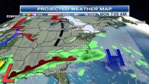
Next week, we have our eyes on a few systems developing well to our southwest and two systems to our northwest. We will continue to monitor these over the next few days as these move closer, but it all depends on the timing of cold air and when these systems move in midweek.
As always, stay tuned for the very latest forecast updates on the air, online, and by downloading the necn and also the new NBC Boston mobile apps.
