


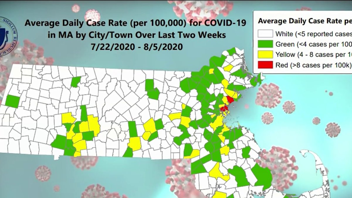
Massachusetts released a map showing coronavirus hot spots across the state.
Massachusetts has identified how much coronavirus is currently spreading in all its communities, pointing out the 33 that are at moderate or high risk of spreading COVID-19 in a new map.
The map is based on the average number of cases based on population size in the last two weeks. The metric will show where in Massachusetts a new COVID Enforcement and Intervention Team will be working to tamp down the virus' spread.

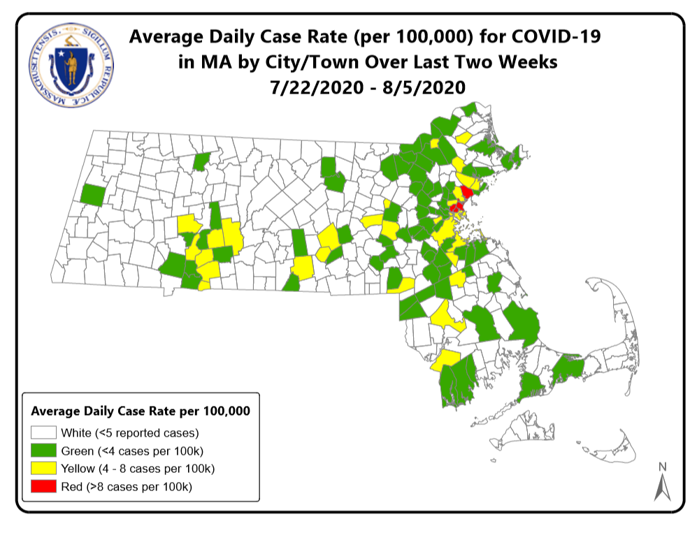
This map provided by the Massachusetts state government shows which communities are at high, moderate or low risk of coronavirus transmission based on how many cases per capita have recently been detected there.
Amid rising coronavirus cases in Massachusetts, Gov. Charlie Baker identifies four communities as "high risk" that will be the focus of increased enforcement of the mask mandate and crowd control.
"People need to step up and be aware of the level of spread in each community, especially in your own area, and be vigilant," Gov. Baker said in announcing the new metric.
Here's the full list of communities at high and moderate risk:
High-Risk Cities and Towns
- Chelsea
- Everett
- Lynn
- Revere
Moderate-Risk Cities and Towns
- Auburn
- Belchertown
- Boston
- Brockton
- Charlton
- Chicopee
- Fall River
- Framingham
- Georgetown
- Granby
- Holyoke
- Hull
- Lawrence
- Longmeadow
- Malden
- Marlborough
- Maynard
- Middleton
- Northampton
- Peabody
- Quincy
- Randolph
- Salem
- Saugus
- Springfield
- Taunton
- Winthrop
- Worcester
- Wrentham
More on COVID-19 in Mass.


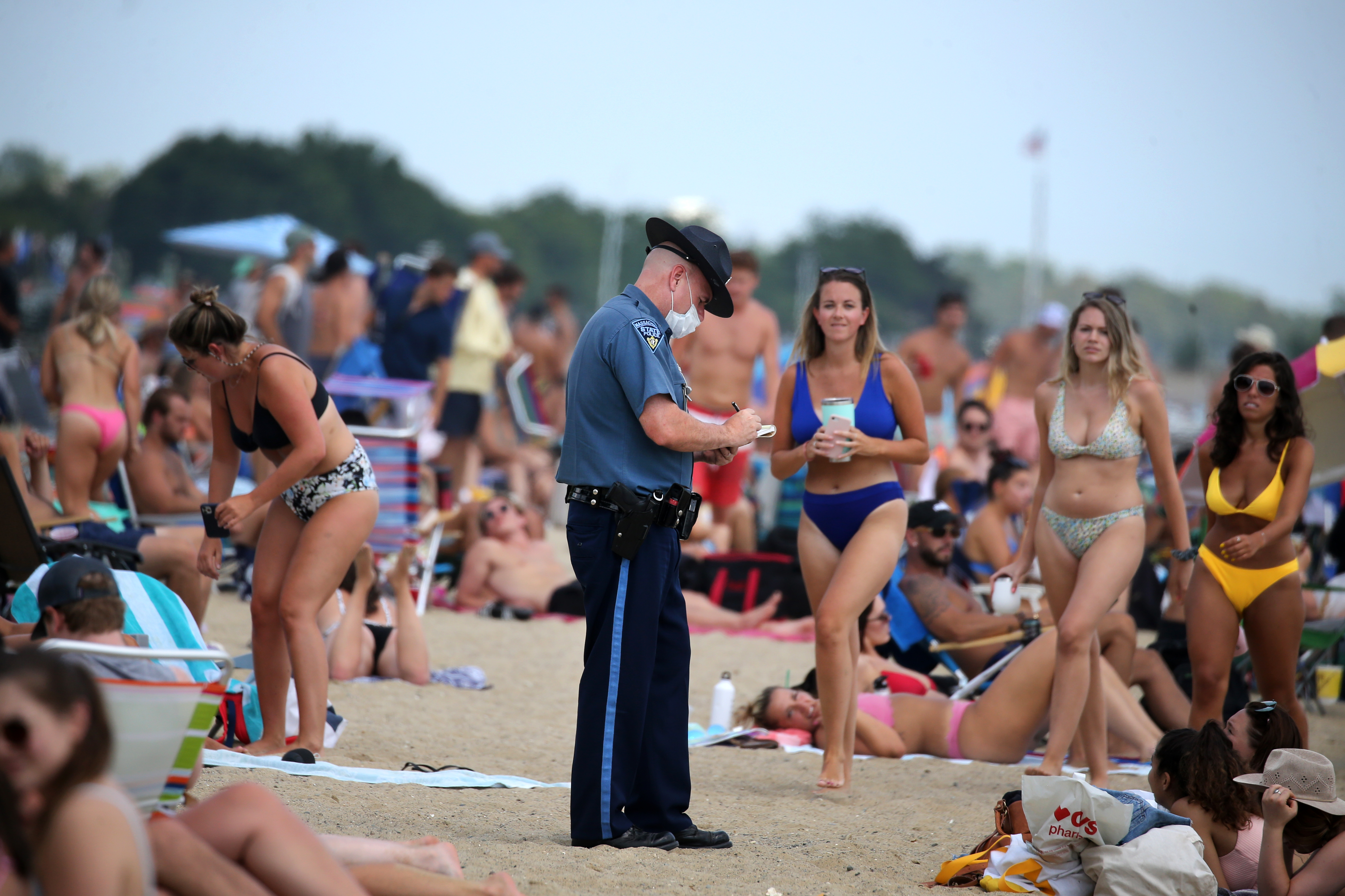
With a recent uptick in coronavirus cases, Gov. Charlie Baker is implementing new regulations starting Tuesday.

