Overnight: Few clouds, cold. Lows low 30s, 20s north and west. Sunday: Sunshine with a few clouds, chilly. Highs upper 30s to low 40s.
Sunday Night: Thickening clouds, showers late, brief mix far N & W. Lows mid 30s, rising into 40s.
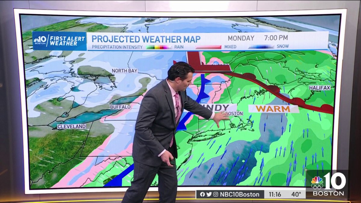
Monday: Mild and windy with showers, a few storms possible, potential for damaging winds. Highs in the 60s.
A weak frontal system will bring some mountain flurries and snow showers and perhaps a brief flurry to southern areas Saturday evening into tonight. Not much in the way of accumulation is expected, perhaps a coating to an inch or so across the higher mountain tops.
Temperatures drop into the upper 20s to low 30s south tonight, mostly in the 20s north, teens closer to the Canadian border.
Sunday will seasonably cold with clouds on the increase late in the day. A nice day to do some holiday shopping and outside decorating, or perhaps tie down some of those outside holiday decorations or take them in, if possible as we are expecting some strong winds on Monday with our next storm! Highs south reach the low to mid 40s, mostly in the 30s northern areas.
Clouds increase Sunday night ahead of the next system with showers developing late, there could be a mixture of precipitation at the onset across the interior of southern and central New England, but the warm air will win out quickly by Monday morning. Temps drop into the 30s but rise overnight to near 40.
Get Boston local news, weather forecasts, lifestyle and entertainment stories to your inbox. Sign up for NBC Boston’s newsletters.

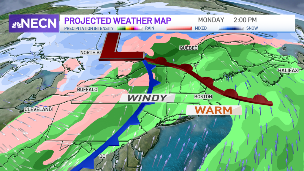
We have put a First Alert stamp on the 10-Day forecast for Monday due to the increasing chance for damaging wind during the afternoon and evening ahead of an approaching cold front.
Low pressure tracks well north of the region during the day which will leave us on the milder side of the storm with the chance for showers throughout the day across southern New England, any snow northern areas get will quickly change to rain by midday.
Local
In-depth news coverage of the Greater Boston Area.


Winds may gust up to 60 mph, especially across the south facing shorelines, which may cause damage. There is also the risk for a few thunderstorms, something we will watch closely during the afternoon and evening hours. High temperatures will reach the 60s across southern areas, 50s north.
It will be a colder, blustery Tuesday with temperatures in the 30s to around 40.
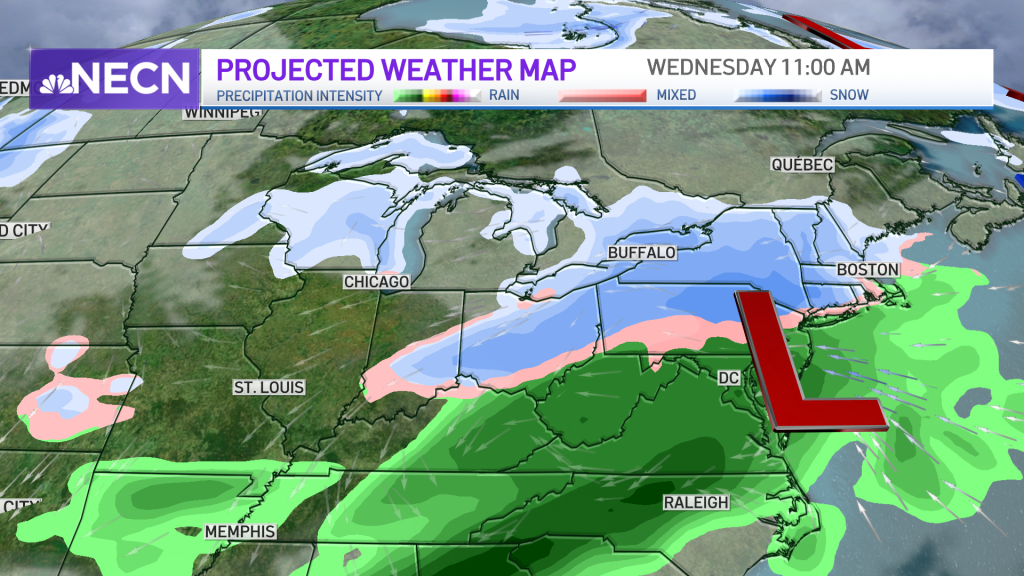
Another system arrives Wednesday bringing a mixed bag of precipitation to the region. Right now the rain/snow line has yet to be determined for southern areas, but it looks like we’ll be on the colder side of things and will be monitoring this storm very closely!
Stay tuned!