
We’ll remain mostly cloudy through Sunday evening with isolated showers and thunderstorms in the forecast across the south, more scattered in nature north, as a weak upper level system passes through the region.
The shower threat will diminish overnight, but we will remain mostly cloudy with some fog developing across the south coast of New England and across coastal Maine.
Unfortunately, it’s not the forecast we’d like be giving you with a lunar eclipse occurring, but I’m still holding out some hope that we’ll be able to see a few glimpses of it as the eclipse reaches totality around 12:11 a.m. Monday!
Get Boston local news, weather forecasts, lifestyle and entertainment stories to your inbox. Sign up for NBC Boston’s newsletters.
More on the Eclipse
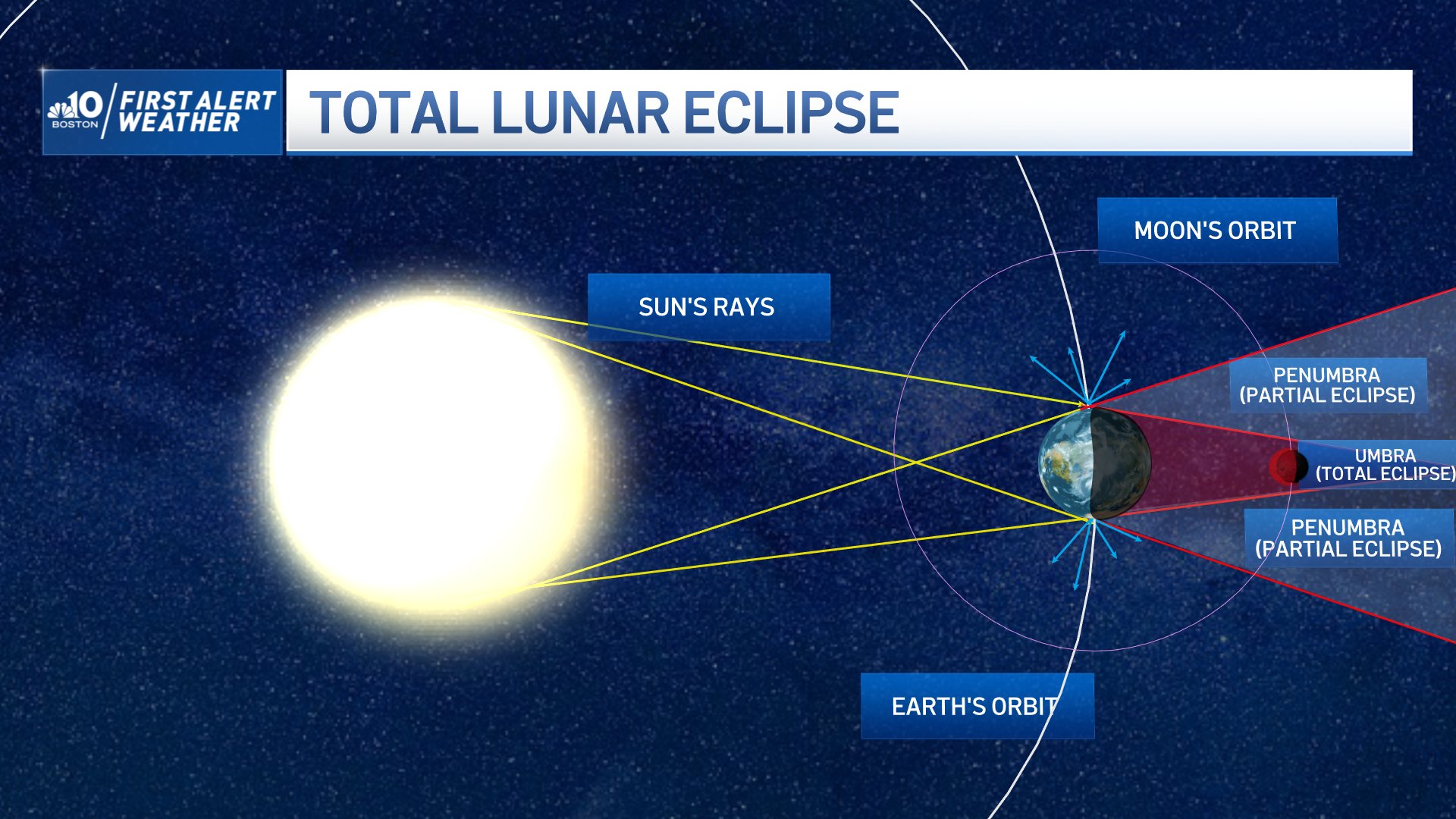

The whole event will last from 9:32 p.m. Sunday to 2:50 a.m. Monday -- with totality lasting almost 1.5 hours!
Overnight lows will be mostly in the 60s, and 50s across Maine.
The new work week starts out warm with the threat for showers and thunderstorms increasing during the afternoon on Monday ahead of a cold front which will arrive during the evening.
Much of the day should remain dry with clouds and sun along with isolated showers and t-storms during the afternoon.
Widespread showers and thunderstorms arrive during the evening across western New England as the cold front moves through, some of which may be severe with damaging winds, heavy rain, and hail.
The First Alert Stamp has been put on our 10-Day forecast Monday due to the possible severe weather.
Highs reach the upper 70s to mid 80s, cooler Cape and Down East Maine where we’ll see some fog and southerly winds off the Ocean.
Beyond Monday, the rest of the work week is looking fantastic and on the seasonably warm side with the risk for a few pop-up showers, mainly across the north and inland areas Tuesday.
By the weekend, we may be talking about record heat once again with highs reaching the 90s across portions of the region! Stay tuned!
