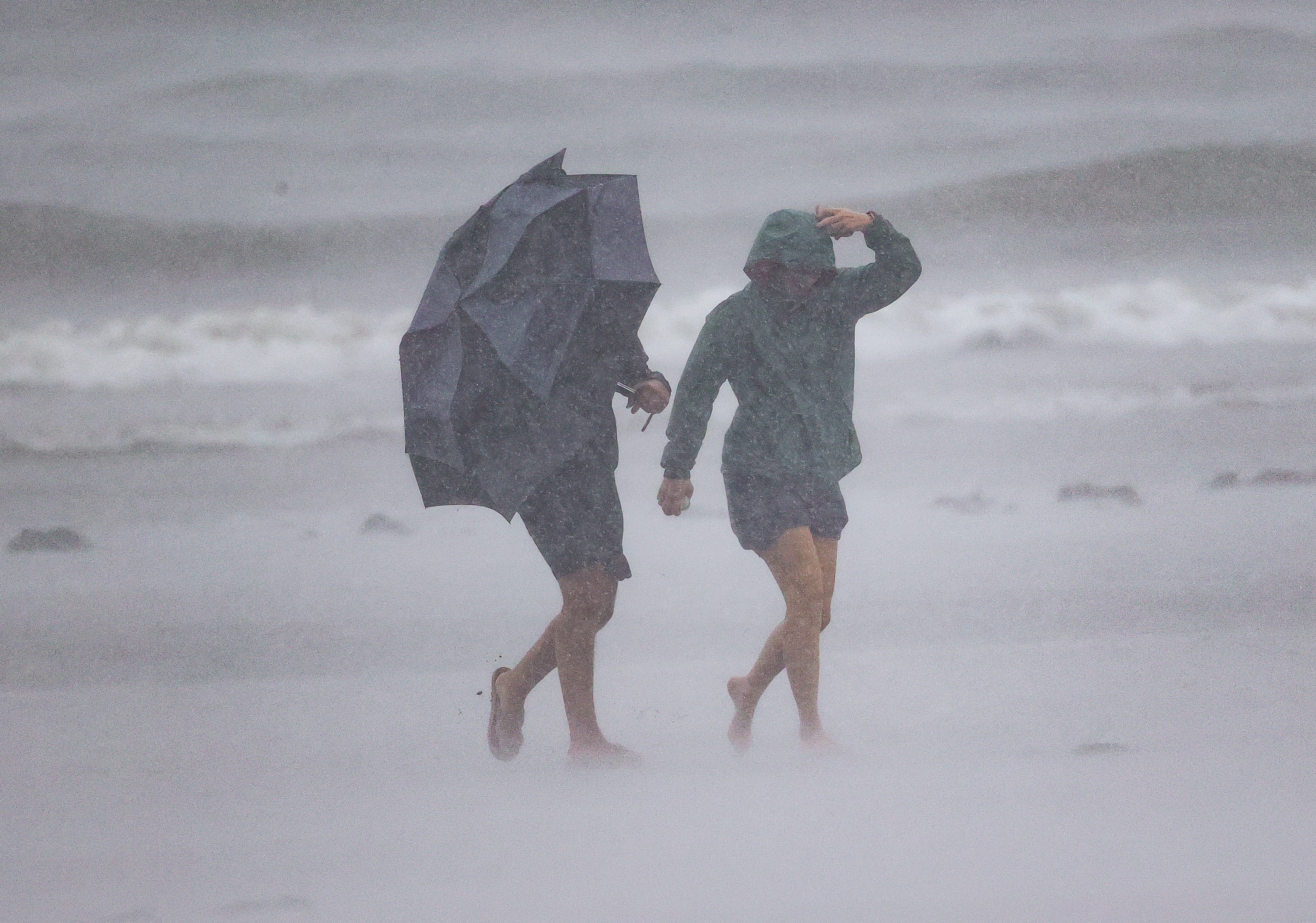
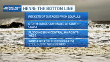
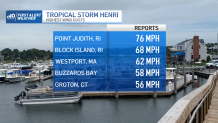
Hurricane Henri weakened before making landfall and arrived as a tropical storm near Westerly, Rhode Island, around noon Sunday with wind gusts that reached 75 mph in Narragansett Bay. The wind Sunday afternoon could reach close to 40 mph in eastern areas as the tropical storm continues to weaken.
Meanwhile, the highest risk will now be the slow moving trend that this cyclone will take as it heads inland towards the northwest and takes a turn to the northeast during the evening hours.
Get Boston local news, weather forecasts, lifestyle and entertainment stories to your inbox. Sign up for NBC Boston’s newsletters.
This is not expected to be a one day event; this means that on Monday we’ll be watching for another round of downpours brought by the outer bands of this cyclone, which is likely to weaken into a tropical depression by the morning hours.
After receiving more than five inches of rainfall totals in some spots in Connecticut, the soil remains saturated and now the west and southwestern areas of New England remain prone to inundation.
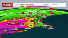
Three to five inches could be falling in Connecticut and western Massachusetts, but in low lying areas, it could all come together to bring higher amounts of water in one single place, bringing serious flooding.

On the coasts, water is expected to start receding close to 3 p.m. after high tide has passed, but the rip current activity will likely continue as we begin the work week.
Remember not to cross any flooded roads, as this may end up getting you stalled in the middle of the road, and keep your NBC10 Boston and NECN apps handy to receive prompt notifications on the latest weather updates. Stay safe.