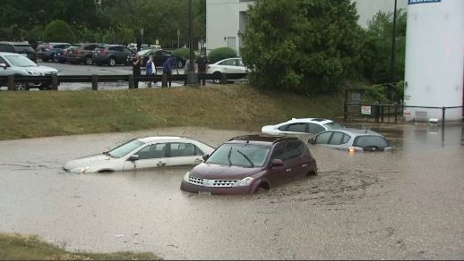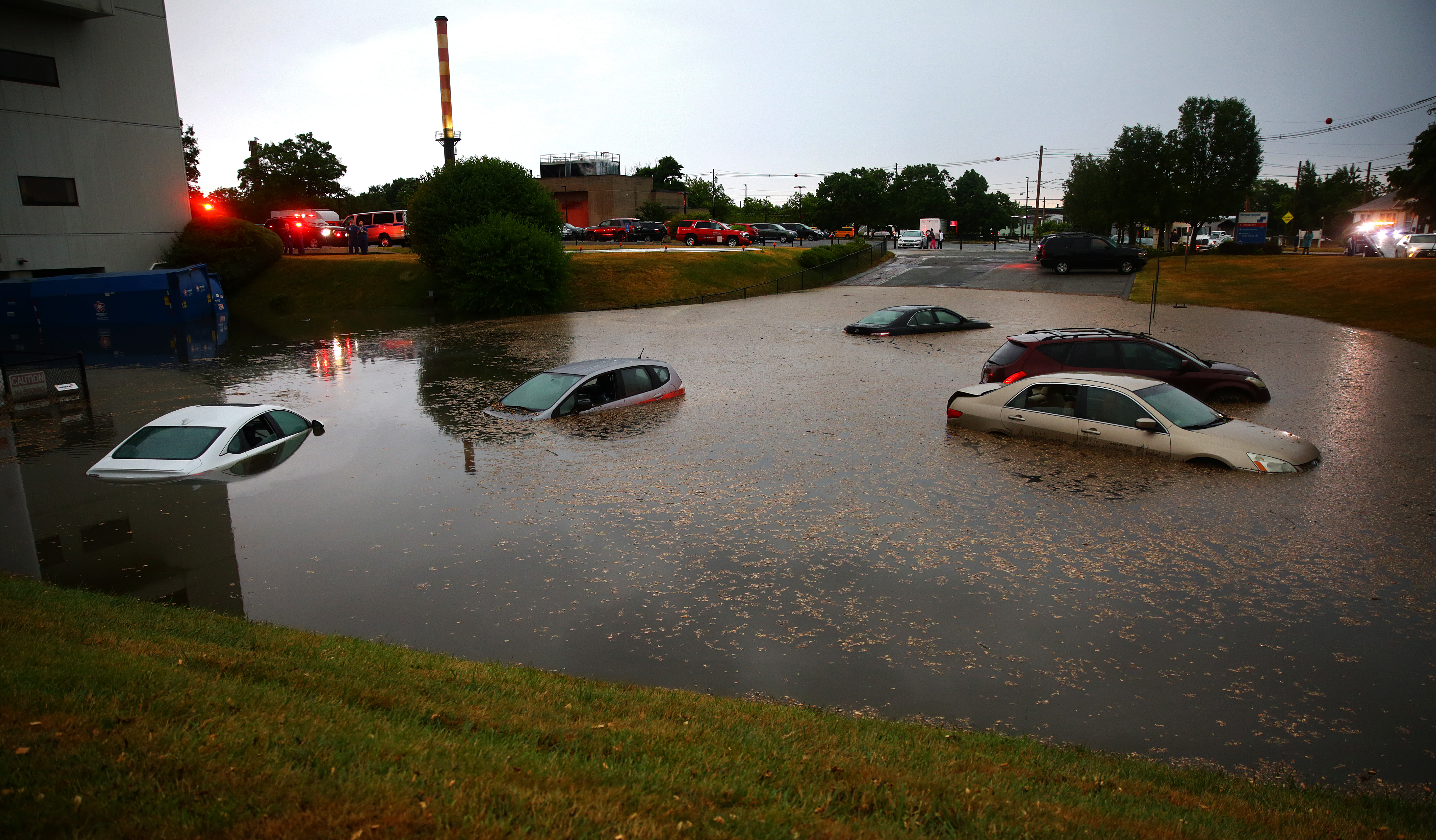
Four inches of rain fell on Norwood, Massachusetts, in 90 minutes, prompting flooding that closed a local hospital. Other towns and cities across Massachusetts may be at greater risk than they thought, as data provided to NBC10 Boston and NECN show.
On Sunday, torrential rain flooded Norwood, Massachusetts, so intensely that a hospital had to be evacuated and closed indefinitely.
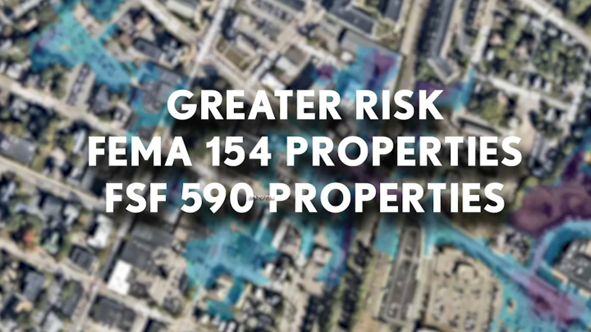
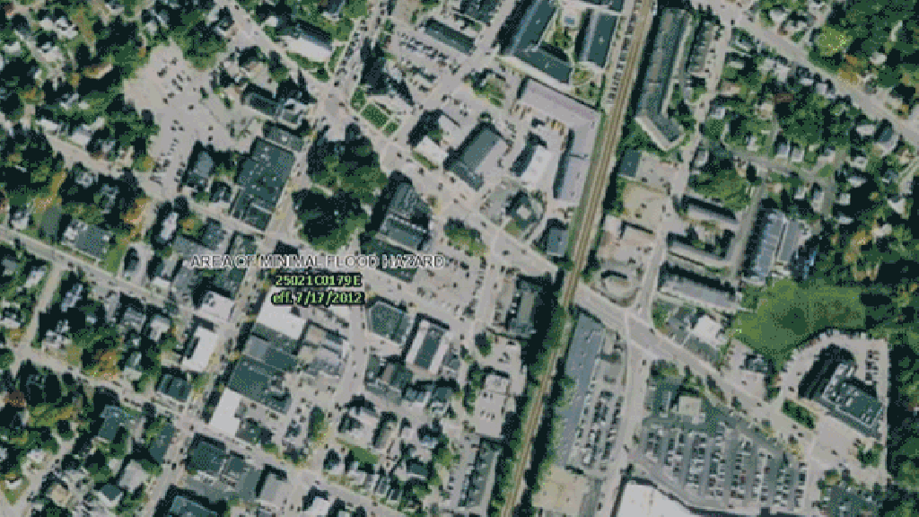
Norwood's downtown area is considered at minimal risk of flooding by the Federal Emergency Management Association, but four inches of rain fell in 90 minutes during Sunday's storm, causing flooding so bad an emergency was eventually declared. The nonprofit research and technology group First Street Foundation, which is pushing for a major reassessment of flood risk across the country, found the risk in Norwood was actually much higher, as shown below.

First Street shared Massachusetts flood risk projection data exclusively with NBC10 Boston and NECN, and, with a few exceptions, it shows much greater flood risk across the state than has been assessed by FEMA -- in some places dramatically so.
Mass. Comparative Flood Risk
This map shows comparative flood risk in Massachusetts as assessed by FEMA, the federal agency whose determinations are a benchmark for the insurance industry, and by the First Street Foundation, which generally found a greater risk of flood for municipalities. Click on each colored-in municipality for more information.
Data: First Street Foundation, FEMA
Nina Lin/NBC
First Street found that 8.7% more properties in the city of Boston are at risk of flooding than FEMA found -- that's four times the number of properties at risk.
The greatest increase in risk statewide is in Adams, a town in the Berkshires, according to First Street's data (which didn't cover all municipalities in the state). In a few places, FEMA assessed a higher flood risk than First Street did, mostly in the towns surrounding Buzzard's Bay, the body of water to the southwest of Cape Cod.
First Street's flood maps factor in climate change, which is causing more heavy rain events around the world. In Blue Hill, for example, near Norwood, 2-inch rain events have gone from happening once per year on average in the late 1800s to three times per year now.
"We have 7% more water vapor that we can cram into the atmosphere. This is the basic premise that leads to larger, more frequent rainfall events as climate changes," said Ed Kearns, chief data officer of the foundation.
First Street's nationwide projections were covered by The New York Times this week, and it reported that, nationwide, nearly twice as many properties are at risk, according to the nonprofit's maps, than what FEMA has found.
FEMA told the newspaper that First Street's project is welcome as a "complement" to what FEMA does.
Interactive Flood Risk Assessments
You can assess your home's flood risk with First Street's Flood Factor tool, here.
Below, use the slider to compare flood risk maps created by FEMA (at left) and Firs Street) at right.
Boston's Back Bay and Fenway neighborhoods:
Worcester
Lynn
Why Are Flood Maps Important?
Flood maps are important not just to help residents predict their level of risk because of insurance costs.
Someone who lives in a FEMA flood zone can face premiums in the tens of thousands. But it's possible to purchase flood insurance outside of those zones, and, while the cost of the premiums varies, it can be significantly lower, even into the hundreds.
Some residents who live in higher-risk areas as determined by FEMA pay hundreds, even thousands of dollars to contest where the lines are drawn so that their property is not designated as being in a flood zone.
Flood assessments are also important for building infrastructure. Towns like Norwood generally don't build in a way to mitigate floods if they don't think flooding will happen.
"Most infrastructure components are designed within a certain range of events that are likely to happen," UNH civil engineering professor Jo Sias said.