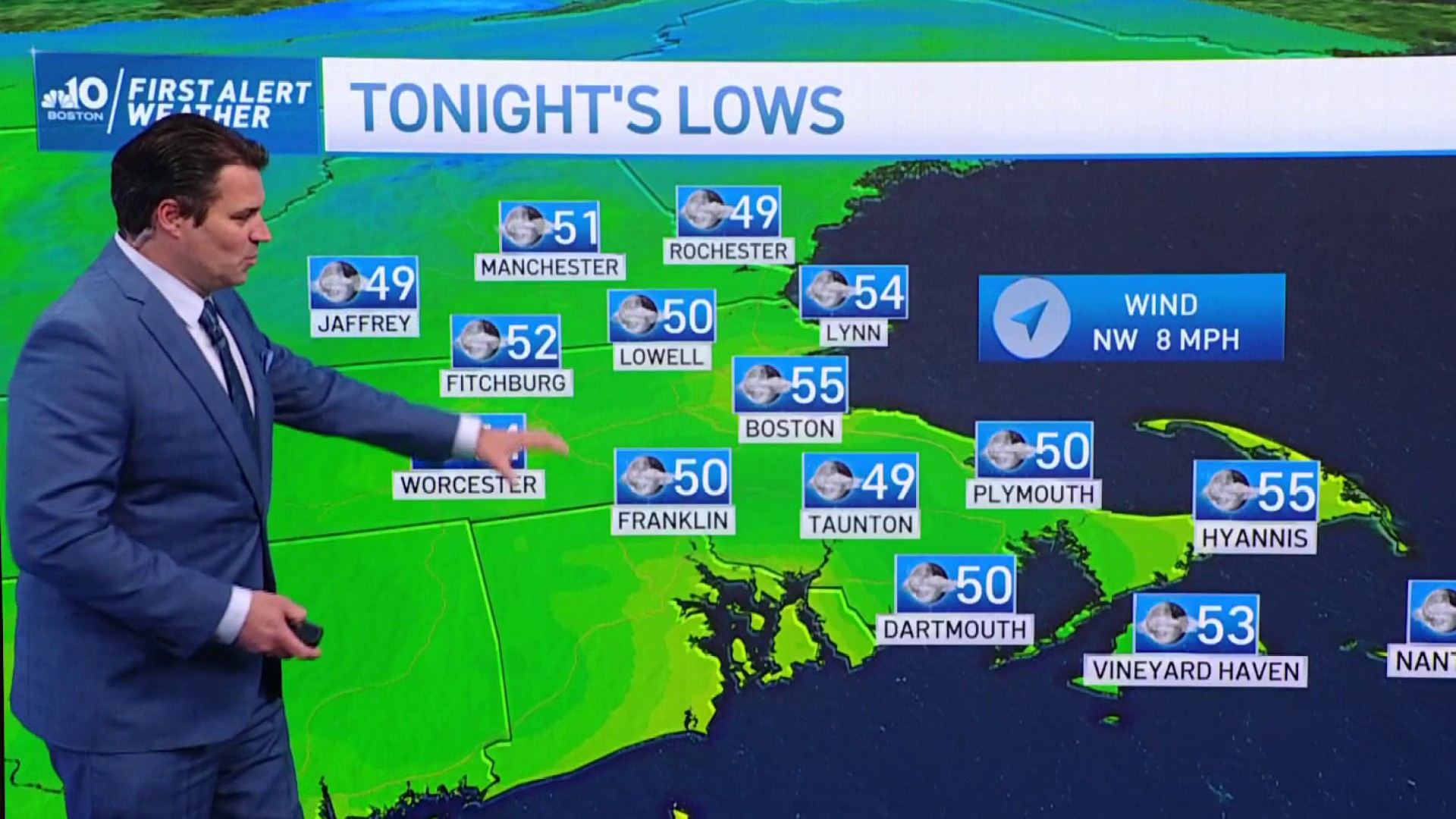
High pressure will provide us with mostly clear skies tonight and another cool night across the region. Lows will range from the low 40s far north to the low 50s south with some 40s peppered across the traditionally cooler spots.
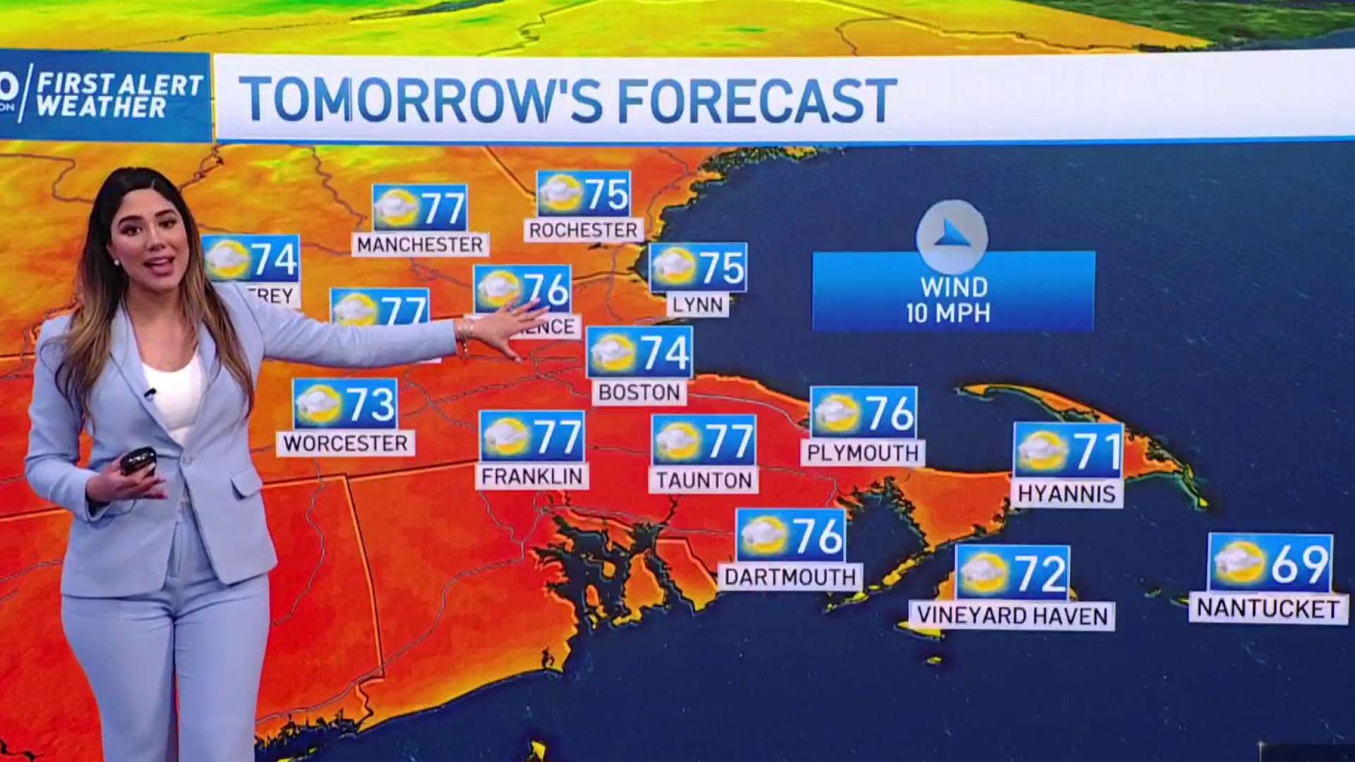
After a cool start early, high pressure will provide us with another warm and dry day across the region. Like today, we’ll deal with a few afternoon clouds and likely see a more prominent sea breeze along the coast. Highs temperatures will push 80s inland, low 70s along the coastline.
Southerly winds will usher in slightly warmer temperatures and a bit more humidity Tuesday with mostly dry conditions, however clouds will rapidly increase from the west during the afternoon as a system approaches the region. A late day shower or t-storm is possible for western areas.
Widespread showers and thunderstorms will arrive overnight Tuesday and continue into the day Wednesday along a frontal boundary which will slow down as it reaches the coastline. We’ll also be dealing with a bit of wind.
Get Boston local news, weather forecasts, lifestyle and entertainment stories to your inbox. Sign up for NBC Boston’s newsletters.
A wave of low pressure will develop along the boundary Wednesday night and ride up, bringing in more rain along with gusty winds as it pushes through the region. Rain looks to continue into Thursday with improving conditions during the afternoon from west to east.