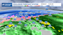
A powerful low pressure system will pass through the region Monday, bringing snow to the higher terrain of southern and northern New England, and rain and damaging winds to coastal areas.
Rain, with a few rumbles of thunder, will be heavy at times Monday morning and may result in some ponding and flooding on the roadways, especially in areas of poor drainage.
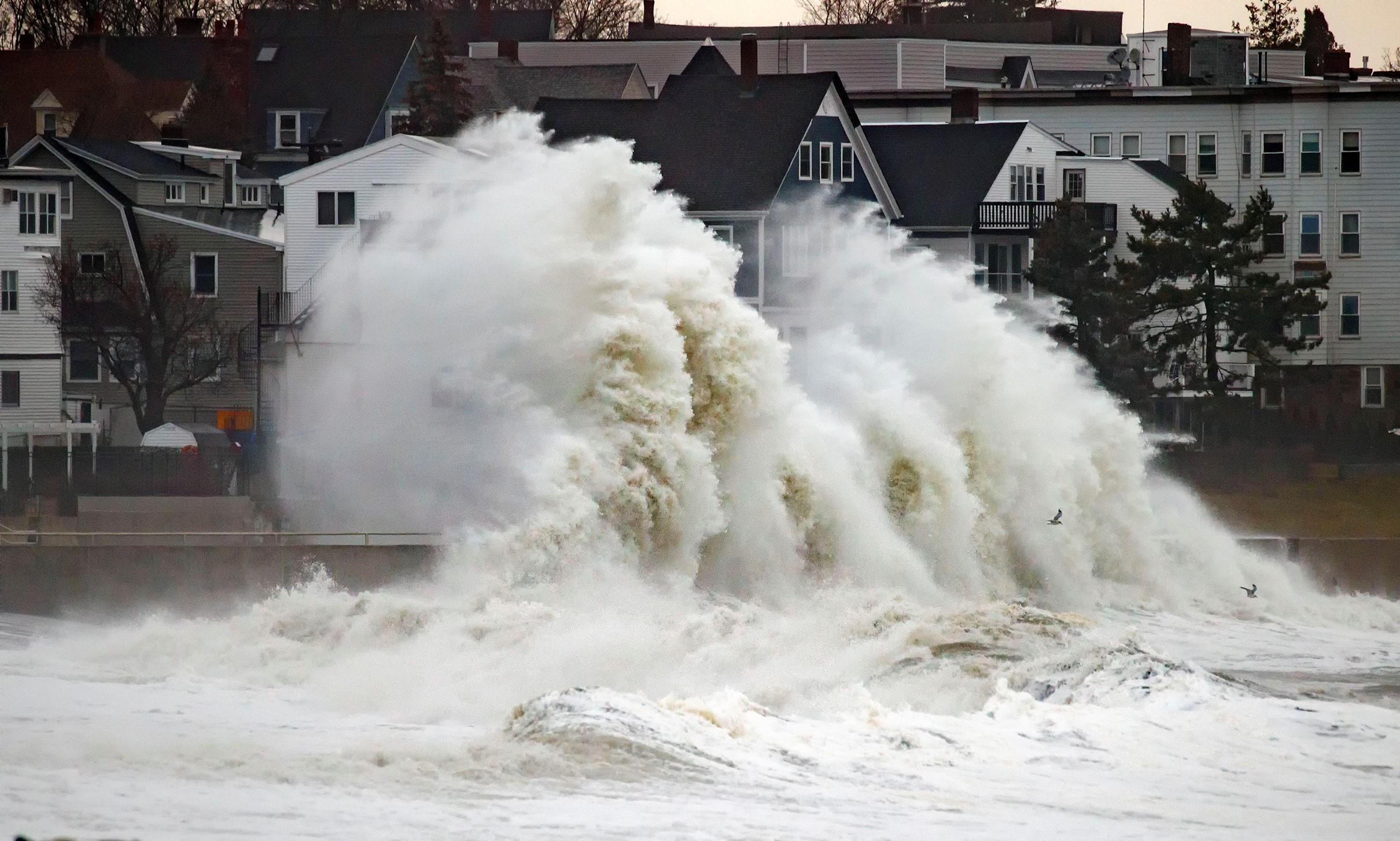
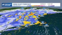
Along with the rain, coastal New England will see a period of strong, damaging winds early Monday morning through early afternoon as east/southeast winds gust up to or over 60 mph at times, which may result in localized power outages.
Get Boston local news, weather forecasts, lifestyle and entertainment stories to your inbox. Sign up for NBC Boston’s newsletters.
How widespread will power outages be?
The strongest winds will be from 4 a.m. through about 11 a.m. from south coastal New England to the seacoast of New Hampshire. Thereafter, the strongest focus of winds will reach the Maine coastline by around 11 a.m. and continue into the early afternoon hours.
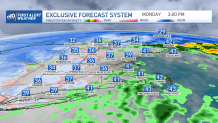
The winds couldn’t come at a worse time as well, as they will coincide with the late morning high tide cycle, resulting in minor to moderate coastal flooding through the early afternoon.
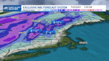
How much snow will Massachusetts get?
We’ll see all the action wind down during the afternoon from south to north as the system races north into Canada. When all is said and done, the higher elevations from the Berkshires, Green Mountains of Vermont, White Mountains of New Hampshire and into western Maine will end up with the snow jackpot of 8 to 12 inches or more of snow! It will be a welcome treat for the ski resorts!
However, if traveling through these areas during the day, please take it slow due to poor visibility because of snow and blowing snow.
Our team has issued a First Alert Monday due to the many weather issues we will see across the region and will be keeping you updated throughout the day.