A cold front moved through overnight, with some snow showers before dawn. This set us up for some slick roads and a light sugar-coating of snow even to Cape Cod.
The wind and cold temps continue to dominate the day even with sunshine. Highs only reach the 20s to 30s, with “feels like” temps in the teens and 20s Wednesday afternoon thanks to the gusty northwest wind.
An upper level low continues to spin near the Bay of Fundy and that will bring in more rounds of snow or rain bands to Maine and the southeastern Massachusetts coast by Wednesday night. Temps Wednesday night actually stay milder as we see our wind direction more onshore.
Clouds thicken up for Thursday as we get some ocean-effect showers near the coastline too. Most areas in New England stay dry, with highs around 40.
Get Boston local news, weather forecasts, lifestyle and entertainment stories to your inbox. Sign up for NBC Boston’s newsletters.
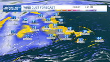
Friday First Alert: Strong winds expected
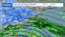
Our First Alert day is Friday, as a large storm system move toward Canada and a secondary coastal low develops off the Delmarva coast. Rain moves into Boston by the Friday morning commute and the wind increases during the day to gusts from the east 40 to 50 mph. Farther inland, the wind will be 30 to 40 mph.
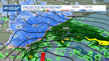
Where will the snow-rain line be?
Temps stay in the 40s inside 495, but farther northwest and in higher elevations temps are cold enough to support sloppy snow and a rain mix. Then there’s snow for the mountains of northern and western New England.
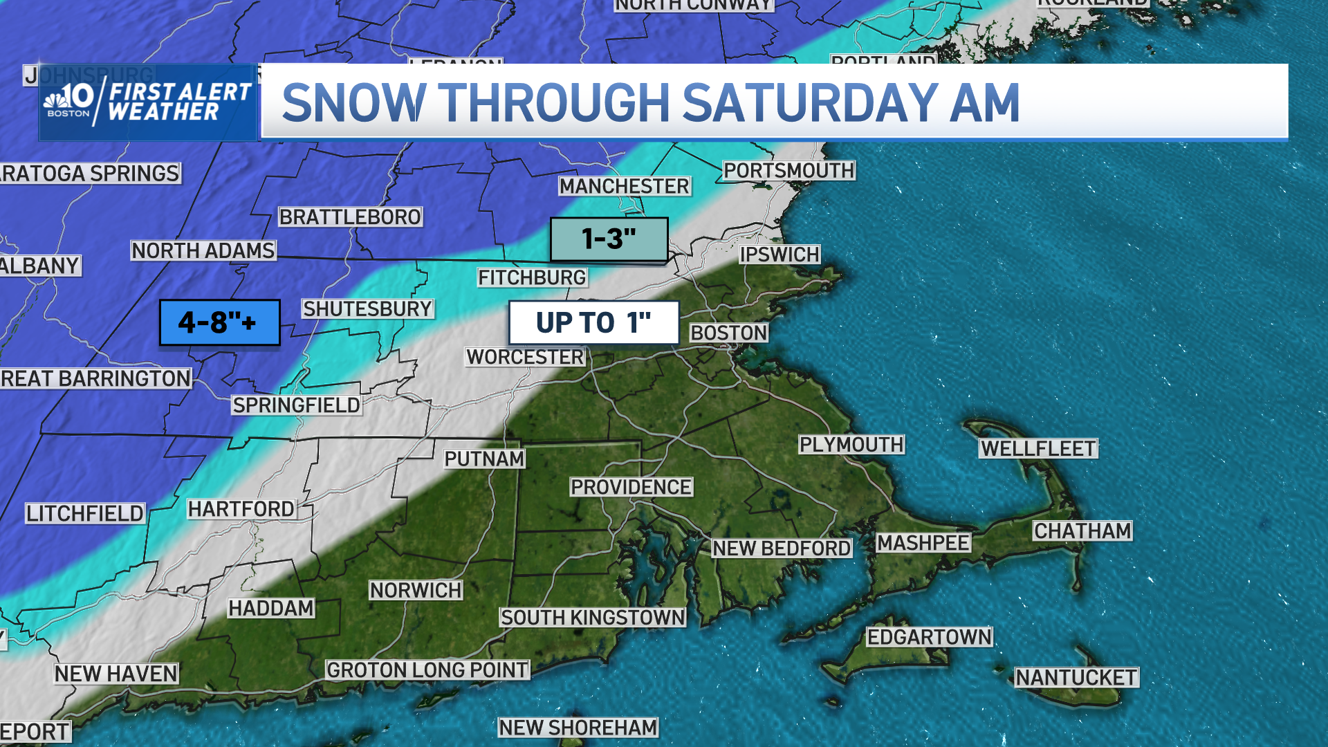
How much snow will we get in Mass., N.H.?
The snow there sticks around through Saturday morning, with the North Country experiencing more snow through Saturday evening. Dry air moves into Boston by Saturday morning, as it has continued to rain all day Friday through Friday night.
A sneaky area of cold air could wrap around the low Saturday morning, swapping rain in Boston to a brief burst of snow, but we're not expecting accumulation from that. Then we stay breezy and cool off for Sunday. Mid 40s Saturday, to highs in the upper 30s Sunday.
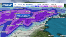
Here's a look at how much snow is expected across New England by the time the storm is over:
Next week we remain quiet and cold with highs in the upper 30s and low 40s through midweek. Another possible coastal storm develops for the night before Christmas Eve, and there are signs that this one will have more cold air to work with.
Snow for all of New England may be in the works. Stay tuned!