
-
Temperatures warm up this week: here's what to expect
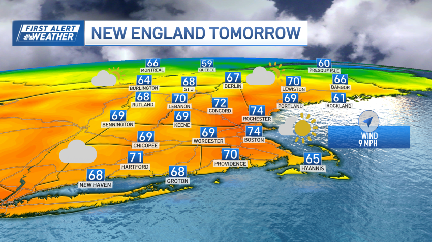
A stunning stretch of weather is unfolding in our First Alert forecast with high pressure the dominant feature on the map over the next several days. Warmth continues to build on the western side of that high, with highs in the 70s set to arrive to New England as early as Wednesday for some of us and last into the…
Trending
