
The rain and snow moved out before sunrise, and now we are celebrating Red Sox Opening Day.
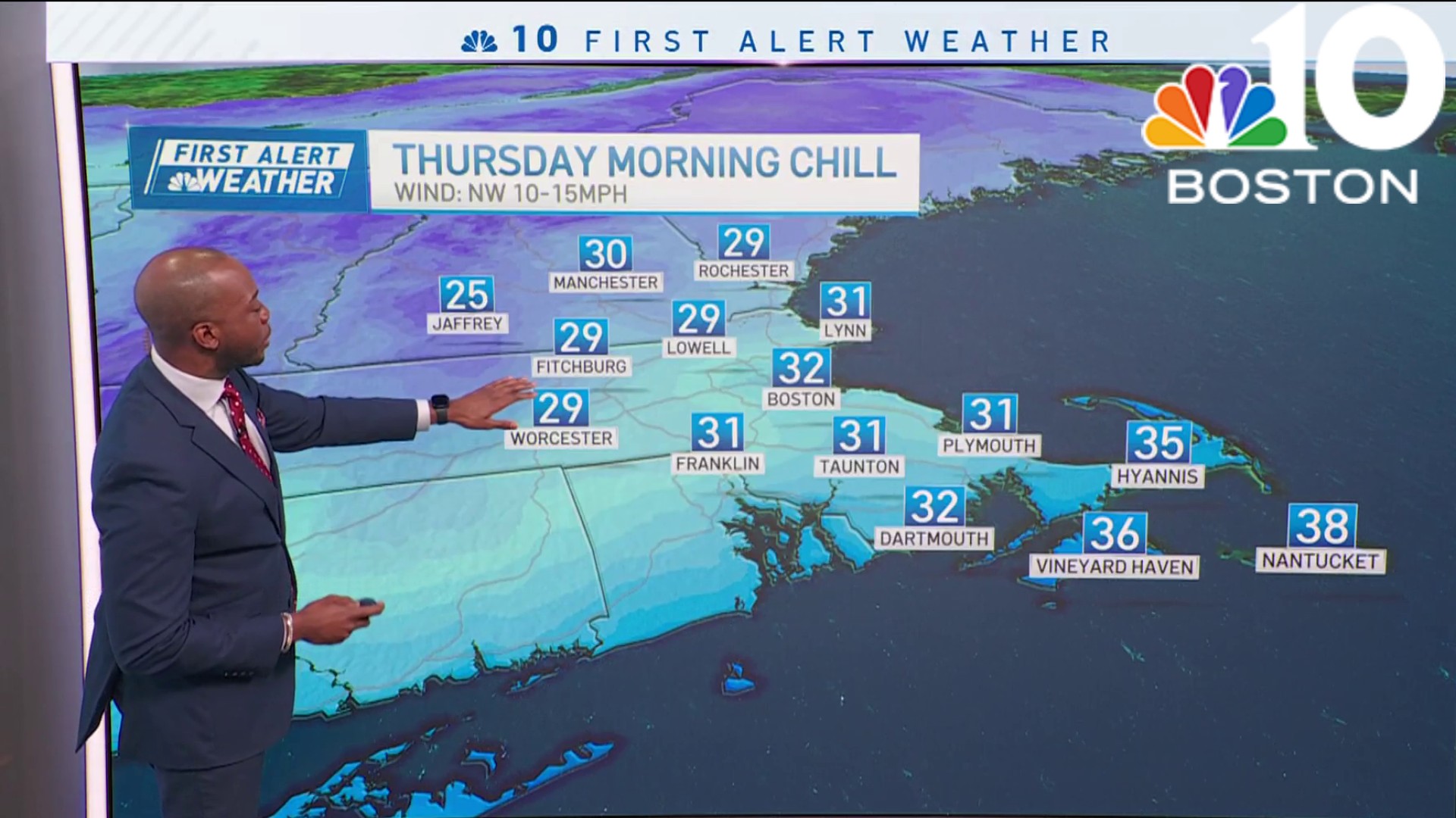
Temperatures on Thursday afternoon remain cooler than average, with that recent cold front that pushed through last night, so our highs will remain in the upper 30s to lower 40s across much of the area. Fortunately, the sun is shining bright, but the wind has made it feel a lot cooler.
Wind chills began in the teens to lower twenties in the morning, and now we’ve made our way up to the 20s and 30s. While there won’t be any rain, the wind will be a nuisance in the next few days, especially Saturday and Sunday.
Get Boston local news, weather forecasts, lifestyle and entertainment stories to your inbox. Sign up for NBC Boston’s newsletters.
Friday will be a transition day as we look out for milder temperatures in the long run, but also more cloud coverage by the afternoon setting up the stage for the rain. So, as the wind remains breezy on Friday, clouds increase by the early afternoon and snow showers take over the mountains.
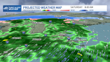
Rain will hover over central and southern New England and will remain through Saturday night. While Saturday’s warm front pushes in mild warmer air that may reach the 60s, a cold front late in the day will crash us down to the 40s for Sunday along with drier and brighter weather.
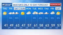
Our NBC exclusive 10-day forecast is keeping us on the milder trend when looking out to temperatures next week; we’ll remain with highs in the 50s to 60s pretty much from Monday through next Friday. The chance for showers stands out Tuesday, Wednesday and Thursday of next week.
