
Our seasonable stretch of temperatures continues as we round out the month of May. Dry skies prevail for much of Tuesday, as we see breezy winds settle in from the east.
That will keep temperatures across the immediate coastline at bay. Boston, Hingham, Weymouth and South Shore towns will reach the mid 60s. With high pressure overhead, sunshine beams down for much of the day, cranking in warmth.
Across MetroWest and central Massachusetts, highs will be nearly 10 degrees warmer in spots. Smoke from active wildfires in Nova Scotia will drop in Tuesday afternoon, bringing hazy sunsets across central and eastern Mass. The sea breeze breaks by Wednesday, with a July-like feel to the air to close out May. The day is dry and highs soar into the upper 70s through the region.
Get Boston local news, weather forecasts, lifestyle and entertainment stories to your inbox. Sign up for NBC Boston’s newsletters.
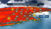
The pinnacle of the warmth awaits us on Thursday with dry conditions. While there will be a much weaker breeze, the region should still manage to reach the low-to-mid 80s. The pairs of days (at or above 84 degrees) would be the first time consecutively in Boston since late August—marking a sure sign of summer’s return.
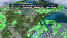
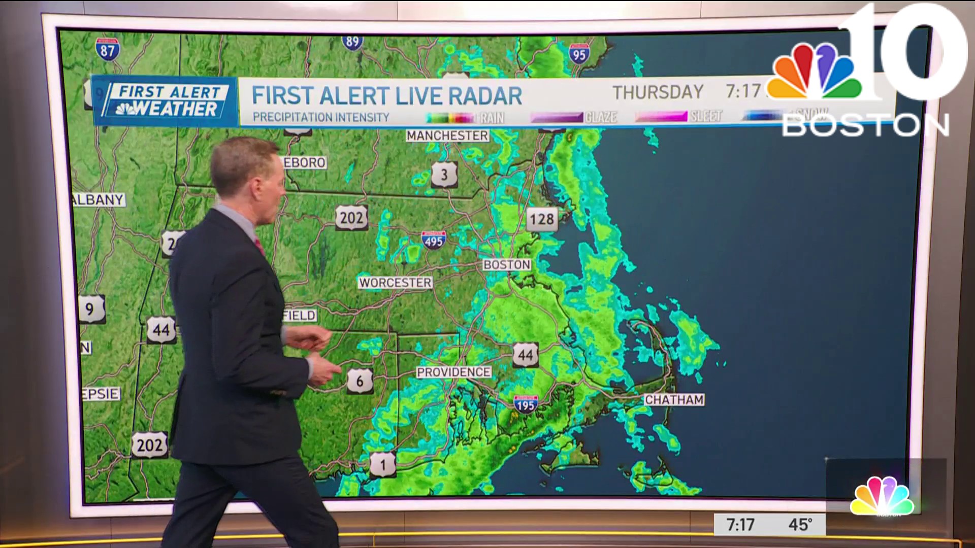
Ultimately, the week will finish on a much different note. A cold front will drop in Friday night and Saturday, bringing scattered showers through. While the timing is still in flux, it does appear that neither day will be ruined with rain.
Weather

Saturday’s temperatures are much more in check, in the mid-to-upper 60s for much of the weekend.
