


Saturday night: dropping to upper 20s, clear. Sunday: Mostly sunny, highs in the low 40s with increasing clouds evening. Monday: slight chance of snow showers, highs in the upper 30s.
We had some festive snow and minor accumulation on grassy areas, elevated surfaces and in higher elevations in southern New England overnight. Northern New England continues to pile on the snow in the mountains Saturday.
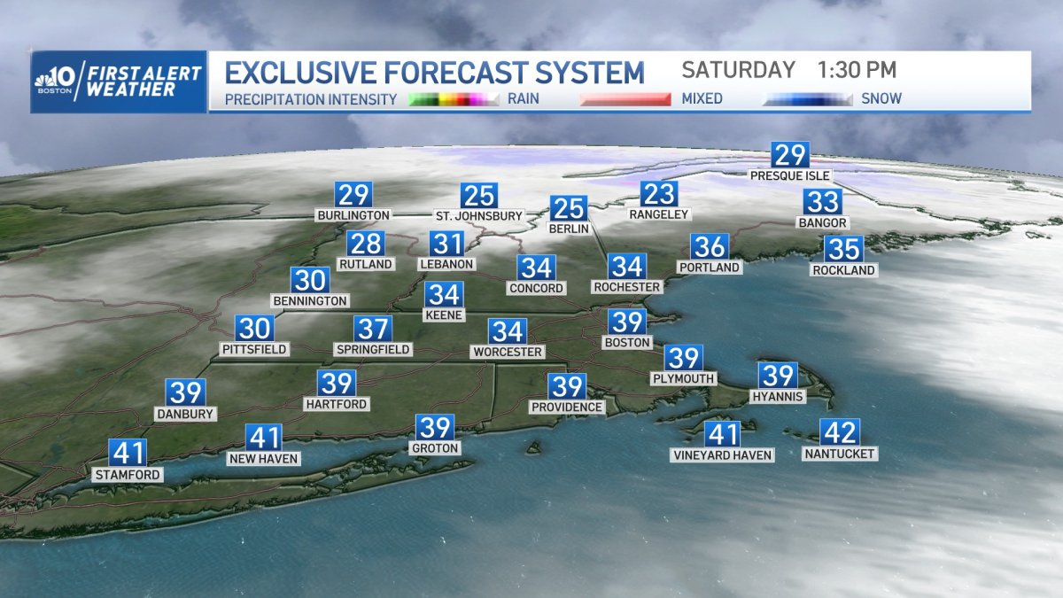
Everyone is waking up to cold temps and blustery weather as the wind continues to gust 30-40 mph from the west. Northwestern New England may see some tree damage or outages this morning as the snowfall from overnight weighs down tree limbs or power lines.
The wind stays strong until sunset. The wind also creates the wind chill factor. It will be cold with highs in the upper 30s, but feeling like the 20s even with decreasing clouds and more sun late in the day. Saturday night we drop to the teens and 20s with a clear sky and diminished wind, so watch for icy spots on the roads.
Get Boston local news, weather forecasts, lifestyle and entertainment stories to your inbox. Sign up for NBC Boston’s newsletters.
Sunday brings our temps a few degrees warmer in the low 40s south, 30s north and less wind. A disturbance in the atmosphere brings in a shower chance, to a little wintry mix in southern New England Sunday night. This wave doesn’t have a lot of lift with it, so only light snow accumulation is possible.
Also, the forecast models suggest a coastal low developing, but the wave may be far enough offshore that the low takes off after moving through our area, this also cuts down on snow totals going into Monday. A coastal front may be the only chance to see accumulation from this low.
Taking all that into account, a coating to 2” seems like a reasonable outlook through Monday in southern New England, but stay tuned this weekend as we make forecast adjustments.
Local
In-depth news coverage of the Greater Boston Area.


Next week, we stay cool until the end of the week with a return of some 50s around Thursday.

