
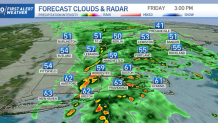
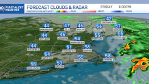
We continue under a First Alert with a severe weather threat. Showers have now become stronger and will continue to intensify as they advance east Friday afternoon.
Hope you’ve got all loose items from your patio stored inside by this time!
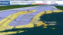
We’ll continue watching strong wind gusts exceeding 50 mph in the most vulnerable sites to the southeast. This can damage trees and bring power loss for some areas. With embedded thunderstorms and heavy downpours, this system will push through swiftly, moving off by Friday evening, but not without first producing over an inch of rainfall in the most affected spots.
Get Boston local news, weather forecasts, lifestyle and entertainment stories to your inbox. Sign up for NBC Boston’s newsletters.
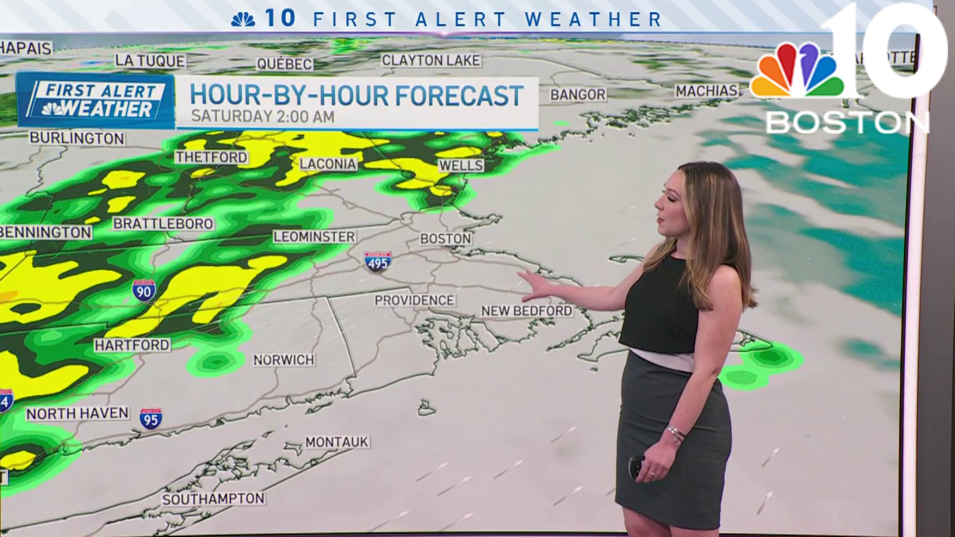
Western New England will be drying off first before the eastern side gets to see a dry night. All of the northeast, however, will be enjoying a dry Sunday overall.
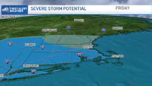
For now, stay weather alert as the risk of severe weather will continue Friday afternoon; these storms have already produced rotation out in New York with the capability of bringing additional tornadic activity to New England. Stay away from windows if indoors and tall objects if you’re outdoors. Thunder will continue to be another element that can bring life threatening conditions.
Rather than choosing a winter coat, we’re dealing with rain gear on Friday. It's too windy to be having umbrellas out, and our temperatures have reached the low 60s, which is way warmer than Thursday. They won’t be lasting too long though, and neither have we gotten the chance to enjoy them by being outside. On Saturday, we’ll watch milder temperatures close to the upper 50s before a substantially cooler start to next week.
Our highs will be dipping into the upper 40s Monday afternoon, along with rain chances, while our lows will drop into the mid and upper 30s in the south and upper 20s in the north. But the cold will just be getting started, as Tuesday will be bringing another day with highs in the 40s but lows dropping to the upper 20s and low 30s in the south. Lows in the teens could be popping up for some in the north.
These frosty lows, however, won’t be hanging out for too long. Once we get to Wednesday night and on, our lows with stay in the upper 30s to low 40s and our highs will climb to the 50s and near 60s again though Thursday.
Weather

In our marine forecast, we’ll be watching choppy shores, dangerous conditions for mariners and waves that will continue to build up. Friday night, we’ll be watching heights of up to 9 feet in our eastern shores. Moderate rip currents will also continue through Saturday morning.
