
After a few days of remaining nearly stalled out, the atmosphere in New England is ready to make a move – and the move will be decidedly more into wintry weather.
The first step in that change came Thursday morning, as the freezing line of 32 degree temperature nudged southward into southern Maine and north-central New Hampshire, icing wet surfaces, while snow continued falling from the overnight in the North Country.
With a north-northeast wind, it’ll be a continued but very slow southward progression of the sub-freezing air Thursday, not arriving to Concord and Portsmouth, New Hampshire, until after dark and then nudging to the New Hampshire/Massachusetts border by dawn Friday. That may result in some new areas of icing in southern New Hampshire or extreme northern Massachusetts.
The bigger feature Friday will be an energetic disturbance aloft that our First Alert team has been monitoring for snow showers all week. This disturbance will create a blossoming area of snow and rain for most by around mid-morning Friday, lasting into middle and late afternoon.
Get Boston local news, weather forecasts, lifestyle and entertainment stories to your inbox. Sign up for NBC Boston’s newsletters.
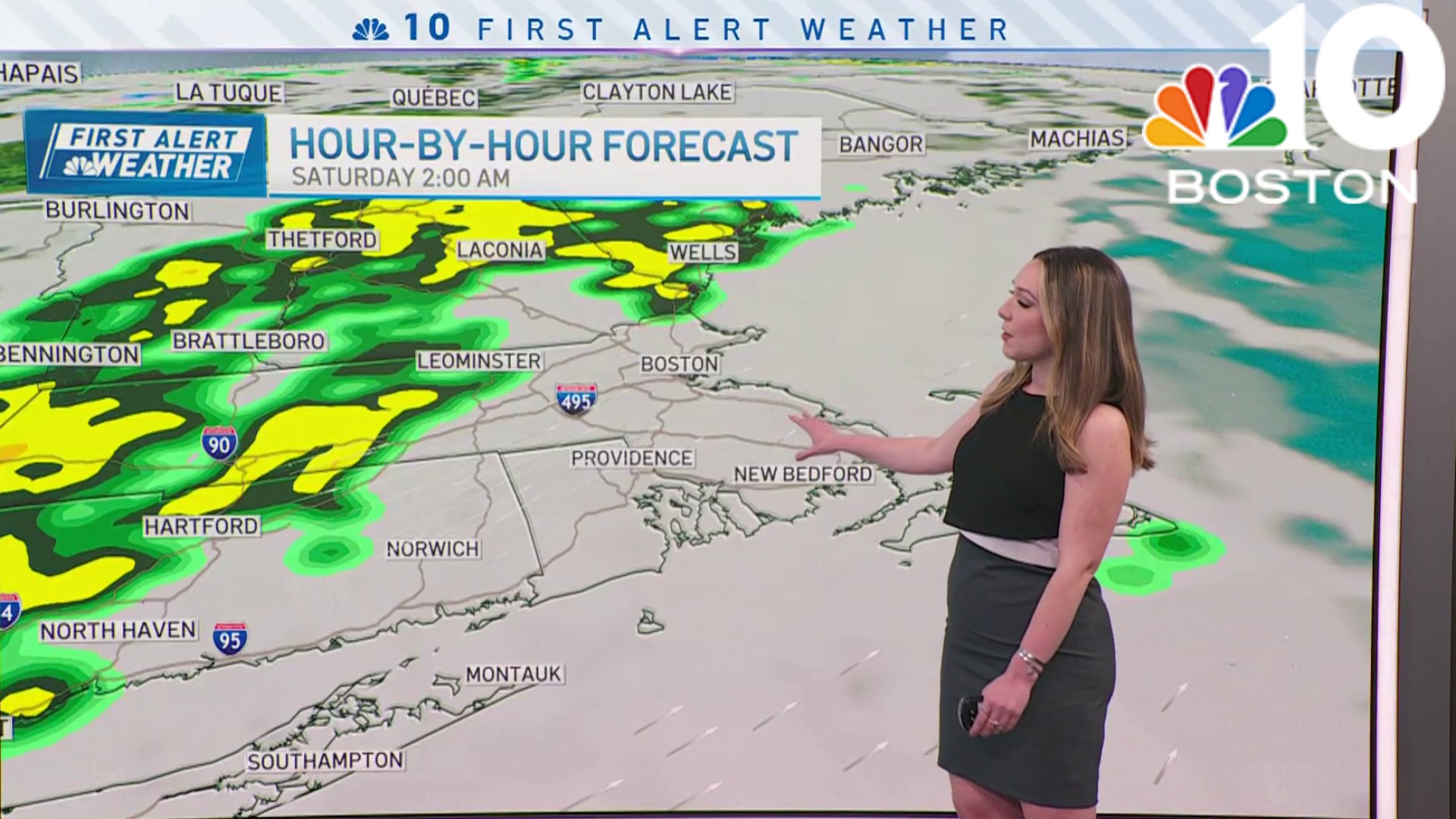
Though mostly light, there may at times be some heavier bursts of snow and rain, with the rain/snow line setting up from northern Connecticut and northern Rhode Island to around Brockton, Massachusetts, with points southeast rain and northwest snow. When all is said and done late day, either side of two inches of snow should be measured from interior Massachusetts into central New Hampshire and southern Vermont, with one to two inches for many others. That's enough that roads likely will need at least rock salt treatment in many spots, and likely enough to plow on some roadways in the solid two inch zone.
By Friday evening, snow and rain will exit but with temperatures dropping below freezing Friday night, slick spots will develop on untreated roads. Saturday brings a shot of chilly air accompanied by plenty of clouds with a few flurries and sprinkles – scattered snow showers in the mountains – and highs barely into the 40s south and 30s central and north.
Weather

Sunday, the cold but dry air from Canada is reinforced in New England, meaning more sunshine but colder daytime temperatures in the 30s. Next week should feel like January regionwide in New England. High temperatures will run near or slightly above normal in the upper 30s to lower 40s each day, and disturbances at the jet stream level are nearby on Monday, Wednesday and Friday into Saturday.
The first two are quick-moving and unlikely to strengthen much – in fact, one or both of these may remain so weak that they avoid impact on New England entirely, especially the Monday disturbance which may zip to our south, but we’ll be keeping a close eye on it.
Wednesday’s disturbance also looks to be quick-moving right now, so at this point we reflect little more than scattered snow and rain showers. Friday into Saturday of next week has more potential — stronger disturbance that enters a jet stream trough, or dip in the jet stream, that tends to favor strengthening storms.
If the path remains south of New England, that would put most of the region on the cold, snowy side of the storm, but this many days out it remains a potential to be watched, far from a certainty. Our team will keep you posted.
