
After a Sunday beauty, defrost mode ends with a wintry mix Monday, then a very cold week ahead, with a snow threat by later Wednesday into Thursday.
A weak front may bring a shower or two Sunday afternoon, but for the most part it’s dry and the temperature with many of us in the 50s to near 60 degrees in southern and eastern New England, cooler to the west and north.
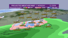
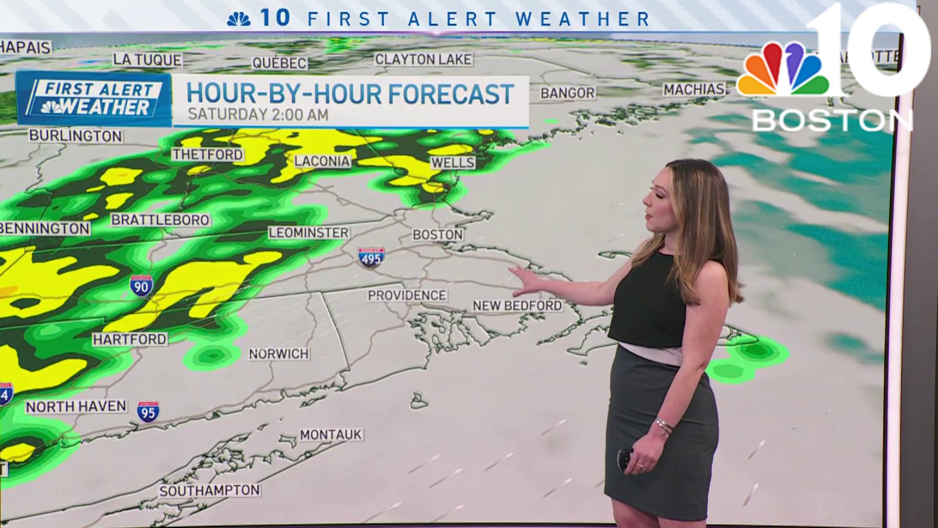
A cold front passes through Sunday night with a wave of low pressure developing on the front to our south that’s going to bring back another period of rain changing to snow for southern and eastern New England on Monday.
The temperature is marginal for snow on Monday, with highs near 40 degrees in the morning, falling through the 30s during the afternoon.
It may snow hard enough for a couple inches of snow in the higher elevations and on grassy surfaces. Our roadways probably just stay wet or slushy, but visibility may be poor Monday afternoon and evening.
A low pressure system is going to strengthen rapidly and pulls away at night, generating strong wind and some of the coldest air since last winter.
Weather
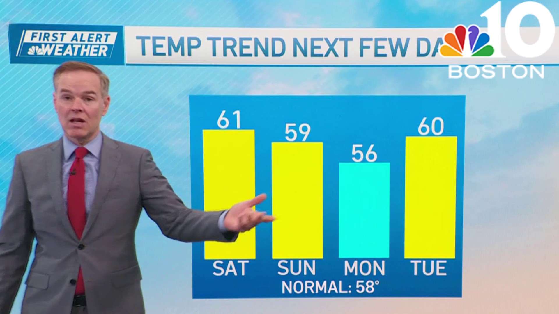
Temperatures start off in the 20s on Tuesday with wind chill factors in the single numbers. There should be plenty of sunshine Tuesday with highs near freezing south and even colder north. Strong high-pressure in southeastern Canada gives us a clear cold night Tuesday night with lows near 0° near the Canadian border to the low 20s at the South Coast.
That sets the stage for a significant winter storm impacting New England late Wednesday, Wednesday night and early Thursday. It looks like it’s going to hit hardest in central and southern New England and along the coast in Maine.
Snow may be heavy at times Wednesday night, with a lot of wind and possible coastal flooding with tides running high just past a new moon. We estimate more than a half a foot of snow may be in the cards.
After that, the week ends cold, followed by slight warming next weekend with a chance of another wintry mix by later Saturday night and Sunday, as seen in our First Alert 10-day forecast.
