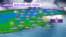
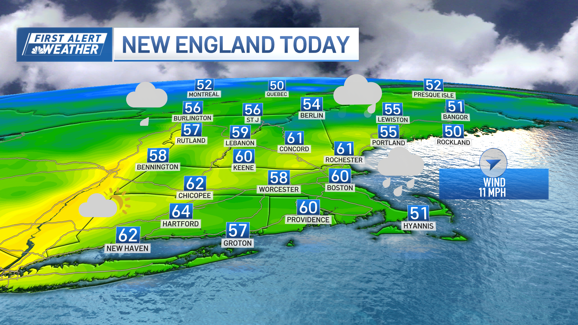
Much of the region will be enjoying a picture perfect fall day Friday with the exception of southeastern Massachusetts, where we are seeing a lot of clouds and a few ocean effect sprinkles and showers.
The good news is that we’ll see improving conditions there through Friday afternoon. Highs will reach the upper 40s to 50 across the south, with mid to upper 40s north.
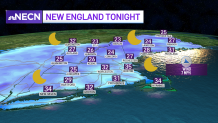
Another frosty night is on tap, with clear skies and light winds. This will allow for temperatures to plummet once again, especially across the inland valleys!
Get Boston local news, weather forecasts, lifestyle and entertainment stories to your inbox. Sign up for NBC Boston’s newsletters.
Much of the area will be waking up to more frost, so grab those ice scrapers once again early Saturday. Lows will range from the low to mid 30s across the metro areas south, with upper 20s to low 30s inland and mostly in the 20s north.
High pressure will dominate our weekend’s weather. That is a good thing because a storm will be getting its act together over the mid-Atlantic by late in the weekend and it looks to remain offshore as high pressure dominates and shields us from any threat of it moving into the region.
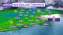
Highs Saturday will be in the low 50s south and upper 40s to 50 north. Sunday will be a tad warmer, with a bit more clouds around south during the afternoon as the ocean storm exits out to sea well south of the region.
Weather
Highs will be in the low 50s south, and upper 40s to near 50 north.
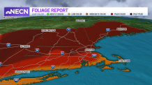
Overall, the weekend is looking fantastic for early November and should allow for some decent viewing of the foliage across southernmost New England, where we are now seeing peak colors!