It’s a record-setting day in Boston and around New England!
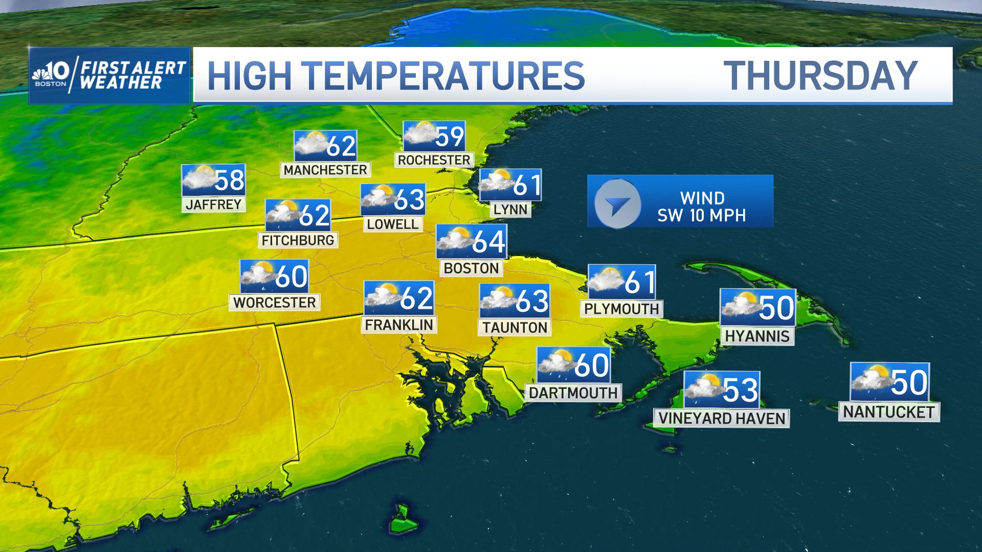
Highs Thursday are stepping to the 60s in Connecticut, Rhode Island and southeastern Massachusetts. Hitting 61 degrees, Boston broke the previous record for Feb. 16 by 10 a.m.
Get Boston local news, weather forecasts, lifestyle and entertainment stories to your inbox. Sign up for NBC Boston’s newsletters.
Here are a few of the new records set Thursday:
- Boston: 61°, previously 60 in 1910.
- New London, Conn.: 71°-, previously 56 in 1954.
- Norwood, Mass.: 63°- previously 60 in 2006.
- Providence: 66°, previously 60 in 1910.
While we get to enjoy a dry first half of the day, our evening sees scattered showers pushing east. A more varied precipitation will be seen Friday, as a cold front pushes south early and produces snow in the mountains, freezing rain/sleet in southern New Hampshire and Vermont and rain in southern New England by early and mid-afternoon.
If this system lingers long enough through the evening, the cold front may allow some snow in parts of Massachusetts that will provide a quick dusting before the system exits. Six to 10 inches of snow may fall in the crown of Maine by Friday night.
The same system that’s extending into the Northeast Thursday has been clashing temperatures in our central country, which has been increasing instability and generating severe thunderstorms as well as tornado warnings in the lower Midwest. The Ohio River has been keeping an eye on more rain and thunderstorm formation along with strong wind gusts.
While this activity will weaken as it nears New England, the chance of a thunderstorm or two is not ruled out of the question for western New England, with the aid of daytime heating Friday.
Regarding temperatures, they will crash down Friday night into Saturday morning, with possible wind chills in the single digits in northern New England and teens in central New England. After that, sunshine will play a role in helping temperatures go up to the lower 40s Saturday afternoon.
Sunday welcomes milder temperatures but increasing clouds. The chance of showers returns Sunday night into Monday morning.
A more unsettled weather pattern will take over much of next week, with temperatures dropping. We’ll start with highs in the 50s and end our work week with temperatures in the 40s and the chance for more snow!