Partly sunny skies will start the day on Monday, before more clouds arrive by late afternoon. High temperatures will be colder — in the middle 30s.
When Will the Snowfall Begin in New England?
By late Monday night, or early Tuesday morning, snow will begin to fall across the area. The Tuesday morning commute will be rough, as temperatures are slightly below freezing and some of the heaviest snow falls.
Get Boston local news, weather forecasts, lifestyle and entertainment stories to your inbox. Sign up for NBC Boston’s newsletters.
The Massachusetts Emergency Management Agency urged anyone commuting in the Bay State on Tuesday morning to "take extra caution and make sure your car is stocked with emergency supplies."
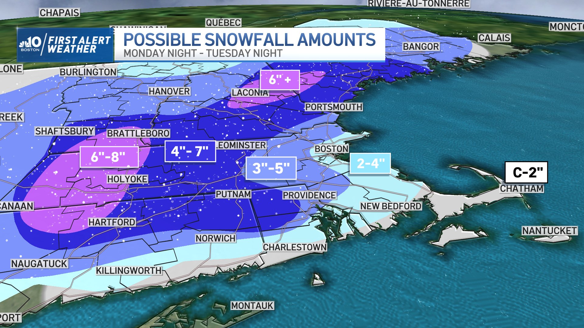
Snowfall Totals by Region
However, with a higher sun angle and temperatures that rise above freezing throughout the day, we can expect much improved road conditions by midday. A general 2 to 4 inches of snow is expected in and around Boston. 4 to 7 inches are likely in Worcester County, and only a coating to an inch is likely on the Cape and Islands.
Highs on Tuesday will be in the upper 30s. Wednesday is partly sunny and milder. Highs will be in the lower 40s.
Two More Storms This Week in New England
Thursday is very mild, with rain likely. High temperatures will be near 50 degrees.
As one storm exits Friday morning, another arrives late Friday evening. With colder air in place, we will watch for the possibility of snow or a wintry mix going into Saturday. Highs on Friday will be near 40.