Outside of a few inches of snow in the mountains of Vermont and New Hampshire, we have a mostly dry and much less cold Wednesday evening ahead.
Temperatures made it back into the 40s in southern New England with even a few spots hitting 50, while to the north we were in the 30s. The wind is more reasonable out of the west gusting close to 25 mph.
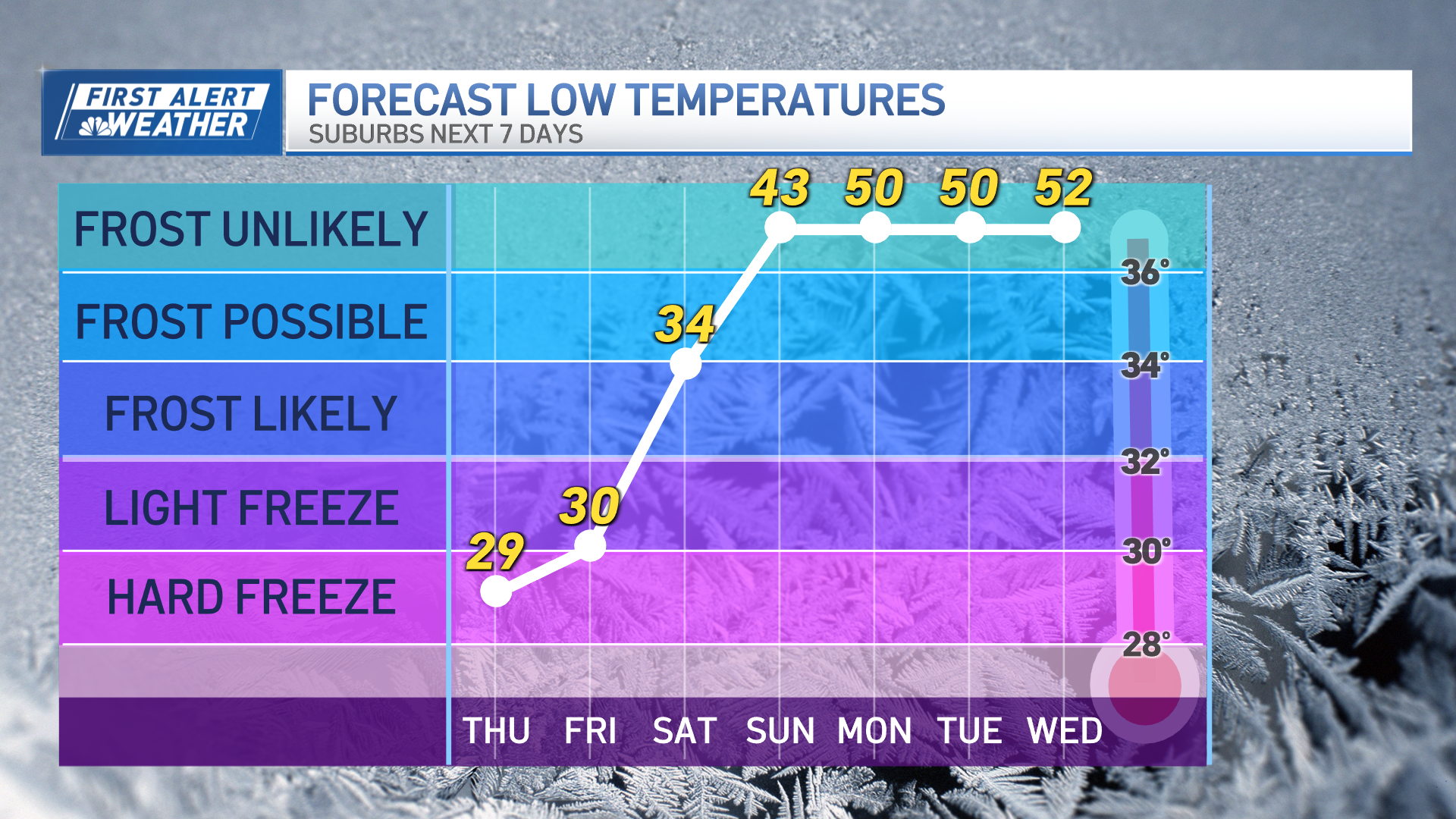
There’s very little change over the next few days. It will get cooler, though, as the old storm (from Tuesday) is backing toward the south in Quebec, pulling another batch of colder air in for the end of week and the weekend. The air is dry, but there are enough clouds to generate some more upslope snow in the mountains of Vermont and northern New Hampshire and western Maine -- a few inches for the ski areas each night.
Each day should bring more sun and clouds, with high temperatures back near 40 degrees in southern New England Thursday, then we are all in the 20s and 30s for Friday and Saturday.
Get Boston local news, weather forecasts, lifestyle and entertainment stories to your inbox. Sign up for NBC Boston’s newsletters.
Wind from the northwest will increase to 25-30 mph later Thursday and Friday, creating wind chills in the teens to around 20. The wind will gradually relax over the weekend making for a great weekend of winter sports.
A weather system bringing snow to Southern California Wednesday will move across the country, and it will be to our east on Sunday. If the disturbance stays out to sea, we are going to be storm-free into next week.
Weather Stories
Then the weather pattern is going to shift, allowing a strong low-pressure system to head toward Ontario by the second half of the week -- pushing a warmer air mass into New England.
We may have the first string of mild days by next Wednesday, in the 50s and maybe even 60s with rain showers.


