
This week is unsettled with a few minor systems heading through, with quiet weather in between.
Cold, but relatively average temperatures start March
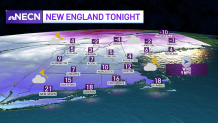
Temperatures are either right around average or just below average for the rest of this week. Tonight we will see a few more clouds, with lows near zero, single digits to teens south and a diminishing wind.
Get Boston local news, weather forecasts, lifestyle and entertainment stories to your inbox. Sign up for NBC Boston’s newsletters.
Meteorological spring begins tomorrow, and even though we stay unsettled for the next several days, there are no major storms. March seems to come "in like a lamb" as clouds thicken and our highs reach the 30s north and low 40s south during the day. Clouds increase and there will be a breeze around.
Sprinkles and light snow as minor systems roll through
There is a clipper system heading into northern New England that will bring in light snow showers for the second half of the day. A couple of sprinkles are possible in southern New England and a spot rain shower late in the day, but most spots should stay dry. Overnight, the snow showers will add up to about a coating to 3” in northern New England.
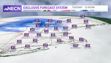
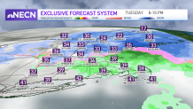
A light wintry mix will fall in southern New England into Wednesday morning. Highs Wednesday reach the mid 40s with some sunshine as we have a brief break between systems. Another clipper system moves in for Wednesday night into Thursday and this one will bring about 2-4” of snow for northern New England and rain to snow south. This one may have a little more impact as we head into Thursday, so stay tuned for updates.
Weather Stories

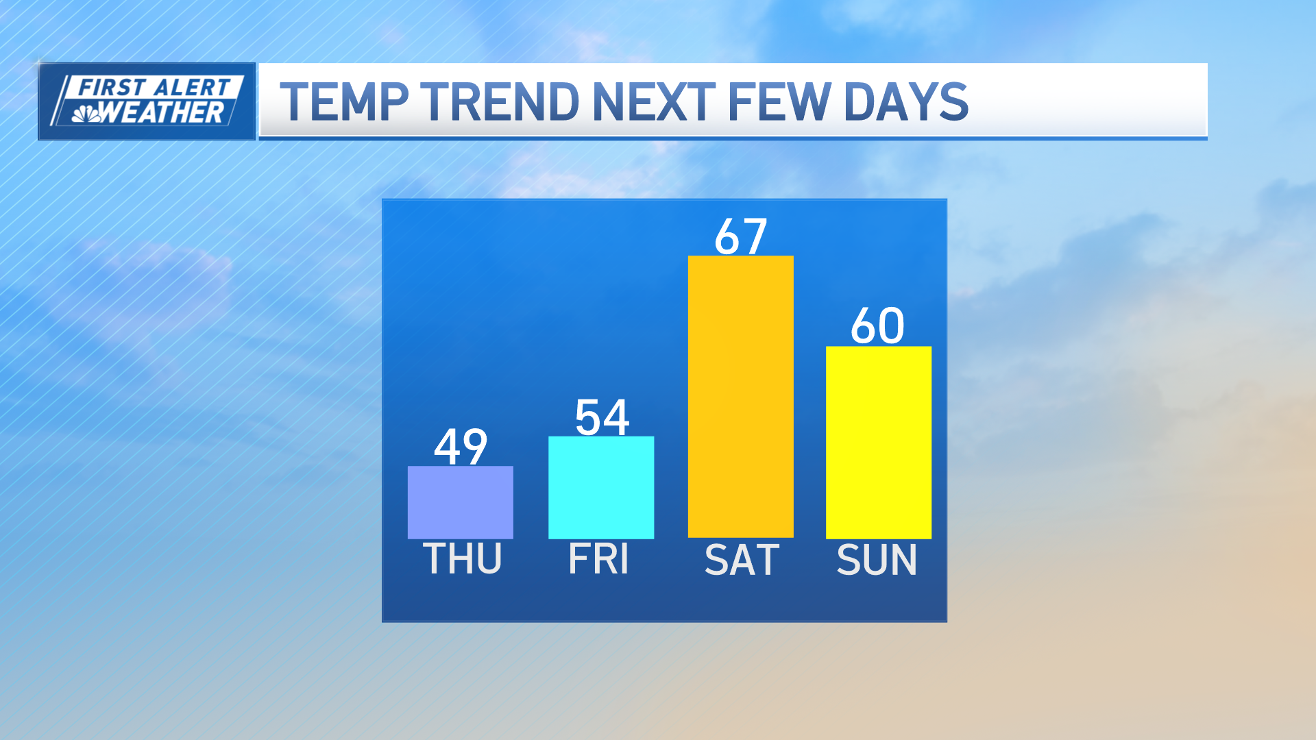
Highs cool for the end of the week with the 30s for Thursday and Friday. We’re watching a wintry mix for Saturday into Sunday which could bring more snow for northern New England and rain south, but this is not set in stone so keep checking back for updates.
