
This weekend is fabulous for any outdoor activities you have planned. We had another frosty morning in New England, with lows in the teens and 20s north, some 30s south. Pure afternoon sunshine will help to warm us up again to the low 50s.
High pressure is in control again for Sunday as morning lows dip to the teens, 20s, and 30s south under a clear sky. Then we see sunshine for the northern half of New England and highs in the 40s, while southern New England will see a few more clouds from a storm system way south and highs in the 50s.
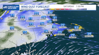
Tides this weekend are running astronomically high through Monday, so shoreline roads or parking lots will again see minor coastal flooding and splash over. The high tides to watch are around noontime today and Sunday, around 1:30 p.m. on Monday.
Get Boston local news, weather forecasts, lifestyle and entertainment stories to your inbox. Sign up for NBC Boston’s newsletters.
As a storm system sits off the coast of the southeastern U.S. it will increase our wave heights enough to bring a bit of a surge (a few inches to half a foot).
More Weather Stories

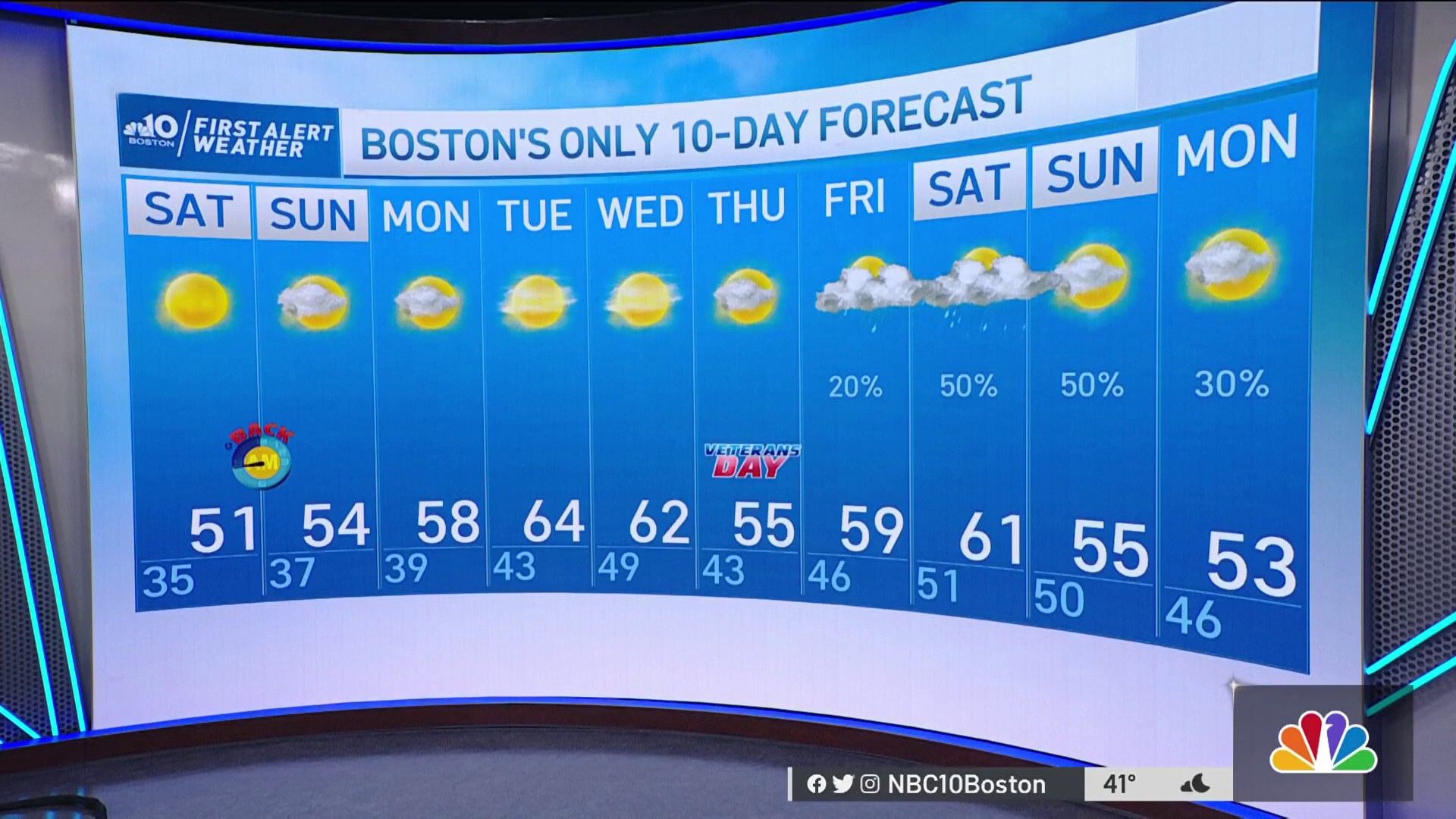
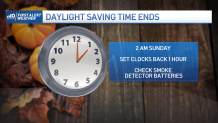
We stay dry through much of next week as we experience our 4:30 p.m. sunsets and 6:30 a.m. sunrises after falling back one hour before bed on Saturday night. There’s more sunshine in the forecast and a warm up as highs reach the low to mid 60s by Tuesday.
Temps decrease a bit to the mid 50s for Veterans Day, then we return to highs around 60 ahead of a cold front. This frontal boundary is set to move through sometime Friday into next weekend. Stay tuned for timing updates on that next chance for rain.
