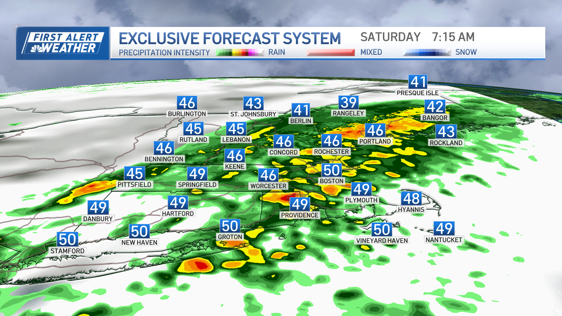
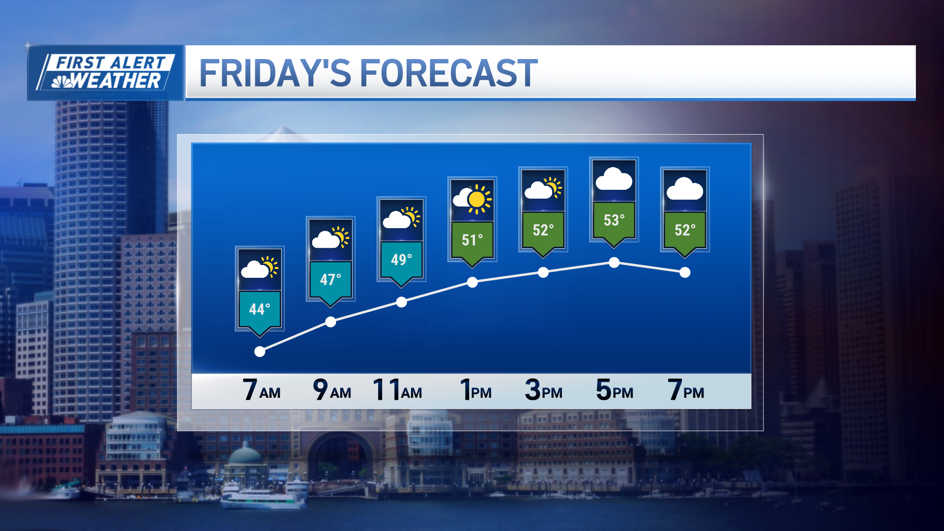
Beautiful puffy clouds have given way to showers in eastern Massachusetts; graupel and small hail have also been reported with these showers. Snow has stretched from the north mountains to the Berkshires and Worcester Hills.
Fortunately those showers are leaving soon.
We’re having breaking clouds by sunset along cool temperatures. The wind has kept its speed and gusted over 20 mph; these winds will diminish Sunday night as the clouds also leave and allow for more radiational cooling.
Our wind chills will drop to the low 30s by Monday morning and will give way to a cool marathon start. The wind will flow in from the Northwest by the first half of the morning and then shift to fill in from the east before noon. Highs will climb to the 50s Monday with another blustery afternoon. The breeze will keep the temperatures feeling cooler with an already 40s and low 50s day.
Get Boston local news, weather forecasts, lifestyle and entertainment stories to your inbox. Sign up for NBC Boston’s newsletters.
Be prepared for your day and week ahead. Sign up for our weather newsletter.
We’ve placed a First Alert on Tuesday due to the widespread precipitation, accumulation and timing of our next system. Clouds will increase Monday night with the proximity of a coastal storm. This system brings periods of heavy rain over much of New England on Tuesday morning, along with snow in the higher elevations.
Total rainfall amounts may exceed an inch of accumulation by the time this system leaves. It will be before lunch time that our low pressure will shift into the northeast and brings clearing skies. The strong wind will bring another threat to the area due to the chance of watching over 50 mph wind gusts, the outer cape may watch gusts over 60 mph.
Weather Stories
Our models are still showing our low bringing over 40 mph winds inland and a few 50+ in isolated spots. Wet snow will also be spotted in the mountain tops and will exit the northeast on Wednesday.
While it’s still possible that this system brings the heaviest rain overnight, some streets may be affected on the morning commute for which alternate routes may be required. Isolated power outages may also result in the passage of this storm. Wednesday brings sunny skies and highs in the upper 50s with a jump to the 60s by the end of the week.


