
These are always the strange, forgotten days ahead of a major storm. People (especially meteorologists) are so focused on the event, no one is paying attention to the present.
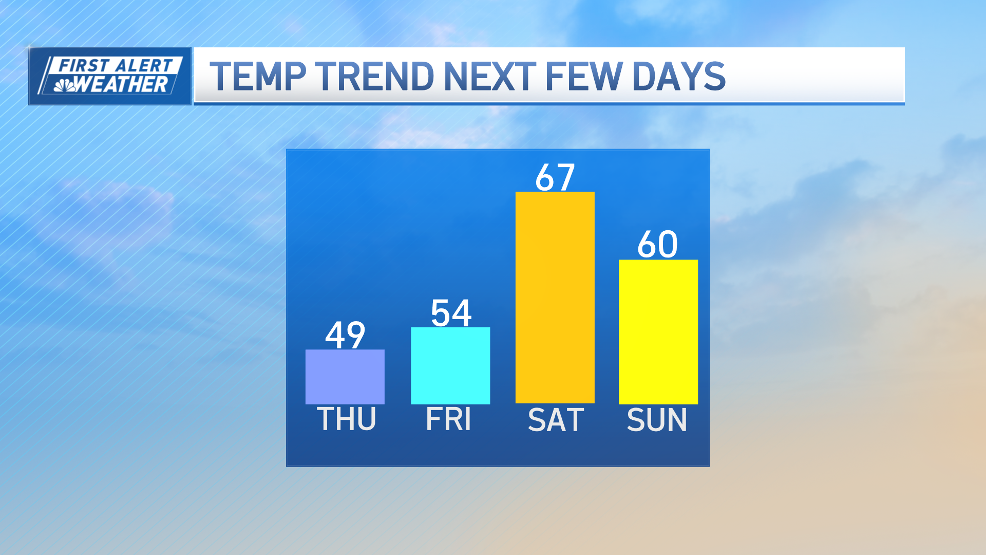
Well, perhaps the cold will jolt you back to reality this morning. Wind chills will demand your attention as they hover near zero thanks to a steady northwest wind. That wind backs off tonight, allowing temperatures to plummet to the single digits and low teens under a starry sky. We’ll come back to the 20s tomorrow as streamers of high clouds begin to drift in from the storm late in the day.
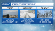
Friday will be wrapped in the clouds, but we’ll hold back the snow until late at night or even into the wee hours of Saturday morning. Then the “fun” starts.
Get Boston local news, weather forecasts, lifestyle and entertainment stories to your inbox. Sign up for NBC Boston’s newsletters.
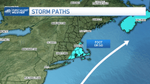
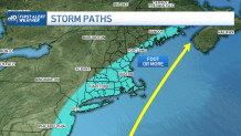
First, a primer. When we’re forecasting days in advance, we often talk about track. It’s not like the track of a hurricane, with strike probabilities and forecast cones. A “landfall” from this storm would mean snow to rain with some strong wind and highs in the 40s.
What makes this storm more sinister is a track OFF the coast, typically near the “benchmark” of 40N/70W, due south of Nantucket. If the storm continues into the Gulf of Maine, we remain on the western side of the storm and are hammered by snow for hours on end.
The sheer size of this storm makes it easier to get buried too. Even a glancing shot could get you closer to a foot – although that would likely be sequestered to southeast Mass & the Cape. The winds will also be powerful with a glancing shot. And coastal flooding likely can’t be avoided either.
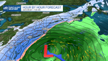
But what’s the actual track? Hard to pin down this far from the event, but the swath of heavy snow will be widespread. We’re on the fence between where the foot or more may fall, or if we’re closer to two feet in spots.
Timeline brings the steady snow in near/around midnight Friday and keeps it going through the day Saturday. Some signs point to it tapering Saturday night or even very early Sunday.
Weather Stories

Gusts of wind appear powerful enough to cause some outages. White-outs seem certain. Blizzard conditions are probable, and the coastal flood threat, while not major (thanks to us missing the new moon by three days), borders on minor to moderate during the Saturday morning high tide.
Certainly there’s a grocery list of items to discuss in the coming days. We’ll stay focused on the details. And please don’t hoard bread and milk. Some of us like toast and Cheerios on Sunday mornings.
