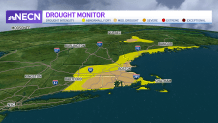
Drought conditions have expanded across the Northeast in the last week, and we have had a large rain deficit this month in some parts in eastern and southern New England.
This has lead to abnormally dry conditions and moderate drought in some areas.
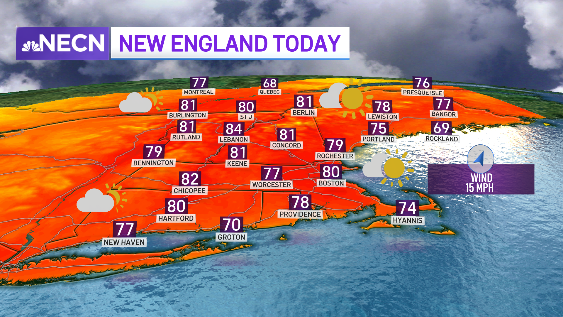
Here's how much rain cities across New England have gotten since the beginning of the year, and how that compares to average.
Get Boston local news, weather forecasts, lifestyle and entertainment stories to your inbox. Sign up for NBC Boston’s newsletters.
- BOSTON: 13.71 inches, which is 4.75 inches below average.
- WORCESTER: 18.25 inches, 1.22 inches below average.
- PORTLAND, MAINE: 16.26 inches, 3.82 inches below average.
- HARTFORD: 17.70 inches, 1.09 inches below average.
- PROVIDENCE: 17.91 inches, 2.89 inches below average.
- BURLINGTON, VERMONT: 13.65 inches, 0.14 inches below average.
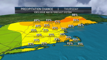
We have 1-2 inches of rain in the forecast for Wednesday morning and also Thursday afternoon as two waves of rain move through.
This will likely help the dryness, but the drought monitor data stops on Tuesdays. While the map is released on Thursdays, this means this week’s rainfall won’t be taken into account in the updated map.
So it's potentially next week’s drought map that will show an improvement — with even more rain for this weekend.
In the meantime, keep watering the plants and vegetable garden!