
We have an egg-cellent Easter Sunday with temperatures in the 50s and 60s.
It is dry outside so lip balm, lotion and drinking plenty of water will be necessary to keep skin hydrated. The only issue Sunday is our enhanced fire threat due to a northwest breeze gusting to 20 mph, lots of sunshine, and low humidity so it will be a good idea to forego the firepit this evening.
Some clouds have moved in from the west due to a decaying warm front from the east thanks to an area of low pressure that intensified south of Nova Scotia and retrograding, moving backward towards Maine.
Get Boston local news, weather forecasts, lifestyle and entertainment stories to your inbox. Sign up for NBC Boston’s newsletters.
Sunday night, snow and rain showers will move into Maine, where some towns could get 1-3 inches of fresh snow while clouds increase across eastern New England. Lows will be in the 30s and 40s.
As this storm gets closer to the region, it’s possible that we see a few showers from down-east Maine, to the Seacoast and down towards Cape Cod. Drizzle and mist could impact areas inside of Interstate 95 while a blend of clouds is forecasted inland with gusts up to 40 mph.
Weather Stories

This is a typical spring setup for the region when we get cooler conditions at the coast with 60s and sunshine across the Connecticut River Valley.
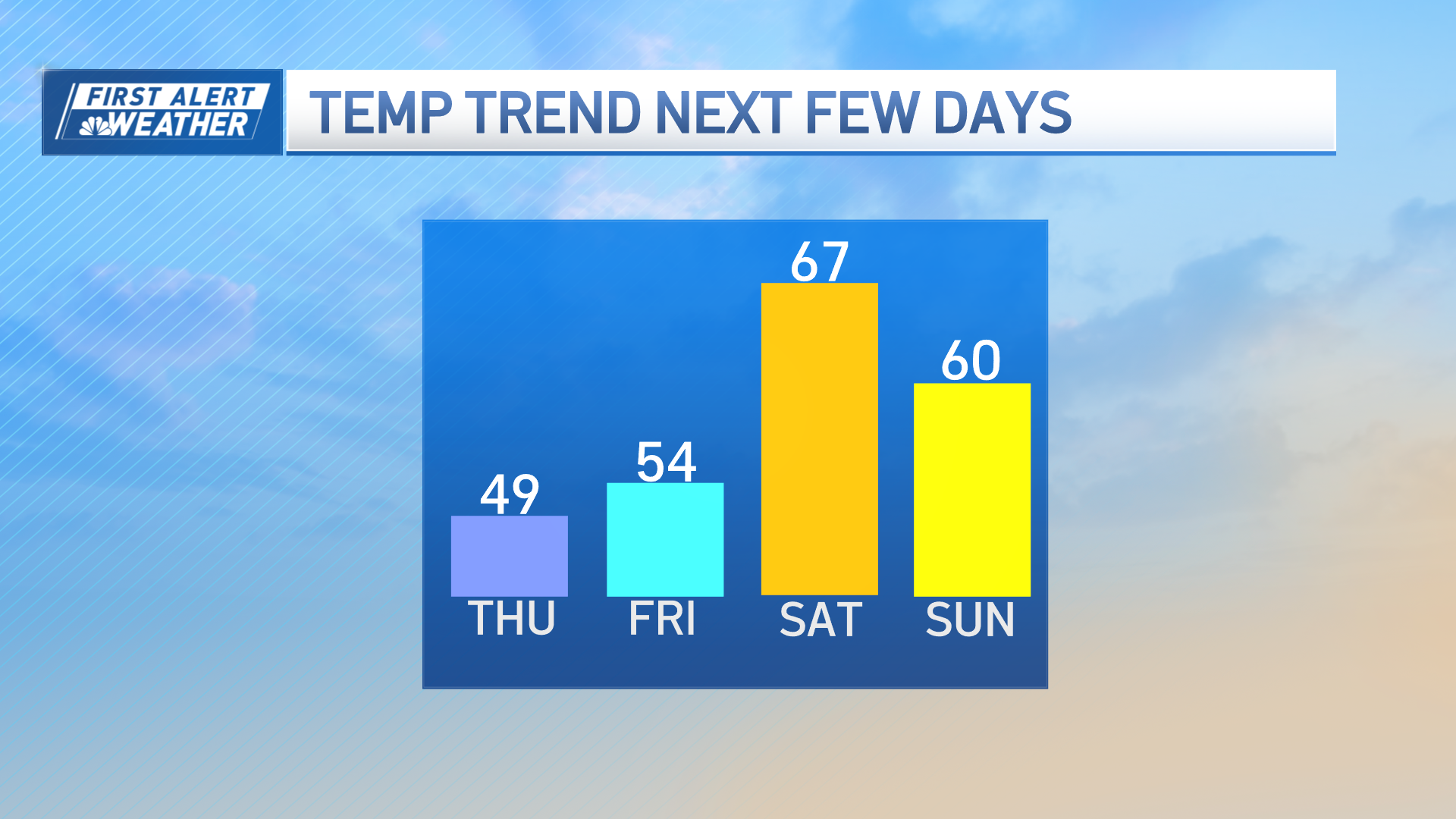
It will continue to stay quiet until Thursday, with a chance for showers Friday night into next weekend. The long-term forecast continues to evolve, and confidence is low on exactly how much rain, if any, we get so stay tuned to our First Alert 10-Day forecast.
