
The rain is done, but stubborn clouds and pockets of drizzle remain across the region Tuesday evening. As advertised, though, some breaks in the cloud cover have been developing, and that trend will continue into the overnight with sunshine returning Tuesday.
A beautiful stretch of weather is setting up for the next few days, with a ridge of high pressure building out of eastern Canada. Cool mornings will be replaced by very pleasant afternoons under a nice blend of sun and clouds and high temperatures around or just over 70 for many of us through Friday.

The tricky backdoor cold front will swing in later Friday, marked by a sharp wind shift, cool marine air and low clouds. This will mean some clouds and cooler temperatures to kick off the weekend (60s).
Get Boston local news, weather forecasts, lifestyle and entertainment stories to your inbox. Sign up for NBC Boston’s newsletters.
Sunday and Monday we’ll be wedged between a developing storm center to our south and a front to our northwest. In between, I think we’ll manage to stay mostly dry.
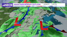
That’s great news for marathon runners on Monday; the early call is for partly cloudy skies and temperatures in the upper 60s (50s in the morning).
Weather Stories


Much of next week features fairly quiet weather with at or slightly above normal temperatures in our exclusive 10-day forecast.
