
We’re at a critical point in forecasting and making preparations for a major storm with blizzard potential that will start to impact the area in mere hours.
Prepare Now for Potential Power Outages
Hopefully all your last-minute preparations have been taken care of and now you’re on cruise control to wait out the storm. We can’t emphasize enough how important it is to make sure your generators are well ventilated, if you have one, make sure you have plenty of gas in your car, and hopefully enough snacks in the house in case you can’t get out for a couple days. It is also may be wise to charge up any of your mobile devices in case of power outages, which we unfortunately will likely see, especially along the coastline where we’re expecting wind gusts over 60mph.
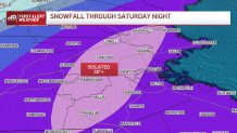
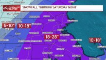
When Does the Snow Start?
Get Boston local news, weather forecasts, lifestyle and entertainment stories to your inbox. Sign up for NBC Boston’s newsletters.
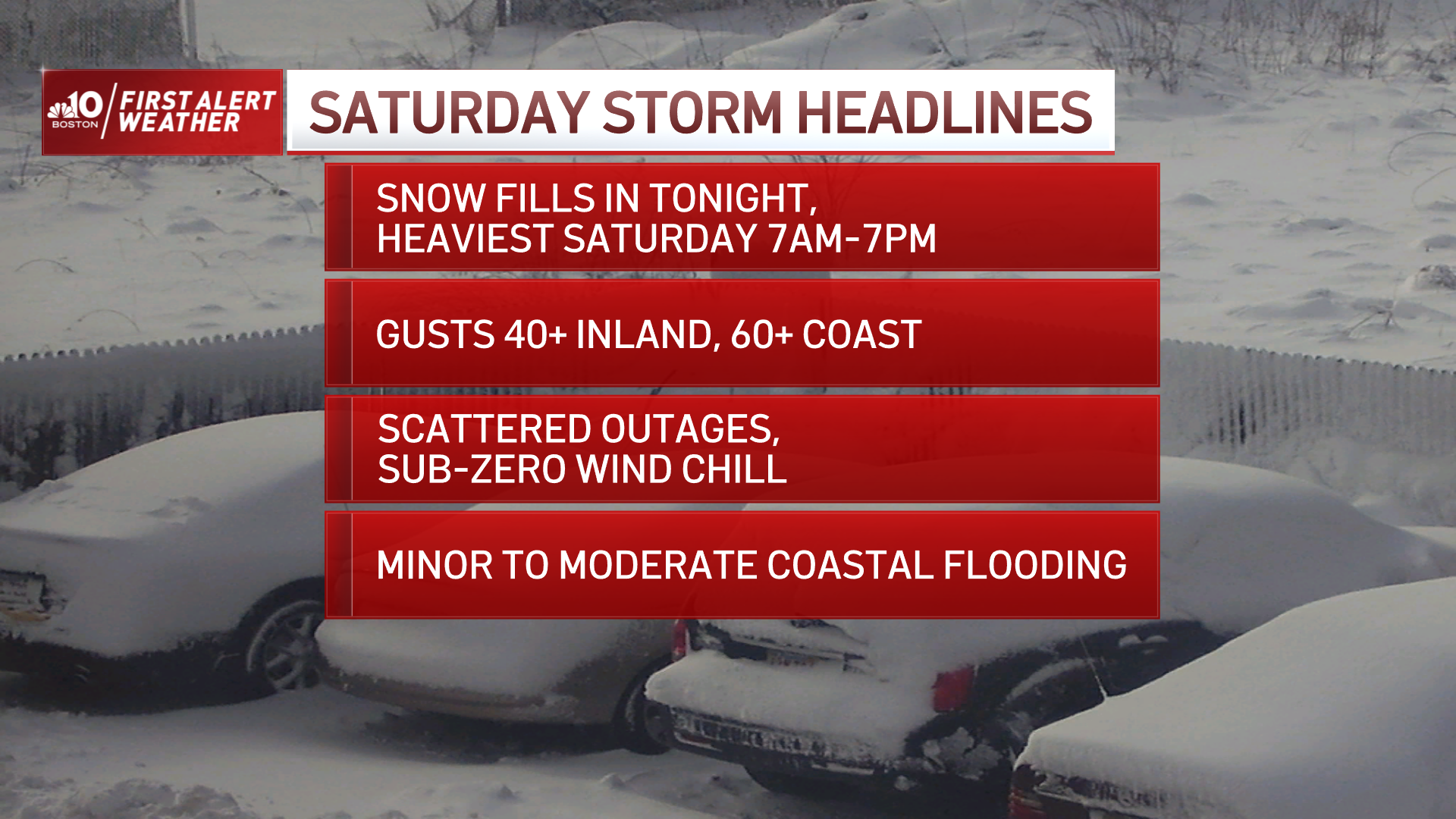
Snow develops late tonight and becomes heavy after 6 a.m. across southern New England. We could easily see 1-3” snow rates along with thundersnow during the height of the storm Saturday morning through the evening hours. We will see a morning high tide, but should only be dealing with some minor issues due to the timing of the tide and storm’s location by then. During the afternoon, we will be experiencing white-out conditions across much of the region with heavy snow and gusty north/northeast winds, especially along the coast.
Damaging Winds Along the Coast
Winds along the coast will gust up to or over 60-70mph at times, perhaps higher across the Outer Cape, this will result in coastal beach erosion and flooding during the late evening high tide cycle. We are also expecting power outages, especially along the coast with these extreme winds.
Roads will also become impassable for a while during the afternoon with heavy snow and gusty winds, travel is most certainly not recommended. If you’re planning on clearing some snow during the afternoon, first be extremely careful doing so, also, we’re expecting high temperatures to barely rise above 20 degrees south, teens north, which will create dangerously cold wind chill values below 0. This is a dangerous storm and we will most likely be talking about this one for quite some time.
More on the Nor'easter
Our First Alert Team will continue to keep you updated throughout the entire storm. Please be safe!
