A tornado warning has expired after being declared in Nantucket on a day of storms across New England.
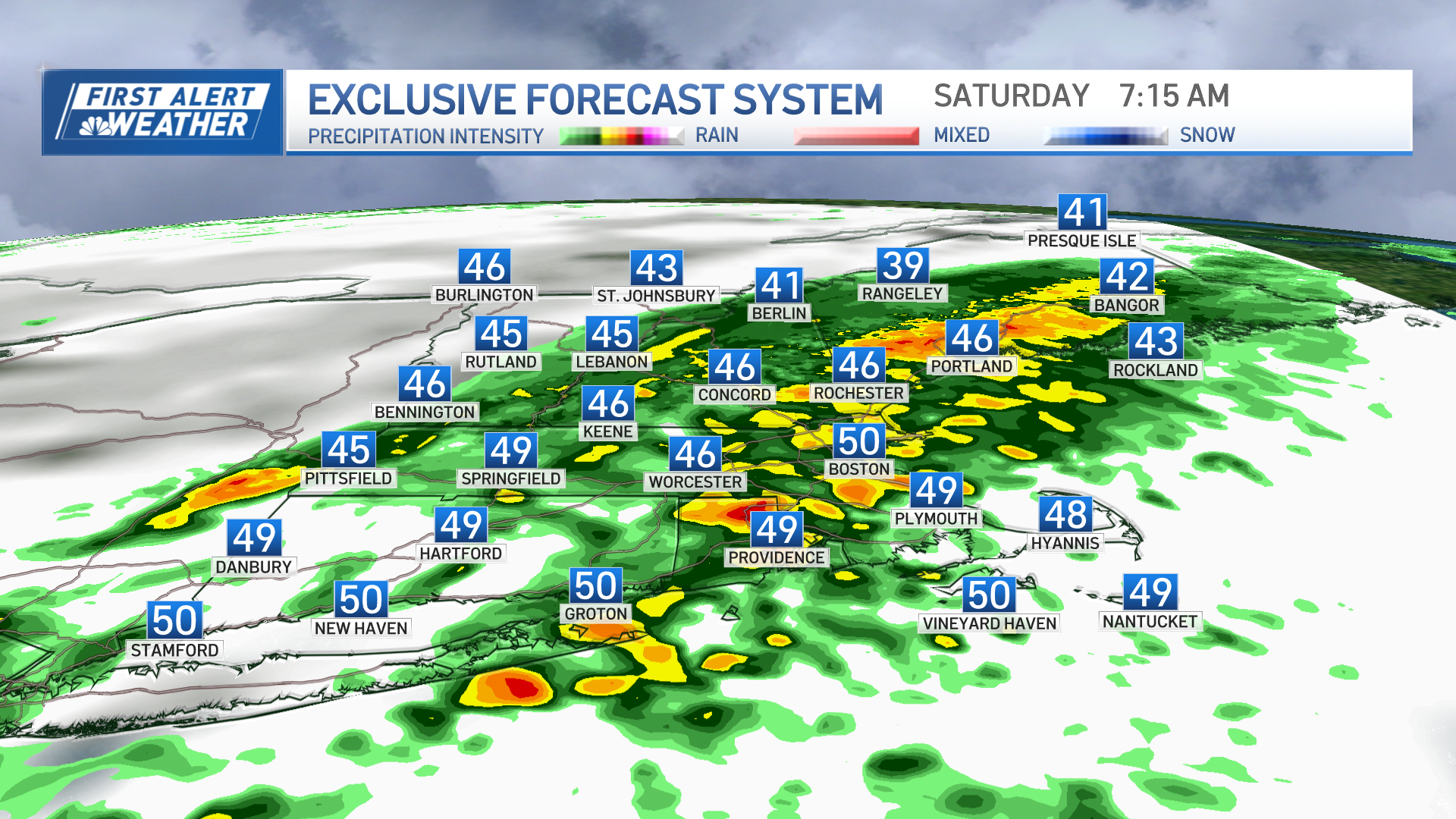
The strong frontal system has been bringing heavy rain, gusty winds and thunderstorms across New England Friday. The storms left people without power and flooded streets.
Winds gusts of 40 to 50 mph were expected at times, especially across the South Coast, Cape Cod and the Islands. With many leaves still on the trees, nuisance poor drainage and street flooding may occur.
There is a also a risk of isolated severe thunderstorms within the heavy rains Friday. This risk exists mostly across Connecticut, Rhode Island and southeastern Massachusetts. The main threat would be isolated straight-line wind damage and a non-zero risk of an isolated tornado or waterspout.
Get Boston local news, weather forecasts, lifestyle and entertainment stories to your inbox. Sign up for NBC Boston’s newsletters.
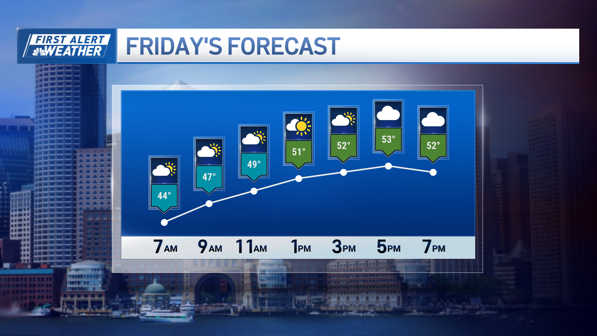
The heavy rains and strong winds will quickly exit the region Friday evening as a cold front rushes in behind the departing weather. Highs will reach into the low to mid 60s across the South Coast; around 60 degrees across the interior; the mid to upper 50s across Vermont, New Hampshire and southern Maine; and low to mid 40s across northern Maine.
Much drier air filters in from the west Friday night, allowing for clearing skies and cooler temperatures. Lows will drop into the 30s across interior locations, 40s elsewhere. Patchy fog may develop overnight in typically-prone areas where winds are light and the wet ground prevails.
Weather Stories
Saturday will start off quiet before a potent and quick-hitting area of low pressure moves across New England, bringing scattered showers and gusty winds back to the region during the late afternoon and evening. Rain will move in after dark, beginning as snow across the higher elevations of the Berkshires and Vermont, northwest New Hampshire and northern Maine as colder temperatures crash in.
After all is said and done, expecting about a quarter to a half an inch of rain out of this system, and a general swath of one to three or more inches where snow falls, especially across the higher terrains of the Green and White Mountains.
Some snow pellets may mix in with rain on the backside of the system. Northwest winds will gust 35 to 45 mph. Highs will reach around 60 degrees across the south, upper 40s to low 50s across the north.
High pressure and quiet weather builds into New England briefly on Sunday. We're expecting residual breezy conditions with seasonable temperatures in 40s and low to mid 50s. A coastal low may bring some snow to the higher terrain late Sunday into Monday. Snow squalls and lake-effect snows may develop. Temperatures will be limited to the 40s to near 50 degrees for most.
Looking ahead to next week, a train of low-pressure systems will continue to parade across our region. Rain showers will develop Monday morning across the south, with snow across northern areas. These rain and snow showers will persist in a scattered fashion into Tuesday.
High pressure builds into New England by mid-week on the exclusive First Alert Weather 10-Day Forecast on NBC10 Boston and NECN.


