
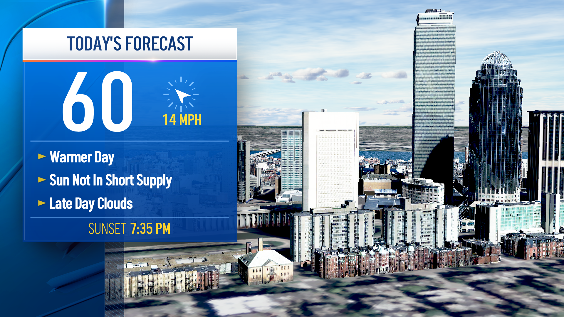
We have a quiet start to the day on this Saturday with cool temps, patchy frost and some scattered dense fog.
Saturday afternoon, many areas will enjoy some sunshine and highs in the 50s to low 60s. However, an area of low pressure will move in late afternoon and will track across the northeast.
Through the evening, northern New England has snow showers, a wintry mix and scattered rain (depending on elevation).
Along the cold front attached to the low, a line of thunderstorms will push through southern New England roughly between 4 and 7 p.m. The storms could bring in briefly heavy rain, lightning, and hail.
Get Boston local news, weather forecasts, lifestyle and entertainment stories to your inbox. Sign up for NBC Boston’s newsletters.
A severe thunderstorm watch is in effect for parts of northern Connecticut through 3:15 p.m.
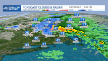
That rain chance is long gone for late evening south, while to the north, mountain snow showers continue and accumulate to around 3-6” in highest peaks. Ski season is in full force now, with more ski areas opening up.
Sunday’s highs fall a bit to the 50s with a gusty west wind. Snow chances linger for the mountains through Monday with upslope snow and as another low pressure system heads in Sunday into Monday.
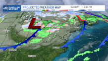
This storm may bring in a chance for snow showers in higher terrain in southern New England for Monday, Boston and southeast spots see rain.
Weather Stories

We expect sunshine and dry weather along with cool temps in the 40s for Tuesday into Wednesday. A brief warm up in the low 60s returns for midweek, before another low pressure system passes to our north.
Showers are likely again for the end of the week for the Thursday into Friday timeframe. Forecast models are also hinting at a coastal storm sometime next weekend, so stay tuned.
