


Today: Occasional downpours transition to heavy late day and evening rain, strong wind gusts late. Highs in the 50s. Tonight: Pockets of flooding and wind damage with power outages. Lows in the 40s. Wednesday: Raw with windswept rain gradually diminishing. Highs 50-55.
A fall nor’easter is developing offshore to our south and will strengthen rapidly. We expect it to undergo bombogenesis, which means it drops 24 millibars of pressure (or more) in 24 hours.
The air pressure drop is expected to happen quickly and strongly enough to qualify this storm as a bomb - a storm that rapidly intensifies and brings heavy rain and strong wind.
As the low strengthens, we see the rain, wind, and waves intensify tonight into tomorrow.
Rain & Timing
Get Boston local news, weather forecasts, lifestyle and entertainment stories to your inbox. Sign up for NBC Boston’s newsletters.
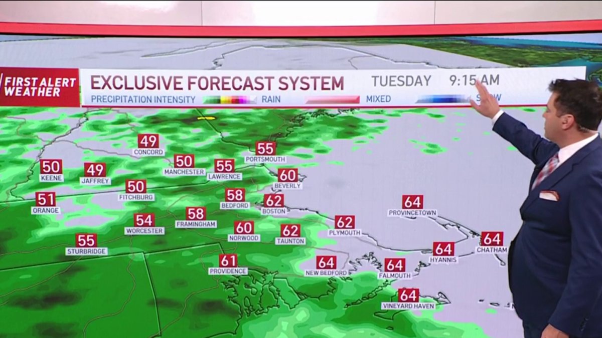
Showers continue to be ongoing this morning, with some lingering thunderstorms embedded within the steady rain. There is a lull potentially this morning before more rain fills in and moves onshore.

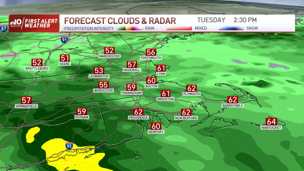
The rain will be steady to torrential today, tonight and Wednesday morning, with bands of rain breaking up as Wednesday progresses. Northern New England misses out on any flooding rainfall, but as you go towards southern and eastern New England, we will see 2-5” of rain through Wednesday.
Weather Stories


Flash flooding, urban and small street flooding, and even minor river flooding (south) is forecast.
Wind
Gusts will be ramping up as the day goes on. We see 40-50 mph winds gusting from the northeast at the coast late this afternoon. Then by night, 60-70 mph at the farthest eastern coastline.
The outer Cape, and eastern Nantucket may get over 70 mph gusts. Around 495 we are looking at 50-60 mph gusts and 30-50 mph winds farther northwest, to light gusts in northern New England.
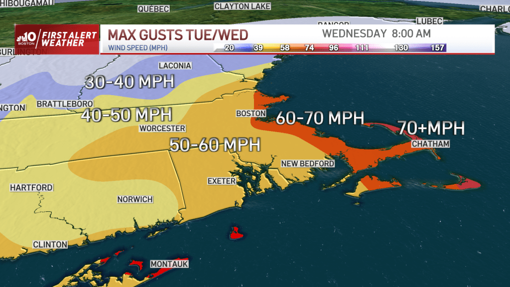
The wind is cranking from the northeast tonight into Wednesday morning (the worst of the wind). Power outages, branches down, trees down, powerlines down, and major leaf drop is expected. It will be a dangerous night to drive in southern New England!
Coastal Flooding
We have (thankfully) low astronomical tides, so the flood threat is low to medium with this storm. Waves build to 10-20 feet offshore for Wednesday.
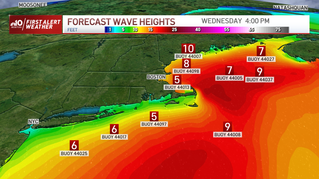
The Wednesday morning and afternoon tides could bring minor flooding (around 1-2’ inundation). Splashover will be significant as well as beach erosion as our waves stay churned up for the rest of the week.
Extended Outlook
We have a break between storms on Thursday. But then another storm system develops for Saturday and this one could also become a nor’easter. Though some forecast models have the center of low pressure tracking across New England as opposed to southeast of Nantucket and offshore. Either way, we will see another round of heavy rain from this storm system.
The rain may linger into Sunday morning, but should get out of here just in time for trick-or-treating on Sunday for Halloween. Stay tuned to the First Alert Weather Team for more information as these storms unfold.

