


Monday Night: Early gusts to 55 mph, areas of rain ending as flurries then clearing after midnight. Lows in the 30s. Tuesday: Noticeably cooler. Sun and clouds. Highs near 40, wind chill 30. Wednesday: Overcast with pockets of snow showers developing, becoming steadier by evening & night. Highs in the middle 30s.
In classic New England fashion, this week’s weather contains a little bit of everything.
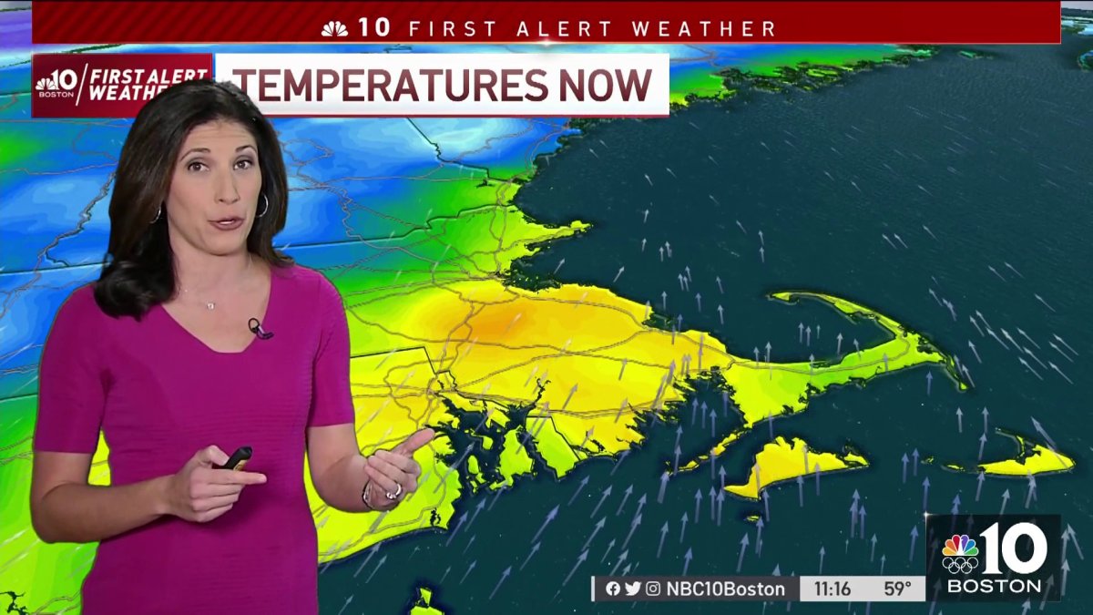
A southerly wind will transport in mild air across the region today, allowing for temperatures to jump into the 50s and even a few lower 60s later this afternoon. That same wind will also become quite gusty, at times to 50 mph (gusts to 60 mph on Cape Cod), resulting in scattered pockets of damage mainly from 3 p.m. to 11 p.m.
Another round of rain will return this evening as well, pushing through from west to east generally 5 p.m. to 9 p.m., and ending as a few high terrain & mountain snowflakes before clearing arrives after midnight tonight.
Behind the front, our Tuesday will be a noticeably cooler day; highs will be in the 30s north & 40s south, feeling about 10 degrees colder with an active westerly breeze 10 to 20 mph.
Get Boston local news, weather forecasts, lifestyle and entertainment stories to your inbox. Sign up for NBC Boston’s newsletters.
By Wednesday, we turn our attention to a developing storm to our south. Right now, the bulk of the steadiest moisture looks to stay out to sea, though the energy associated with it will be over the region.
It’s going to look and feel like snow out of the gate Wednesday morning, and snow showers are likely to develop by midday and continue in bursts through the afternoon. The snow may try to organize into a steadier shield by Wednesday evening and night before departing pre-dawn Thursday.

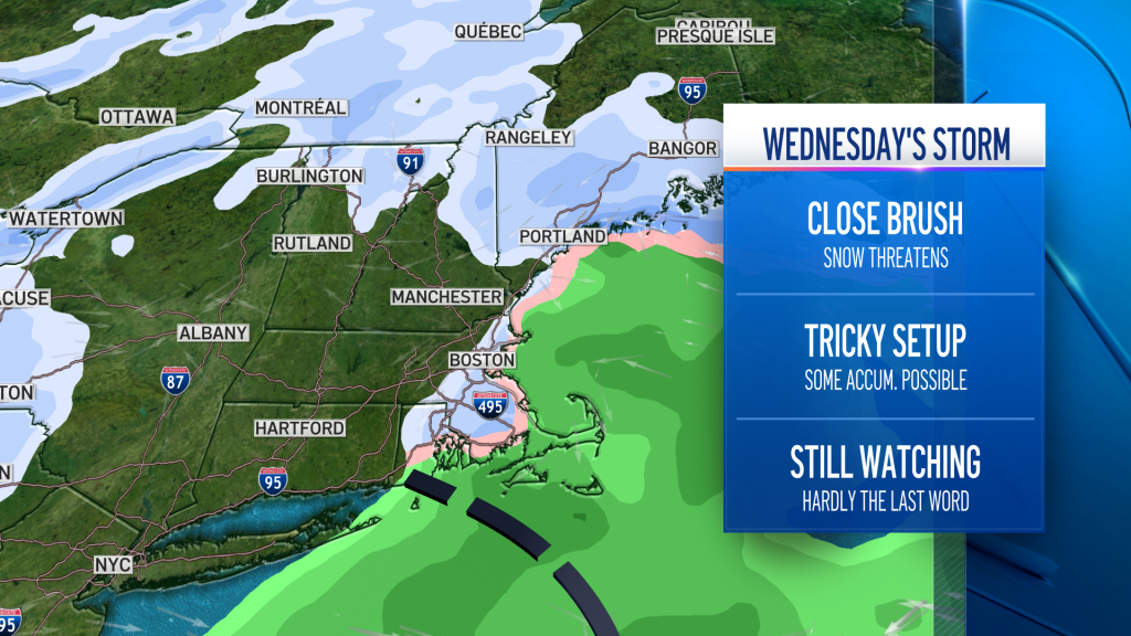
Right now, this event doesn’t look like it will have a significant impact on travel, and our team expects a general coating to 2”. As we narrow down the specifics, we’ll update you on any tweaks to the snowfall map.
Weather Stories


Thursday will be a quieter day with the next disturbance arriving Friday morning. This one may slow things down a bit for the Friday morning commute in southern & central New England as light snow will slowly transition to a mix then rain.
The weekend will feature some unsettled weather with rain showers Saturday that may end as snow in northern New England Saturday night into Sunday morning. Lots to watch in the coming days – so stay tuned!

