
If you’ve been loving the barren winter landscape and sneering at the snow lovers as they whine about a winter that wasn’t, today is your reckoning.
A potent winter storm has come to roost, and besides snarling the morning commute, it promises to deposit numbing cold in its wake and keep the blanket of white intact deep into next week.
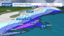
First off, the intense snow will continue through the mid-morning hours. Your ride may be white-knuckled lesson in 10 mph humility thanks to snowfall rates of 1 to 2 inches per hour. This is how the sausage is made if you’re an efficient winter storm. Tremendous lift in the atmosphere translates into near white-outs (thundersnow if we’re lucky) and clumps of snow in the road.
Get Boston local news, weather forecasts, lifestyle and entertainment stories to your inbox. Sign up for NBC Boston’s newsletters.
Even without the pandemic, it was a herculean task for plow operators to keep up. Now with all the sick calls, some towns and cities are going to look pretty ugly. Never mind finding a tow operator if you spin out. Safe to say this is one hazardous ride into work. If you’re able, Zoom into work in your jammies and sip cocoa instead of antacids.
The evening commute fares much better as we’ll get time to clean up as the storm pulls away.
Weather Stories

While the snow lets up near noon and during the early afternoon, the end game isn’t a snap, Thanos. Storms of this nature have a whole lot of pent up energy and as they deepen offshore into nor’easters, they often like to keep the snow machine going well after the models say they should stop. It goes back to the fact that storms of this nature are difficult to capture in a weather model, and dynamic processes such as this always harbor small surprises. Whether that marvels or bores you isn’t really the point, but it could make the flakes keep going deep into the afternoon, perhaps early evening on the Cape.
Speaking of, it would be wise to get cracking on the cleanup. Cold winds will blow (25-40 mph) into the late evening as wind chills drop to the teens by evening and single digits overnight.
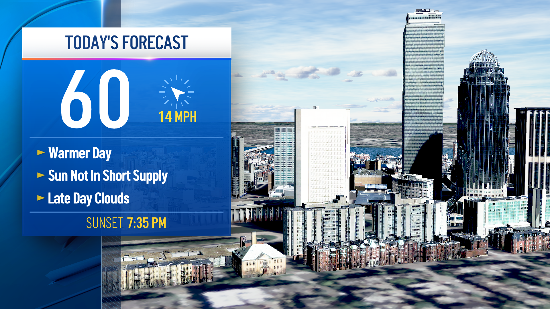
Saturday remains bright and cold with highs barley making it to freezing. We’ll turn things around short-order on Sunday as highs spike to the 40s, but a balloon payment of mid-winter cold comes due by Monday. Can’t decide whether we make it past 19 or 20 on Tuesday as the bitter air settles in.
Fare well and be safe today!
