
Our pattern gets quite active for next week as multiple systems launch a wintry mix across New England, so we hope you can enjoy the quiet weekend.
Clouds build today with a few flurries across Cape Cod and some snow showers in Vermont. Otherwise, it's a quiet day with high temperatures in the 20s for most of New England.
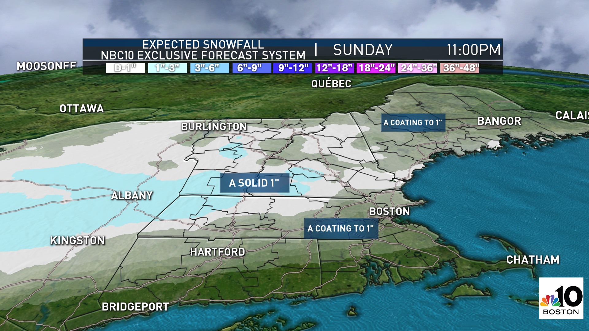
The jet stream shifts position to farther north by Sunday and this means any system that develops will pass right over the northeast. Our first system is Sunday, and this one is pretty minor. Snow spreads in Sunday morning and afternoon, with a solid 1 inch likely across most of New England, between 1 to 4 inches for ski areas, then mixing across southern New England.
Monday we have another storm system that brings us a chance for freezing drizzle or a light wintry mix as this interacts with an onshore surface breeze. A stronger disturbance Tuesday heads right for us.
The jet stream dips far south across the central U.S. and will inject tons of Gulf moisture into this storm as it tracks northeast. With the milder air carried with this storm, and cold surface temps and snowpack in place here, we expect a wintry mix. All possibilities of snow, freezing rain, or sleet and rain are on the table.
Wednesday brings us a break, but another big system heads in Thursday into Friday. This one again could bring a wintry mix to our area.
Weather Stories

We have a First Alert on our 10-day for both storms next week with the concern being several inches of snow somewhere and freezing rain making travel treacherous. Stay tuned this weekend to our First Alert weather team for more updates on next week's storm blitz.
