Numbing air has a grip on our region this morning. We’re waking to single digits and seeing wind chills below zero in many spots. This will be the last day in the deep freeze before another remarkable warmup rushes in toward the end of the week.
For as cold as it is, it’s still a beautiful winter day. Highs only manage the upper 20s after the cold start. If you can shield yourself from the wind, it may not feel all that terrible.
Winds turn to the south tomorrow, and the much-advertised warmup gets underway. This is initially a slow process, taking much of the day and evening to crawl out of the 30s and reach our high in the 40s. In fact, it could take until nightfall to get there, so this isn’t a shorts and t-shirts kind of afternoon.
Sign up for our Breaking newsletter to get the most urgent news stories in your inbox.
Get Boston local news, weather forecasts, lifestyle and entertainment stories to your inbox. Sign up for NBC Boston’s newsletters.
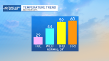
With all the wind expected on Thursday, that may not be either. Gusts approach 40-50+ late day as the warm air continues to stream in from the south. Highs reach for the mid and upper 50s as the clouds tighten and lower. Showers should break out later in the day as well.
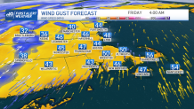
We’ll stay in that pocket of warmth – and wind – right through the night Thursday and into Friday morning. It’s then (oddly) that our high of 60 should be realized. Winds will continue to ramp up as well, peaking at 50-60 for most, perhaps 70 on the Cape & Islands!
Weather Stories

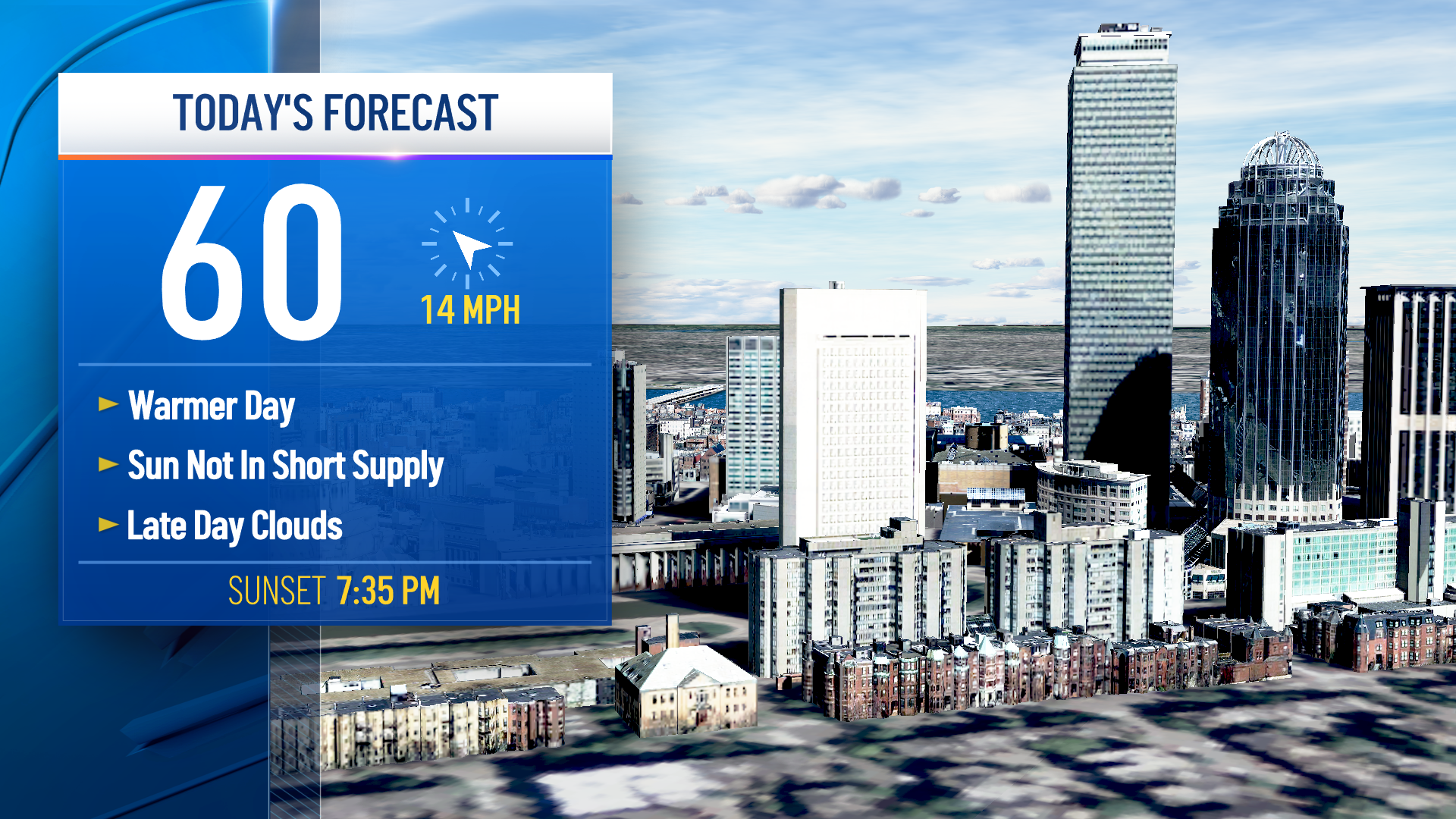
Some power outages are possible along with a driving rain for the Friday morning commute. Colder air will funnel immediately, so Friday’s numbers are likely to plummet after the morning warmth. As cold air rushes in, winds will continue into the afternoon and evening.
The weekend chill isn’t as potent as our current cold, so we’re only expecting a drop to near 40 for both days. No, winter isn’t over, but it’s looking like spring temperatures aren’t either.