
New England is caught between a feed of energetic disturbances with cool air to the north and humid warmth to the south – as it turns out, being sandwiched between these isn’t such a bad place to be for the southern half of New England, with sunshine, wispy, high-altitude clouds and temperatures 85 to 90 degrees Friday afternoon.
Farther north, closer to the stream of cool disturbances, a cold front has been dropping south through the North Country and touches off Friday afternoon and evening thunderstorms from central Vermont through the Upper Valley, the New Hampsire Lakes Region and southern Maine.
Get Boston local news, weather forecasts, lifestyle and entertainment stories to your inbox. Sign up for NBC Boston’s newsletters.
Boaters on the lakes and the coastal waters of Maine should be on guard for these storms during the late day and early evening, and while the chance of a storm making it all the way to the Massachusetts/New Hampshire border is only about 10%, that’s not impossible.
The Cape turns noticeably more humid by Friday night, but otherwise only a modest increase in humidity means most New Englanders can probably squeeze out one more comfortable sleeping night without air conditioning.
Increasing humidity will be palpable Saturday, and with the combination of the slow-moving cold front stalling as it moves into southern New England and a light wind around it allowing sea breezes to develop, all the shifting wind will mean variable temperatures within about 15 miles of the coast and the likelihood of isolated showers and thunder during the afternoon anywhere in the southern half of New England.
Weather Stories

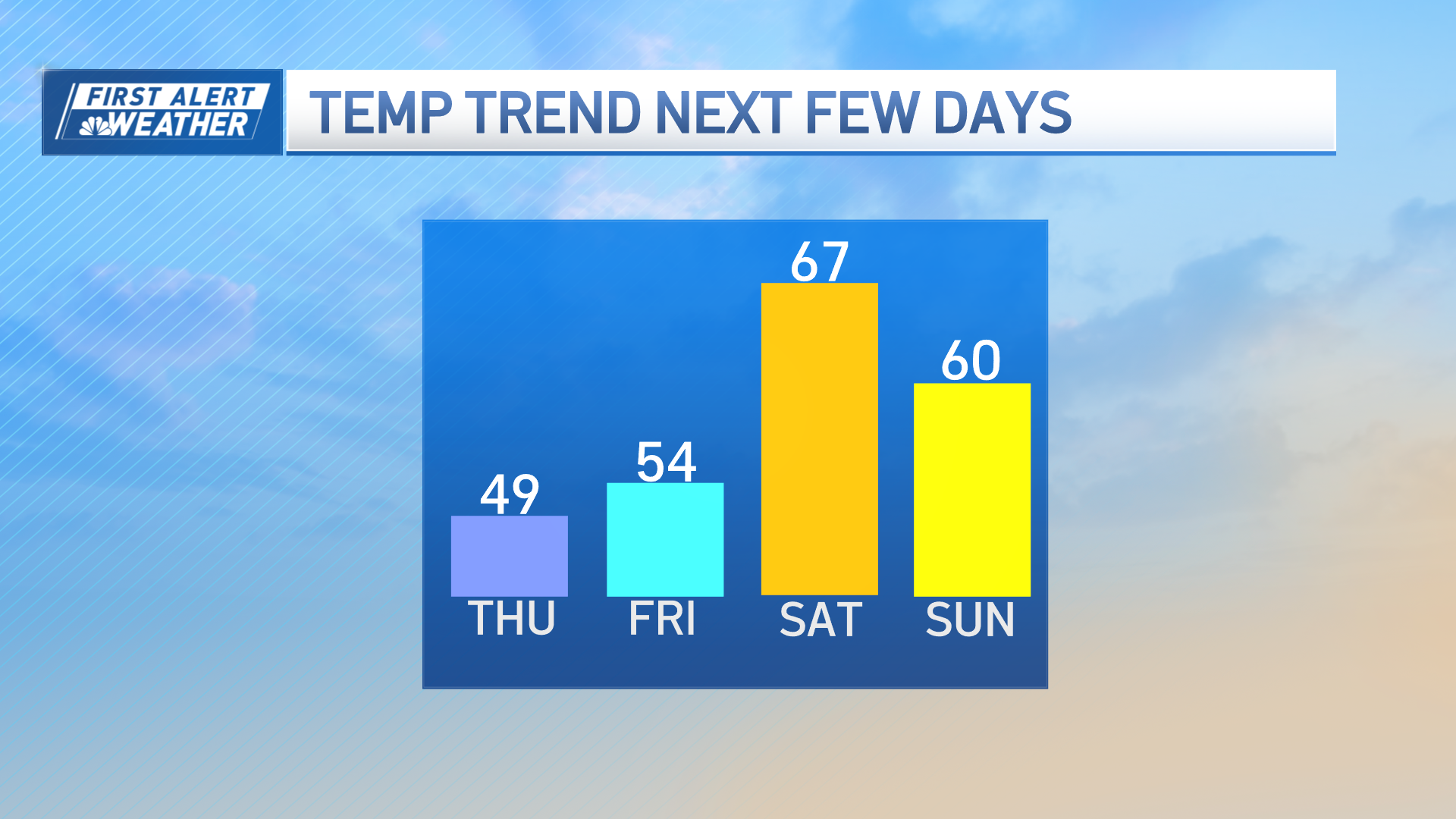
The stalled front is expected to do an about-face and trek north as a warm front Saturday night and Sunday, meaning at least southern New England away from the coast will probably have air conditioners on again overnight Saturday night, and Sunday’s combined humidity with temperatures near 90 will push heat index values into the lower 90s with a chance of afternoon thunder.
Next week starts with lingering humidity and therefore the chance of scattered thunder still in the forecast, particularly during the afternoon on Monday and Tuesday, with a cooler and drier interlude for the middle of next week.
Next Friday, a small storm center may develop along a slow-moving front over New England, and its track is important in determining our temperature but raises the chance for showers and thunder before cooler air – likely much cooler than this weekend – arrives for next weekend in the exclusive First Alert 10-day forecast.
