
We’ve been a rollercoaster of temperature swings across New England over the past week and the ride isn’t over yet.
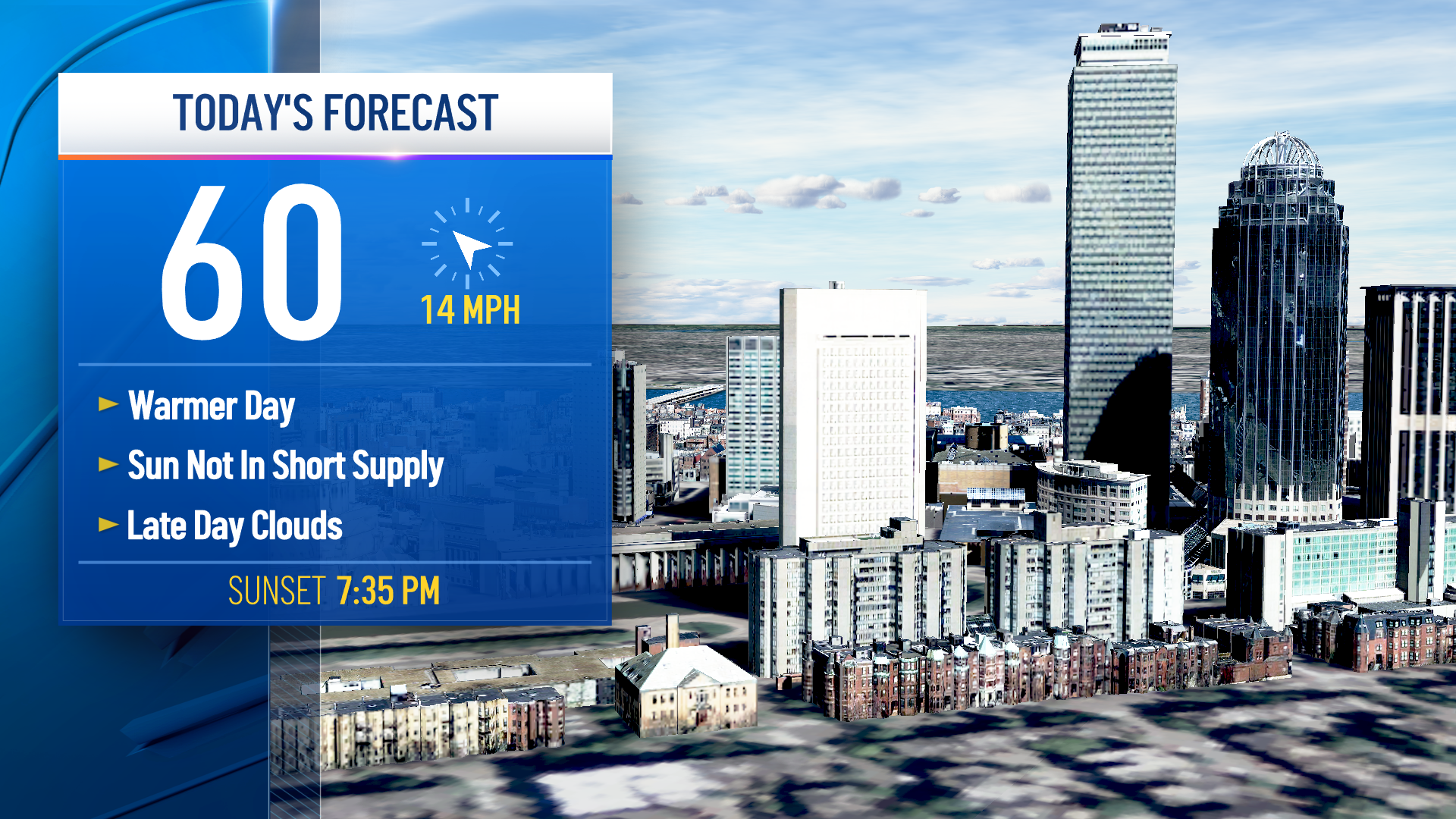
Aside from a brief sprinkle Monday, highs will top out in the 70s for most of us under a blend of sun and clouds. Humidity will be on the rise Monday night as a warm front crosses the region, and you’ll certainly notice the difference right out of the gate Tuesday. The heat returns as well, with highs topping out in the upper 80s and lower 90s.
That, combined with the humidity will yield heat index values in the middle to upper 90s at the warmest time of the day. Sure it’s not as hot as last week, but it’s certainly a day worth hydrating and seeking shade and air conditioning when you can.
Get Boston local news, weather forecasts, lifestyle and entertainment stories to your inbox. Sign up for NBC Boston’s newsletters.
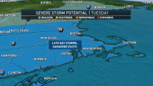
More importantly, Tuesday will feature a chance of isolated strong to severe thunderstorms in the afternoon, mainly during the 1 to 8 p.m. timeframe. Damaging wind gusts and locally heavy rainfall along with frequent lightning will be the greatest threats. Be weather aware and ready to get inside should a storm head your way.
Wednesday will feature another round of some pop-up storms in the afternoon, though with more clouds around, the intensity of the storms may not be able to reach their full potential.
The front triggering those storms will slow and stall over southern New England by Thursday and Friday, focusing more rounds of wet weather and cooler temperatures.
Weather Stories

The rain will be enhanced as Tropical Storm Elsa approaches us Friday, but she is likely to stay offshore. Nonetheless, some heavy rainfall (particularly in southeast Massachusetts) along with some high surf is likely. The core of the strongest wind looks like it will be well out to sea, but this bears monitoring.
The weekend should feature improvement, with sunshine returning along with fairly comfortable humidity and highs in the 70s and 80s.
