In some sense, Monday’s bright and brisk day is quintessential New England spring: sunshine, an invigorating breeze and temperature pleasantly near 60 degrees, feeling like 50 to 55 with a northwest breeze gusting to 35 mph.
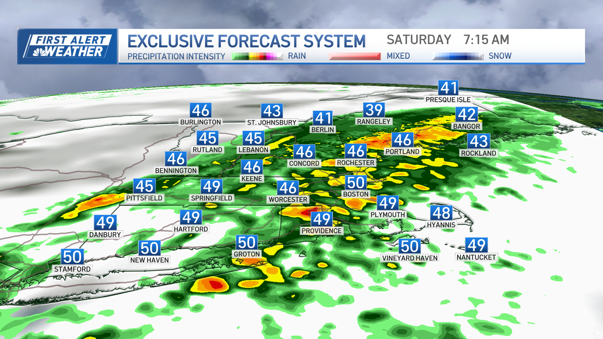
Sunday's rain only clipped southernmost New England with anything beneficial. The system that generated the rain is now a powerful storm now stalled just east of Maine, which is the reason for all this wind. Highs are near 60 degrees with plenty of sunshine south, and in the 40s to low 50s north, with lingering clouds slowly drying Monday afternoon and evening.
There’s more to a dry, gusty pattern this time of the year, though: pollen is bursting from several tree varieties and brush fire danger has spiked. In fact, from southern Maine into central and southern New Hampshire, a Red Flag Warning is in effect Monday into the evening, meaning explosive brush fire conditions.
In our New England communities, cigarette butts tossed out car windows and rolling into the brush are one of our primary causes for brush fires, with the other being embers from burning brush carried by the wind and igniting flames anew.
Get Boston local news, weather forecasts, lifestyle and entertainment stories to your inbox. Sign up for NBC Boston’s newsletters.
Although the sunshine is a treat after showers Sunday, those prone to sunburn will want to keep in mind we’re late enough into the spring that with few clouds in the sky, our UV index is high and you’ll want sunscreen.
Overnight Monday night, the combination of dry air and a quieting breeze under a clear sky will make for chilly moonlight – temperatures dip into the 30s beneath a full “pink moon,” named for the moss pink that blooms this time of the year. It's also a supermoon, meaning it’s closer to the earth than most full moons.
Weather Stories
With no rain in the forecast through Tuesday, both brush fire danger and pollen are likely to be just as high, though some high-altitude clouds will dim the sun’s strength a bit, particularly in the morning to midday.
New England’s chance of showers builds as soon as predawn Wednesday as a push of warmer and somewhat more humid air arrives coincident with a disturbance aloft, raising the risk of scattered showers or thunderstorms from predawn Wednesday into early Wednesday morning, then likely breaks of sun emerging with high temperatures into the 70s inland and cooler near the coast with a light southeast wind.
Sign up for our Breaking newsletter to get the most urgent news stories in your inbox.
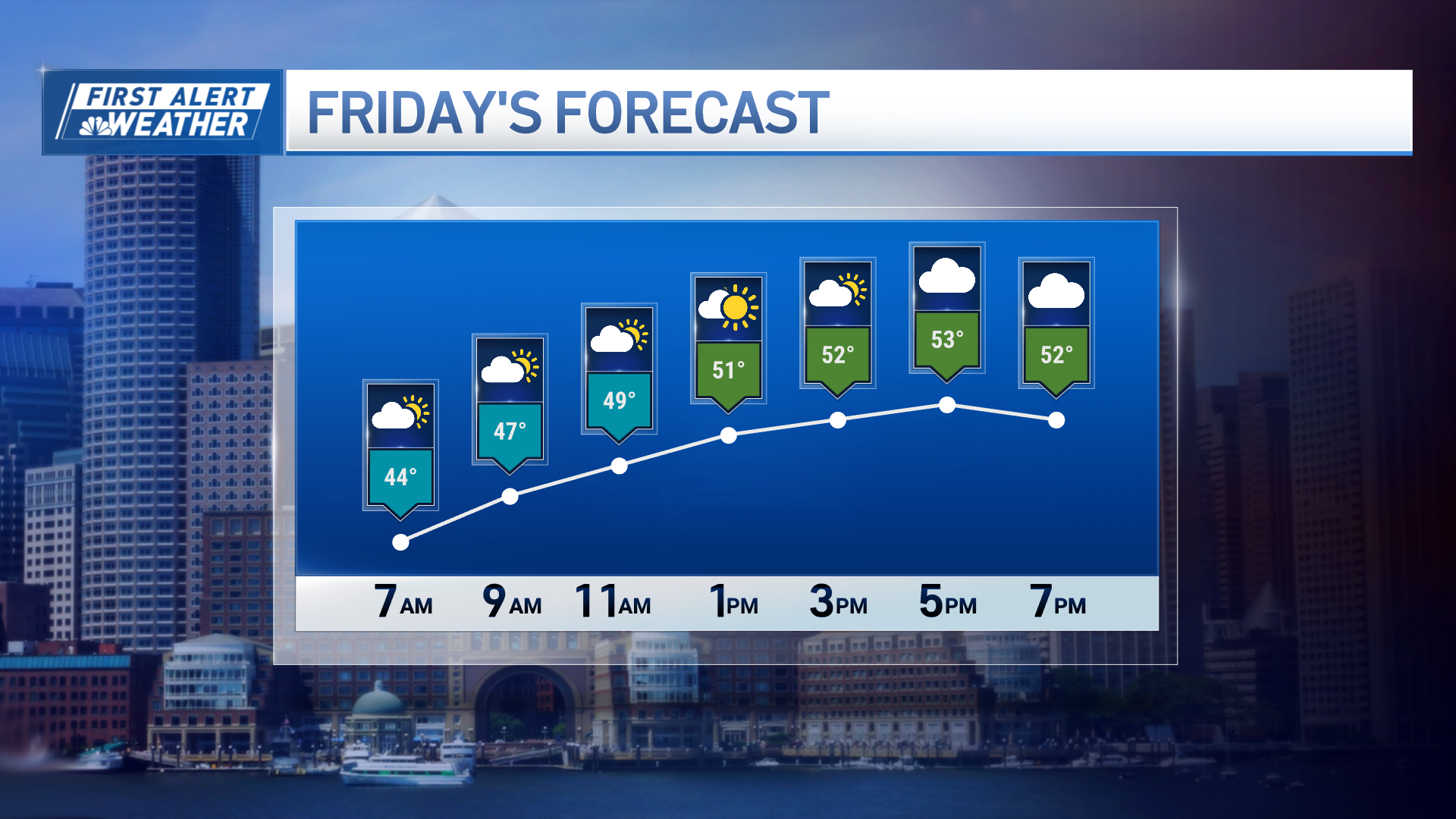
Wednesday evening and overnight, the next atmospheric disturbance ripples through, bringing another elevated chance of showers and thunder as gradually more humid air continues to make inroads to New England. By Thursday and Friday, a more organized storm approaching from the west raises the chance of showers and thunder on both days, before drier air arrives in time for the weekend.
We can’t guarantee gardeners will be frost free in the 10-day forecast – although many communities and especially our urban centers and Cape Cod may avoid frost this weekend, the arrival of drier air opens the door to possible overnight low temperatures in the 30s for some deep inland. We’ll continue with daytime highs in the 60s through early next week in our exclusive 10-day forecast.


