Suddenly it's summer time in New England. Yesterday we tied a record of 91 degrees in Burlington, Vermont, even as Boston, Massachusetts, only got to 70 degrees.
Today is even warmer, including near the coast, due to more of a southwesterly breeze. The coolest weather today will be on the Maine coast and the south coast of Massachusetts, Connecticut, and Rhode Island, where high temperatures are in the 60s and 70s.
Get Boston local news, weather forecasts, lifestyle and entertainment stories to your inbox. Sign up for NBC Boston’s newsletters.
Move inland just a few miles and we are well into the 80s, with much of Vermont and New Hampshire between 90 and 95°, making this perhaps one of the warmest days on record for the month of May.
Humidity is moderate to high, with dew points in the 50s and 60s. It’s even more humid over the next couple days, even though the temperature might not be as high tomorrow and Friday.
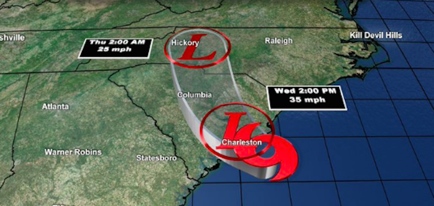
Also in the breaking news department, the national hurricane center this morning named tropical storm Bertha as moving. It made landfall in South Carolina with winds of greater than 50 mph near the coast, but more importantly with heavy rain and flooding that will move to North Carolina this afternoon and evening.
The remnants of that storm will cross over New England on Friday. At that point it will not have any wind, but could enhance some rainfall that we need here in our 6 state region.
The forecast for rain is challenging the next few days. This afternoon we have a few showers and thunderstorms in central and northern Maine. With such hot air, it does not take much for these storms to become strong to severe, however they are isolated.
Tonight we get more patchy, dense fog with low temperature in the 60s. Early fog gives way to mostly cloudy skies tomorrow with a chance of a few showers or thunderstorms. With the clouds, temperatures should be a little cooler in the 70s and 80s, but humidity will remain high.
Friday also looks mostly cloudy with a chance for showers and thunderstorms, especially late in the day in western and northern New England. The heaviest weather likely stays just to our west and north.
Showers and thunderstorms will continue Friday night and first thing Saturday, before we turn cooler and drier air for the second half of the weekend. Weather will return to mostly sunny skies by Saturday afternoon and Sunday.
Monday, June 1, is almost chilly. It may snow on top of Mount Washington. But for the most part, it’s a summertime pattern here in our first alert 10 day forecast.