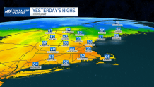
Back to reality -- yesterday’s warmth is but a distant memory as chilly air has returned to New England.
Coupled with a gusty wind, feels-like temperatures will be running in the 20s and teens by later Friday evening, meaning you’ll certainly want to bundle up if you have any Friday night plans.
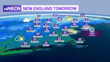
We bottom out in the 20s tonight (most of us, at least) and the wind will gradually ease as high pressure builds towards us.
Get Boston local news, weather forecasts, lifestyle and entertainment stories to your inbox. Sign up for NBC Boston’s newsletters.
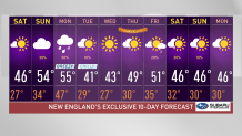
This dome of fair weather will provide us with ample sunshine and dry weather Saturday. Expect highs in the 40s -- though with less wind, it won’t feel as blustery.
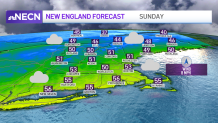
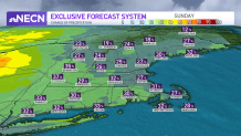
Temperatures rebound a bit on Sunday, into the 50s, but it comes at a cost. Aside from a few breaks of sun, the clouds will win out much of the day.
While I do think many of us may sneak in a dry day Sunday, there is a risk of a few passing showers, so don’t be surprised if there are a few raindrops to dodge.
Weather Stories


Steadier pockets of rain will fill in Sunday night into Monday as the next cold front sweeps through. This disturbance won’t cause major travel headaches, but it will slow things down a bit if you’re going to be on the roads (or on a plane) anywhere from the Ohio Valley (Sunday) to the eastern seaboard (Monday).
After that, another shot of below-average temperatures will return for Tuesday and Wednesday before we moderate towards the end of next week.
That means Thanksgiving is still looking good – classic Fall weather with a cold start and nice rebound, near 50 in the afternoon.
Overall, it’s a pretty tranquil exclusive 10-Day Forecast, by end-of-November standards.