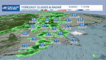
It’s not a typical Sunday - this time many actually get to enjoy having Monday off! So if you’re heading to bed late today, know this: it’ll be a rainy night.
Storms overnight may linger in the southeast by first morning hours, but if you’re staying in bed and waking up late, it will be no problem for you.
For those of us who do have to drive early, take it easy out there. Drive slowly and make sure you plan ahead but you’ll be happy to know most of it will be out by 11a.m.
Get Boston local news, weather forecasts, lifestyle and entertainment stories to your inbox. Sign up for NBC Boston’s newsletters.
Vermont and New Hampshire will likely see those showers through the afternoon, but most of Massachusetts, Rhode Island and Connecticut will be clear after brunch.
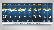
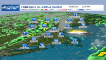
We’ll enjoy highs in the upper 70s again, except it will likely feel stickier since the warm front bringing the rain is tagging along much moisture in the atmosphere.
Along the warm front we’ll also be watching smoke traveling through our skies but leaving on time for Tuesday- the nicest day of the week. Temperatures will be staying in the upper 70s for then and humidity will drop.
It’s Wednesday when we’ll see some trouble heading back with the possibility to wake up some storms across New England.
Weather Stories

Coming off from the west, this low pressure system will produce thunderstorms but will be in charge of pushing away Hurricane Larry. I know, another hurricane mentioned close to New England, but this one should be staying well off to the northeast.
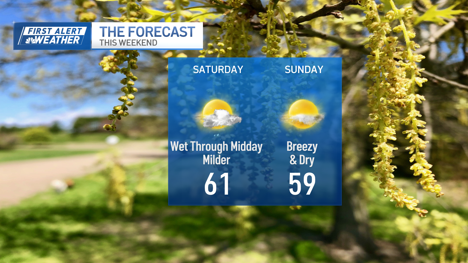
And let’s get to the fun part: the weekend forecast! From Friday to Sunday our weather is looking fantastic for now. We’ll keep you posted on any chances on NBC10 Boston and NECN. Take a look at out exclusive 10-day forecast to plan ahead.