
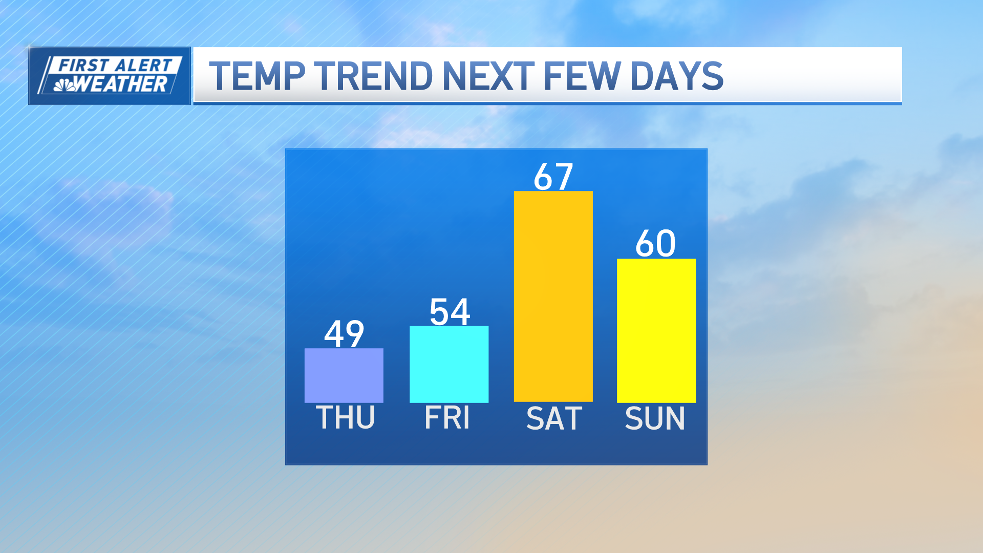
The dry weather continues into Friday and we keep the milder temperatures around.
Tonight, some wispy clouds will stick around and help to trap some of the daytime heat so we won't cool as much. Plus, a southwest breeze will keep temperatures elevated a bit more as the center of high-pressure shifts east. Lows will be around 30 degrees and since temperatures will be below freezing again in some of the suburbs and northern New England watch out for black ice.
Our next storm system heads in this weekend. The models are still trending warmer and with a storm track across central New England.
This means that rain will fall across southern New England, while the mix and snow chances will stay to the north and in higher elevations. We stay dry for Saturday morning, with the precipitation filling in from west to east Saturday afternoon and evening.
The worst of the storm will be with heavy rain and a gusty onshore wind Saturday night for southern New England. Gusts near the coast may push 40 to 50 mph from the east.
As the low moves over central New England, the wind calms. Then the wind switches direction into Sunday morning, with gusts around 30 mph from the southwest.
Weather Stories

Northern New England will see steady snow across higher terrain through Sunday afternoon. About 1-6 inches of snow will fall with the higher totals across the higher elevations. The storm will be far enough north on Sunday that we will see a lingering snow or rain shower south, but mostly dry and breezy, with snow showers north.
Next week we have another dry stretch and highs around 40 degrees each day. The next Friday into Saturday will bring another storm possibility. This one also looks like a wintry mix, but stay tuned!
