
While we await rain showers on the northern side of a storm center passing over the waters south of New England, the sunshine that started Wednesday for New England gives way to increasing and thickening clouds from southwest to northeast throughout the day, giving way to developing showers in far southern New England and in the mountainous terrain of the north late day and evening.
Before those showers develop, an onshore wind keeps high temperatures in the lower 50s near the coast, but about ten to 15 miles inland, high temperatures will rise closer to 60 degrees.
Evening showers will morph into a shield of rain that falls overnight Wednesday for most of New England except the North Country, with very light rainfall amounts for most, but as much as a quarter-inch around Boston and closer to half an inch on Cape Cod.
A brief mix with some wet snowflakes overnight Wednesday can't be ruled out in parts of southeastern Massachusetts, but with temperatures well above freezing, no impact is expected.
By early Thursday morning, the rain will taper to leftover showers and sprinkles, with a few sprinkles still possible during the day even as sunshine breaks through the clouds.
Cooler than normal daytime highs in the 50s are expected to continue Thursday before another quick-moving disturbance brings the chance of a brief overnight scattered shower Thursday night before an increasing breeze Friday pushes high temperatures closer to 60 degrees.
Weather Stories

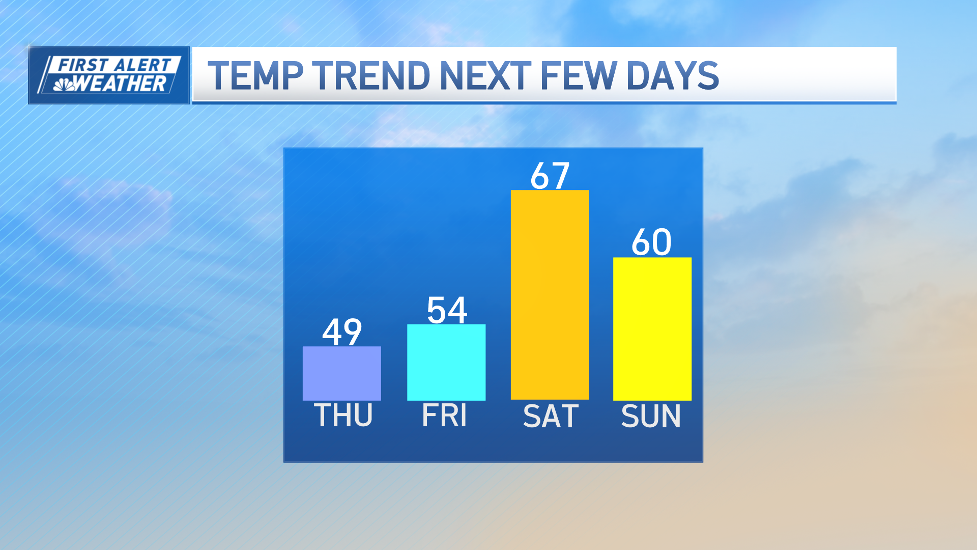
The busy breeze Friday precedes a strong cold front moving out of Canada, poised first to produce a strengthening storm center along it's leading edge of changing air that will deliver rain and mountain snow to New England Friday night, then a shot of chilly air Saturday.
Saturday's high temperatures will fail to launch out of the 40s for the vast majority of New England and a busy wind from the west and northwest will mean wind chill values in the 30s for a truly chilly start to the weekend!
As the wind quiets Saturday night, a widespread frost is possible – frankly, that's something many saw on this Wednesday morning, but it reinforces the idea that planting right now is not advised outside in New England.
Although the cool air lingers on Mother's Day, the wind will be lighter and the sky will be fair – a great day for moms after a chilly start – then cooler-than-normal air dominates through midweek.
At the end of our exclusive First Alert 10-day forecast, we see a true bonus of being your only 10-day forecast in Boston: warmth at the end of the stretch. Our team believes high temperatures will rebound into the 60s and 70s by week's end, and that may be a better time to put plants in the ground, particularly in southern New England, but we'll continue to evaluate and keep you posted.
