
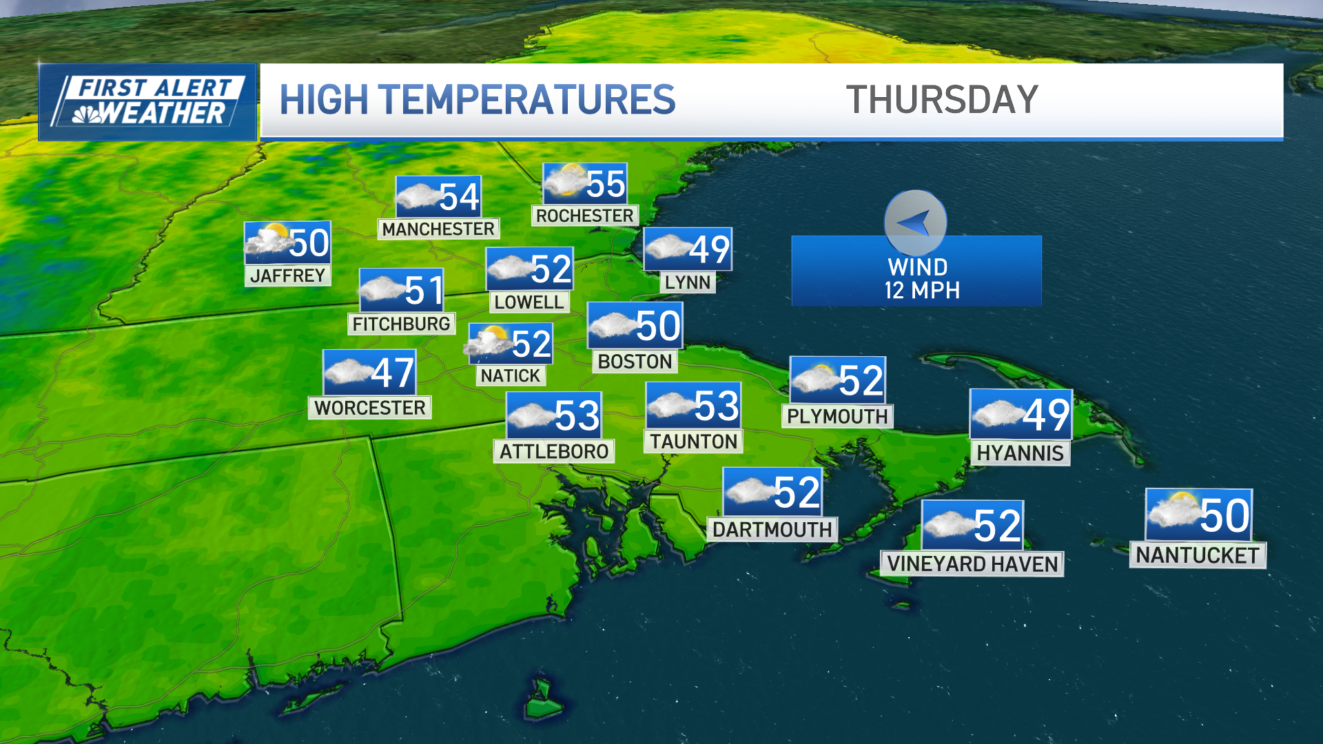
Friday brings a break between Thursday’s weak system that delivered light rain and snow to some and what remains of the once-powerful storm that’s crossed the northern tier of our nation and passes through New England Saturday.
Breaks in the clouds for partial sunshine Friday morning to midday will eventually close as clouds increase both from the east in lower levels of the atmosphere, and from the west aloft.
These different clouds are a product of changes in the atmosphere ahead of the approaching storm: an east wind off the ocean near the ground and the energetic disturbance approaching from the west, aloft.
As clouds thicken Friday evening, a few sprinkles of rain, flurries of snow and pockets of light freezing rain sprinkles will develop across New England, but steadier and heavier precipitation won’t arrive until predawn Saturday from southwest to northeast.
Saturday morning sees snow falling in northern, western and much of central New England, but a rain line in central Massachusetts to southern New Hampshire will quickly progress north, stopping shy of the mountains where mostly snow continues until over half a foot of snow accumulates in the mountains of Vermont, New Hampshire and Maine.
For most of the remainder of New England, any sloppy start Saturday gives way to rain showers by middle to late morning, then rain breaks into showers for most of the southern half of New England by afternoon…and some breaks in the clouds are possible by day’s end.
Weather Stories

A shifting wind Saturday evening will mean a transition from temperatures in the 40s Saturday to falling temperatures Saturday night and mountain snow showers Sunday with a brisk wind, cool air and variable clouds for the rest of New England Sunday.
Mostly dry weather is expected to start next week in our exclusive First Alert 10-day forecast, though our team is watching a potential nearby storm Wednesday that may be able to graze some of southeast New England if it passes close enough. A better chance of snow exists next Thursday night into Friday, but that’s a long way out so we’ll keep you posted and the early call on next weekend is fair weather, but chilly air.
