
Although we start Tuesday morning dry for most of New England, some roads in northern New England will remain a bit slick due to the snow showers from Monday night.
Tuesday, we have a weak area of high-pressure and several hours of sunshine before dual low-pressure systems cross during the night and on Wednesday.
Temperatures will be starting off Tuesday in the teens and 20s north, 20s and 30s south and will be going up another 5 to 10 degrees with light wind. Low pressure developing over the middle and Atlantic states will intensify rapidly during the evening as it passes close to Nantucket Island.
That means there will be a period of snow, or rain changing to snow for much of southern New England Tuesday night. Because the storm is evolving very quickly, it may catch us off guard with the intensity of snow. But at least it should be at night, while most of us are not on the roadways.
Precipitation begins on the south coast around 9 p.m. Any rain should change over to snow in southeastern Massachusetts, perhaps heavy at times, especially over eastern Massachusetts late in the evening.
Most of us will get a coating to an inch or two, but we may have some spots of 4 or 5 inches south of Boston. Wind from the northeast will pick up briefly around Massachusetts Bay, perhaps to gale force, as the low-pressure system passes late in the night.
Wednesday morning, we should wake up to clearing sky in eastern New England. But as quickly as we clear east, clouds come in from the west.
Weather Stories

We have an afternoon front producing snow showers, snow squalls and gusty wind. Some of the higher elevations of western New England may get a couple of inches in a short time. The temperature climbs to near 40 degrees ahead of the front.
With rapid cooling, we may have some locally icy conditions developing quickly during the afternoon and perhaps even the evening commute. Then, the ocean storm and the arctic front will merge into a powerhouse of a storm in southeastern Canada. That means a blustery wind and very cold weather for us.
Temperatures plummet to the single numbers and teens Wednesday night with wind chill factors below zero. Thursday starts off breezy, but the wind should diminish with a high temperature in the 10s north, 20s south.
A warm front comes in on Friday with a chance of snow and sleet, changing quickly to light rain. Not a lot of precipitation is expected then, but we may have some icy conditions for a time.
Much warmer air comes in Friday night and Saturday with the rain/snow line progressing north into Canada.
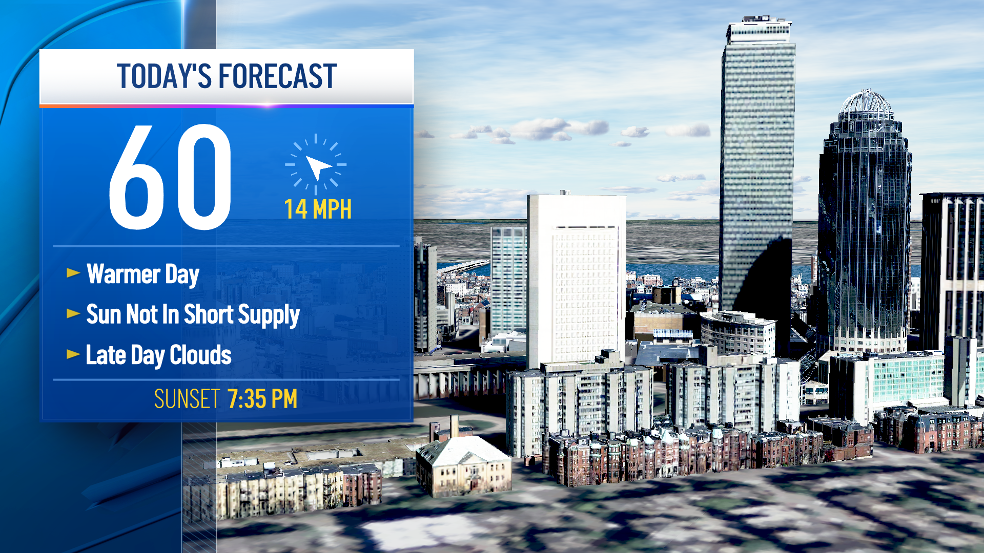
We have the potential for breaking record-high temperature near 60 degrees in southern New England Saturday. Even in the north, it looks like it’s going to be wet with temperatures in the 50s, 40s for this north. But it is also wet, with an inch or more of rain possible.
A cold front comes in Saturday night, with rain changing back to snow in northern New England. The cold front slips south on Sunday with the rain changing to snow and ice in central New England too.
It's a long duration event this weekend, and worthy of closer attention after we deal with the next 48 hours, as seen here in our First Alert 10-Day Forecast.
