
New England is diving into a more active weather pattern as we start the New Year with a few storm systems taking swipes at the region in the days ahead.
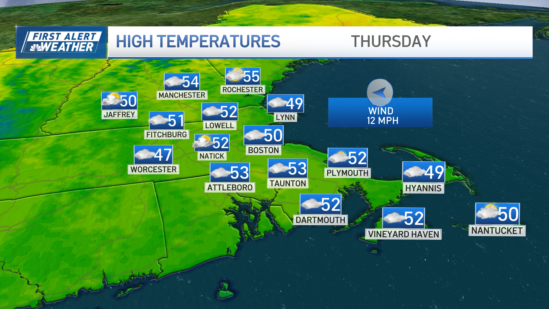
The first disturbance was a cold front early Thursday morning that delivered rain from northwest to southeast – only about one to two-tenths of an inch and fast-moving enough to clear Cape Cod by midday and the Islands during the afternoon, leaving clouds with temperatures in the 40s for most of us to close out the day.
In the evening, temperatures will fall a bit as drier and cooler air moves in on a northwest breeze, but this drier air will also clear the sky. Thursday evening and night from north to south, respectively, clearing nearly all of New England by the stroke of midnight for the start of 2021.
Get Boston local news, weather forecasts, lifestyle and entertainment stories to your inbox. Sign up for NBC Boston’s newsletters.
The clear sky will result in morning sunshine on Friday, but in this active weather pattern, the next storm won’t be far away and will approach New England later in the day, first bringing afternoon and evening clouds, then delivering overnight snow and rain.
At this point, while it looks like there’ll be enough cold air for a burst of snow for interior Southern New England, it looks unlikely that most spots would see more than an inch or two.
The farther north one is, however, the greater the expected snowfall. The change to rain will advance from south to north overnight Friday night, arriving in Central NH by sunrise Saturday, but never making it to the Northern Mountains until the storm wraps up as some mixed showers Saturday afternoon. Southern New England will likely dry out during the second half of the day.
Weather Stories

In northern New England, most of the storm falling as snow means a general four-to-eight-inch snow is a possibility. Although the weather quiets Saturday afternoon through Sunday midday, yet another storm system moves close to New England late Sunday into Sunday night, likely to spread snow and rain across the region once again.
Although it’s early for finely tuned details on this follow-up system, chances are good it will mean at least another couple of inches, if not more, in central and northern New England, and probably another sloppy mix in southern New England.
The heaviest precipitation should be over by the return to work and school Monday morning, but it’s likely some snow showers will linger and a steady snow could still be falling in Maine…we’ll fill in these details as we get closer.
After Monday, the weather does quiet for a few if not several days in our exclusive First Alert 10-day forecast.
