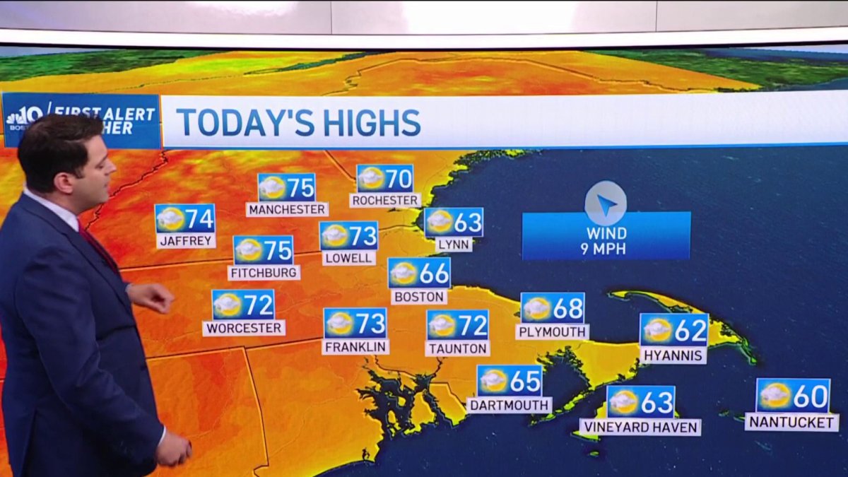
Today: Sun & clouds. Highs in the 70s, 60s coast. Tonight: Mostly cloudy. Lows either side of 50. Thursday: Variable clouds & sun. Highs in the 70s.
A string of beautiful days continues into the midweek. We’re seeing rain-free weather through early Friday, in fact.
Temperature-wise, things are nearly status quo with the sea breeze. Cooler readings can be found at the coast, while just a bit inland, we’re optimistic about highs in the 70s.
Wind direction is everything in the warm season. While yesterday our winds came out of the east and northeast, today they’ll come from the southeast. It’s still off the water, but it’s a somewhat warmer direction.
Additionally, the airmass has warmed a bit too. Put all that together, and we should be in the mid-60s instead of low 60s at the water’s edge.
Get Boston local news, weather forecasts, lifestyle and entertainment stories to your inbox. Sign up for NBC Boston’s newsletters.
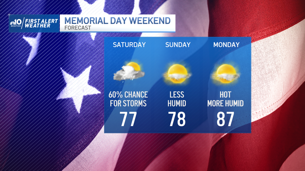
We’ll hold off the rain threat until the end of the week as a slow-moving frontal system chugs in our direction. Key word here is slow. Unfortunately, it’s slowed enough to drag into Saturday, threatening us with a few scattered storms or downpours.

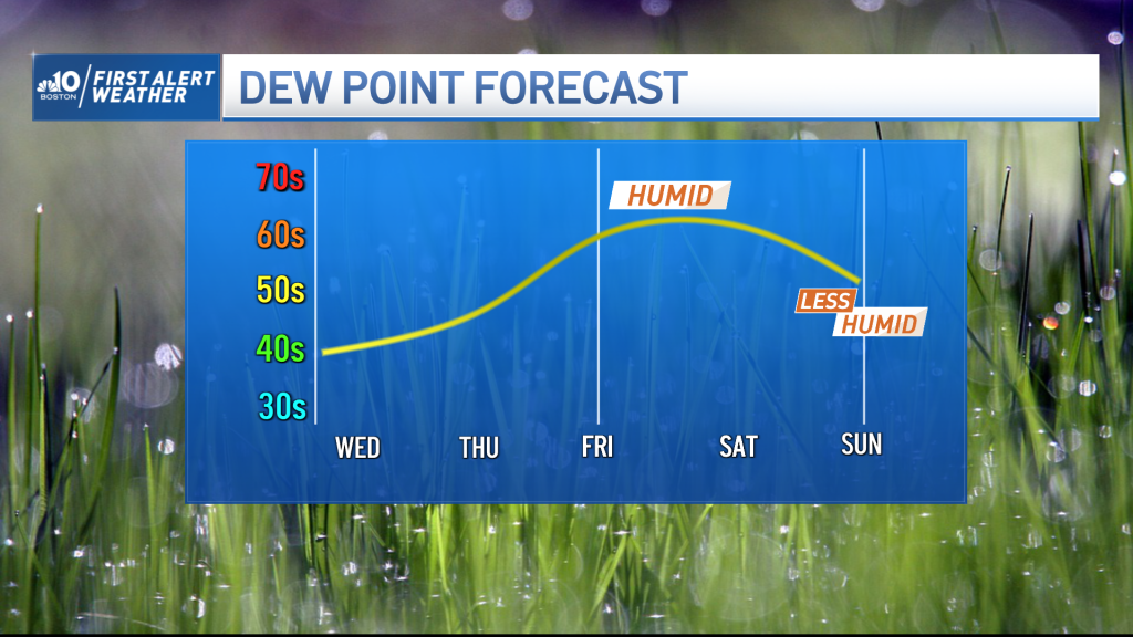
While not a washout, it is our one day of the holiday weekend with a threat for rain. We’ll swing out of it on Sunday and Memorial Day with increasing temperatures (esp. on Monday) and slowly increasing humidity.
Could almost describe Monday as hot with the mid/upper 80s in play. This is a trend we’ll build on Tuesday and (possibly) Wednesday.
I’m wary about a back door cold front slipping in from Maine and inciting a sea breeze at the coast. Time will tell, but in the meantime, get ready for a solid start (unofficially) to summer.