
We have an extreme pattern across the United States. Saturday started with a temperature of 75° in Miami, and 40° below zero in International Falls Minnesota. That is an extreme temperature gradient across the United States. One system after another coming onto the West Coast from the Pacific Ocean is creating a parade of winter storms from coast to coast.
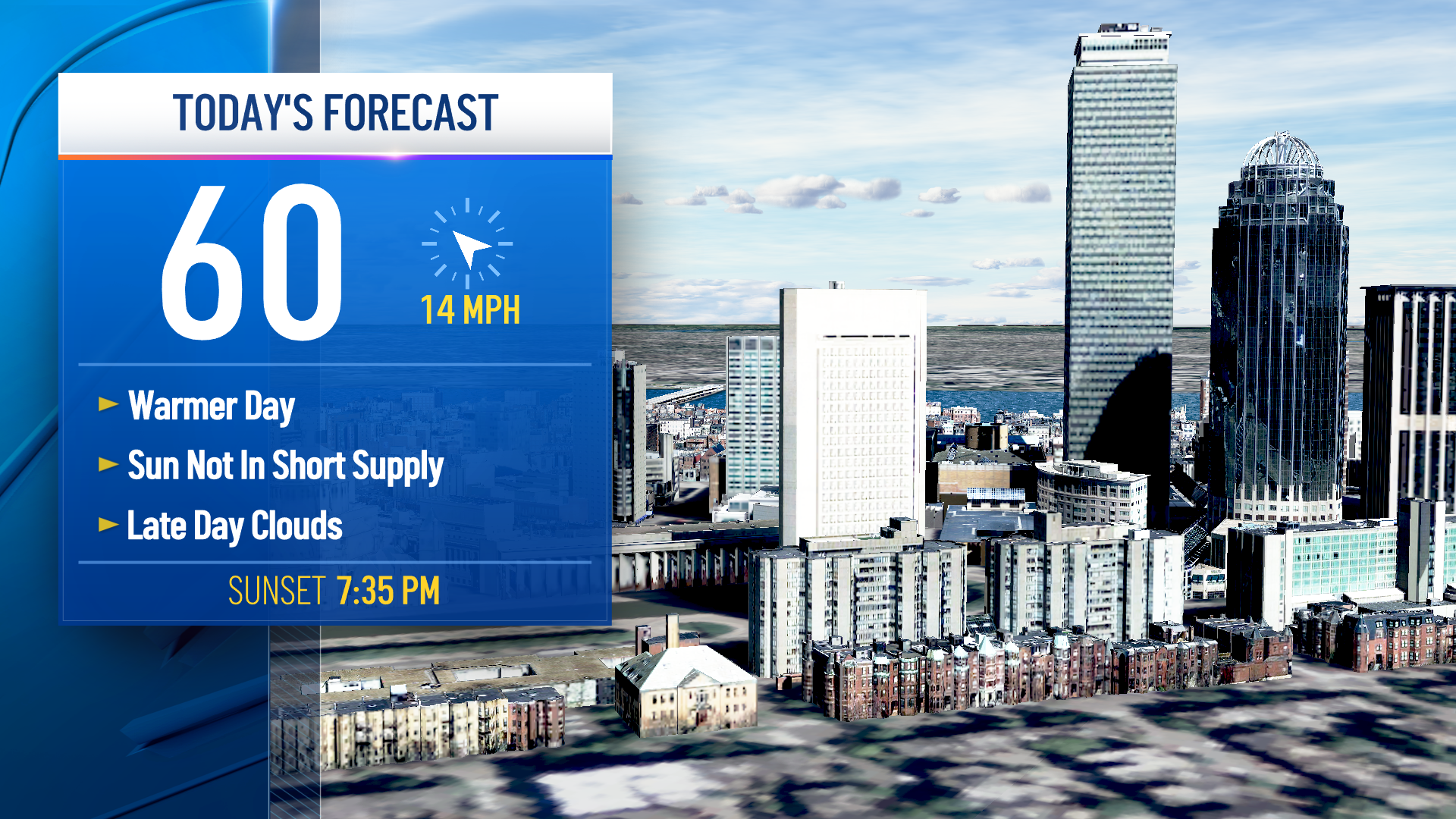
Here in New England we have some of the most quiet weather in the entire nation. With sunshine fading this afternoon, temperatures are still on the cold side with highs in the teens north and 20s south.
Wind is mostly light from the northeast and east.
The next batch of energy to come through is a wave of low pressure south of New England, that will spread snow into much of southern New England this evening. But there’s also a wave of energy crossing northern New England with a period of snow late tonight and early tomorrow.
Expect road conditions to become icy from Boston to Hartford Connecticut and points south by 8 p.m. if not sooner.
The northern edge of that snow will probably end up just past the Massachusetts Turnpike, so along the Pike and points south, may get one or two inches of snow overnight.
Weather Stories

The temperature will rise enough that the precipitation may change to sleet and rain toward Cape Cod and the Islands.
But it will be cold enough, even where it rains, for untreated surfaces to be quite slippery.
Most of central and northern New England probably pick up less than an inch of snow, but it will be slick to start the day tomorrow. Mixed precipitation should end in eastern New England by about lunchtime tomorrow with temperatures holding in the 20s north and 30s south. Not much sun is expected.
We are going to straddle the boundary between the extreme cold in Canada and the warmth off the southeastern United States for the rest of the week.
Monday looks rather gray with just some light snow or freezing drizzle, or plain drizzle near the south coast where temperatures will be close to 40°.
A more important storm moves over the mid Atlantic states Monday night, and will impact just about all of New England Tuesday. Southern New England will see snow change to sleet and rain, perhaps a prolonged period of freezing rain away from the coast.
Where the Tuesday system is all snow we can expect six inches or more. In southern New England though, it’s going to be an icy mess.
We will get a re-freeze Tuesday night with cold air coming back, likely setting up a dry Wednesday with temperatures near 30°.
The next storm arrives Thursday, again with snow changing to sleet, and then freezing rain is possible once again away from the coast. Mostly rain at the shore.
That could be a foot or more of snow on our mountains, and an inch or two of water where it is all rain.
It’s a tough call on the storm track Thursday night and Friday. If it tracks inland we might spike up into the 40s in parts of New England Thursday night and Friday, before the next cold front comes in with a refreeze Friday night and Saturday.
The early call for next weekend is cold and dry, stay tuned to our First Alert 10-day forecast for latest updates.
