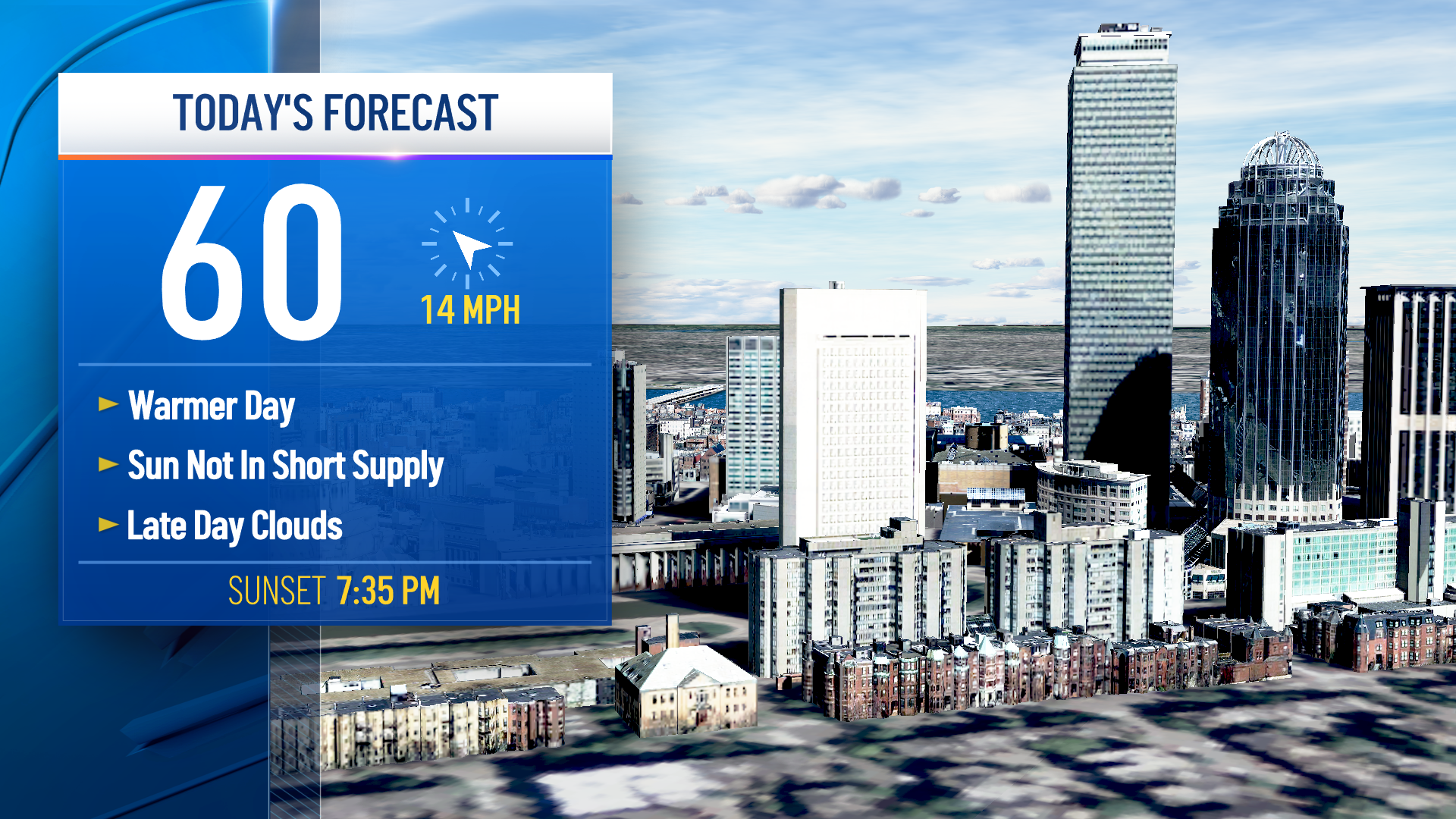
Today is the brightest and driest day we've had for a while in New England.
Overnight thunderstorms dropped large hail, downed trees, and left two inches of rain in parts of western and northern New England yesterday. But that action moved to the east today.
What’s left behind is a small high-pressure system off to our south bringing a good amount of blue sky. Fog was especially dense across much of Maine to southeastern Massachusetts last night, and in some spots has yet to burn off.
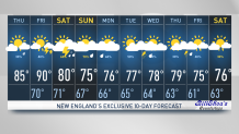
High temperatures today are close to 90 away from the coast, more like upper 70s right at the beach, with high humidity for all.
Get Boston local news, weather forecasts, lifestyle and entertainment stories to your inbox. Sign up for NBC Boston’s newsletters.
There is a very weak pressure gradient over New England, that means light wind. That also means we have a local sea breeze effect near the beaches. That creates a little convergence that can stimulate a few tall cumulus clouds and perhaps a brief sun shower this afternoon.
But for most of us, it’s just a nice quiet summer day for a change. Clouds and fog may fill back in along the south coast overnight tonight, it’s a warm and humid night with temperatures only falling into the 70s for most.
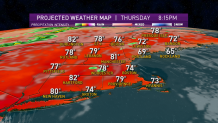
Tomorrow turns into more of a breezy day, that should burn off the fog quicker. There’s also a front approaching from the north with the chance of a shower and thunderstorm in the afternoon. Temperatures should hit 90° for most, wind out of the southwest gusting past 25 miles an hour near the south coast keeping it a little cooler.
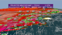
That front is going to stall over us on Saturday with a wave of low pressure coming in, so we may see a few hours of sunshine Saturday morning, but then there are thunderstorms likely Saturday afternoon. Temperatures will be cooler with the clouds in the rain probably closer to 80.
Weather Stories

That front stalls here along the south coast on Sunday with a breeze coming in from the northeast. That probably means low clouds with patchy fog and drizzle for southern New England.
The day may not be a washout depending on the next wave of low pressure; perhaps it’s not raining. The best weather looks like it’s going to be far northern New England, especially northern Maine in the drier air.
Not much change next week, it looks like a relatively unsettled pattern with possible showers and thunderstorms every day or so. Not raining all the time but continuing our pattern of July being cooler and much wider than the average July.
By Monday, our rainfall amounts may have surpassed some all-time records for the month of July. With another week and a half to go, stay tuned to our First Alert 10-day forecast for the latest in this volatile weather pattern.