


Overnight Monday Night: Partly cloudy. Lows in the 20s.
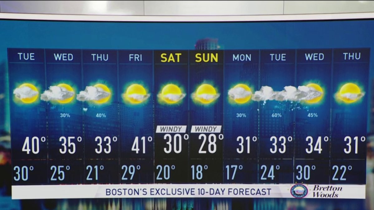
Tuesday: Fair. Highs 35-40.
Several upper level disturbances pass through New England this week, leading to an overall quiet pattern with a few bumps on the way.
Cooling temperatures will be around, periods of clouds and even some snow showers or flurries from time to time.
The mountain snow showers continue to taper this evening to a few flurries, and southern New England will see sprinkles or flurries spitting from the clouds as a weak wave moves through.
Lows Monday night drop to the single digits and teens north and 20s south as the sky clears.
Temperatures each day will fall a bit as we go through the week. Tuesday brings partly cloudy skies and highs in the 30s to near 40.
Wednesday some mountain flurries are possible as we see mostly cloudy skies for all and highs in the mid 30s.
Local
In-depth news coverage of the Greater Boston Area.


Thursday we cool off a tad more to the low 30s and 20s north. By evening some snow showers are likely in the mountains as another disturbance moves through.
Friday again we have highs in the 30s and flurry chances north.
High pressure settles in for the weekend so both days look sunny and dry. Highs feel way more like winter with the teens north, and 20s south both days. A breeze will also make it feel like the single digits and teens when you factor in the wind chill.
Next week a system passes by that may bring a wintry mix or snow south depending on the track. This is our next good chance at any measurable precipitation for southern New England, so stay tuned!

